The Prince-Archbishopric of Bremen — not to be confused with the modern Archdiocese of Hamburg, founded in 1994 — was an ecclesiastical principality (787–1566/1648) of the Holy Roman Empire and the Catholic Church that after its definitive secularization in 1648 became the hereditary Duchy of Bremen. The prince-archbishopric, which was under the secular rule of the archbishop, consisted of about a third of the diocesan territory. The city of Bremen was de facto and de jure not part of the prince-archbishopric. Most of the prince-archbishopric lay rather in the area to the north of the city of Bremen, between the Weser and Elbe rivers. Even more confusingly, parts of the prince-archbishopric belonged in religious respect to the neighbouring Diocese of Verden, making up 10% of its diocesan territory.

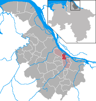
Stade, officially the Hanseatic City of Stade is a city in Lower Saxony in northern Germany. First mentioned in records in 934, it is the seat of the district which bears its name. It is located roughly 45 km (28 mi) to the west of Hamburg and belongs to that city's wider metropolitan region. Within the area of the city are the urban districts of Bützfleth, Hagen, Haddorf and Wiepenkathen, each of which have a council of their own with some autonomous decision-making rights.

Bremen-Verden, formally the Duchies of Bremen and Verden, were two territories and immediate fiefs of the Holy Roman Empire, which emerged and gained imperial immediacy in 1180. By their original constitution they were prince-bishoprics of the Archdiocese of Bremen and Bishopric of Verden.

Kranenburg is a municipality in the district Stade, Lower Saxony, Germany, lying on the river Oste. It consists of the villages Kranenburg and Brobergen and is part of the Samtgemeinde Oldendorf-Himmelpforten. It has a population of 772 as at December 31, 2003, of which 546 in Kranenburg and 226 in Brobergen.
Jork is a small town on the left bank of the Elbe, near Hamburg (Germany).

Oldendorf is a municipality in the district of Stade, in Lower Saxony, Germany. It is situated west of Hamburg. Oldendorf has a population of approx. 3,000. Oldendorf was the seat of the former Samtgemeinde Oldendorf.

Harsefeld is a municipality situated south-west of Hamburg (Germany). Harsefeld has a population of c. 12,500 and belongs to the district of Stade, Lower Saxony.

Zeven [] is a town in the district of Rotenburg, in Lower Saxony, Germany. It has a population of around 14,000. The nearest large towns are Bremerhaven, Bremen and Hamburg. It is situated approximately 22 km northwest of Rotenburg, and 40 km northeast of Bremen. Zeven is also the seat of the Samtgemeinde Zeven.

Neuhaus an der Oste is a municipality in the district of Cuxhaven, in Lower Saxony, Germany.

Ottersberg is a municipality in the district of Verden, in Lower Saxony, Germany. It is situated approximately 20 km north of Verden, and 28 km east of Bremen.

Flögeln is a village and a former municipality in the district of Cuxhaven, in Lower Saxony, Germany. Since 1 January 2015 it is part of the town Geestland.
Agathenburg is a municipality in the district of Stade, Lower Saxony, Germany. It was formerly known as Lieth.

Bliedersdorf is a municipality in the district of Stade, Lower Saxony, Germany. It is east of Nottensdorf, southwest of Horneburg, and northwest of the simple dolmen megaliths of Grundoldendorf.
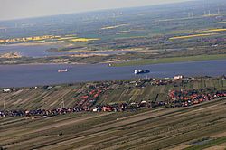
Freiburg on the Elbe (in High German, officially Freiburg an der Elbe; short: Freiburg/Elbe, Freiborg/Elv, or Freiborg is a municipality in the district of Stade, Lower Saxony, Germany.

Grünendeich is a municipality in the district of Stade, Lower Saxony, Germany.

Mittelnkirchen is a municipality in the district of Stade, Lower Saxony, Germany.

Neuenkirchen is a municipality in the Altes Land, district of Stade, Lower Saxony, Germany.
Steinkirchen is a municipality in the district of Stade, Lower Saxony, Germany.

Cranz is a quarter in the Harburg borough of Hamburg, Germany. It is on the left bank of the Elbe river and one of the 104 quarters of Hamburg. In 2020 the population was 843.
The Stade Region emerged in 1823 by an administrative reorganisation of the dominions of the Kingdom of Hanover, a sovereign state, whose then territory is almost completely part of today's German federal state of Lower Saxony. Until 1837 the Kingdom of Hanover was ruled in personal union by the Kings of the United Kingdom of Great Britain and Ireland.