Kranenburg, Lower Saxony

Last updated

Kranenburg
Flagg Kronenborg.svg
DEU Kranenburg Oste COA.svg
Location of Kranenburg within Stade district
Kranenburg in STD.png
Germany adm location map.svg
Red pog.svg
Kranenburg
Lower Saxony location map.svg
Red pog.svg
Kranenburg
Coordinates: 53°36′N09°12′E / 53.600°N 9.200°E / 53.600; 9.200 Coordinates: 53°36′N09°12′E / 53.600°N 9.200°E / 53.600; 9.200
Country Germany
State Lower Saxony
District Stade
Municipal assoc. Oldendorf-Himmelpforten
Subdivisions2
Government
   Mayor Horst Wartner
Area
  Total14.21 km2 (5.49 sq mi)
Elevation
3 m (10 ft)
Population
 (2020-12-31) [1]
  Total762
  Density54/km2 (140/sq mi)
Time zone UTC+01:00 (CET)
  Summer (DST) UTC+02:00 (CEST)
Postal codes
21726
Dialling codes 04140
Vehicle registration STD
Website www.samtgemeinde-oldendorf.de

Kranenburg is a municipality in the district Stade, Lower Saxony, Germany, lying on the river Oste. It consists of the villages Kranenburg and Brobergen and is part of the Samtgemeinde Oldendorf-Himmelpforten. It has a population of 772 as at December 31, 2003, of which 546 in Kranenburg and 226 in Brobergen.

Contents

Both villages lie on the right side of the Oste river, but part of the municipality lies on the left side, called "Hollander Höfe", which was the old ancestral seat of the gentry family "von Brobergen". There is a ferry in Brobergen crossing the Oste, connecting the "Hollander Höfe" with the village of Brobergen. It is a station of the "Deutsche Fährstraße".

The place lies on the border of the marshland near the Oste. The river Mehe, a tributary of the Oste, has its estuary near Brobergen.

The village Brobergen was an own municipality, but then got part of Kranenburg in the course of a reformation of municipality borders in Lower Saxony in 1972.

History

Kranenburg, first mentioned in 1375 as Kronesborg (literally cranes castle), belonged to the Prince-Archbishopric of Bremen, established in 1180. While Brobergen was first the name of the landscape, which referred to a larger area along the Oste between Gräpel and Burweg. In a charter from 1141 it is said, that the Rudolf of Freckleben, as Rudolf II Count of Stade (from 1135 to his death in 1144), gave Brobergen as a fief to one of the three brothers Dudo, Adiko and Ricbert, after they founded the Benedictine Our Lady's Friary  [ de ] in Stade.

In 1286 it was first mentioned, that there was a village by the castle, which was the seat of the von Brobergen family. In 1380 the family von Mandelsloh and other Bremian and Verdian creditors tried to gain by violence the estates, which the bankrupt Prince-Archbishop Albert II pledged in return for credits. The creditors ravaged the city of Bremen and the entire Prince-Archbishopric of Bremen. The city of Bremen concluded a pact with the other cities, the Chapter, the Landsgemeinden of the free peasants of the marshlands, and indigenous families of nobility and ministerialis to fight the exfrediation by the von Mandelslohs. In 1381 the troops of the city of Bremen captured the castle in Kranenburg.

The family of von Brobergen, owning the castle, lasted until 1618, when it became extinct. At this time the manor was sold to merchants from Hamburg. In 1648 the Prince-Archbishopric, including Kranenburg, was transformed into the Duchy of Bremen, which was first ruled in personal union by the Swedish Crown – interrupted by a Danish occupation (1712–1715) – and from 1715 on by the Hanoverian Crown.

In 1807 the ephemeric Kingdom of Westphalia annexed the Duchy, before France annexed it in 1810. In 1813 the Duchy was restored to the Electorate of Hanover, which – after its upgrade to the Kingdom of Hanover in 1814 – incorporated the Duchy in a real union and the Ducal territory, including Kranenburg, became part of the new Stade Region, established in 1823. In 1837, after many changes of owner, the castle and the pertaining domain were purchased by the farmers of Brobergen, who pooled together to become free of the ownership of their land by other persons.

Related Research Articles

Bremervörde Town in Lower Saxony, Germany

Bremervörde is a town in the north of the district (Landkreis) of Rotenburg, in Lower Saxony, Germany. It is situated on the Oste river near the centre of the "triangle" formed by the rivers Weser and Elbe, roughly equidistant from the cities of Hamburg, Bremen and Cuxhaven.

Osten Municipality in Lower Saxony, Germany

Osten is a municipality in the district of Cuxhaven, in Lower Saxony, Germany. It is situated on the river Oste. Osten also means "East" in German.

Elmlohe is a village and a former municipality in the district of Cuxhaven, in Lower Saxony, Germany. Since 1 January 2015 it is part of the town Geestland. It was a component municipality of the former Samtgemeinde Bederkesa.

Schiffdorf Municipality in Lower Saxony, Germany

Schiffdorf is a municipality in the district of Cuxhaven, in Lower Saxony, Germany. It is situated at the eastern boundary of the Bremian city of Bremerhaven, and 35 kilometers south of Cuxhaven.

Bad Bederkesa Ortsteil of Geestland in Lower Saxony, Germany

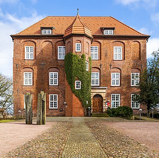
Bad Bederkesa is a village and a former municipality in the district of Cuxhaven, in Lower Saxony, Germany. Since 1 January 2015 it is part of the town of Geestland. It is situated approximately 20 km northeast of Bremerhaven, and 30 km southeast of Cuxhaven. Bad Bederkesa was the seat of the former Samtgemeinde Bederkesa, an administrative division consisting of several component municipalities.

Hagen im Bremischen Municipality in Lower Saxony, Germany

Hagen im Bremischen is a municipality in the district of Cuxhaven, in Lower Saxony, Germany. It is situated approximately 20 km south of Bremerhaven, and 35 km northwest of Bremen. Hagen was the seat of the former Samtgemeinde Hagen.

Hemmoor Town in Lower Saxony, Germany

Hemmoor is a small town in the district of Cuxhaven, in Lower Saxony, Germany. It is situated near the river Oste, approx. 40 km northeast of Bremerhaven, and 25 km south of Brunsbüttel.

Neuhaus (Oste) Municipality in Lower Saxony, Germany

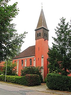
Neuhaus an der Oste is a municipality in the district of Cuxhaven, in Lower Saxony, Germany.

Cappel, Lower Saxony Ortsteil of Wurster Nordseeküste in Lower Saxony, Germany

Cappel is a village and a former municipality in the district of Cuxhaven, in Lower Saxony, Germany. Since 1 January 2015 it is part of the municipality Wurster Nordseeküste.

Drangstedt is a village and a former municipality in the district of Cuxhaven, in Lower Saxony, Germany. Since 1 January 2015 it is part of the town Geestland.

Driftsethe is a village and a former municipality in the district of Cuxhaven, in Lower Saxony, Germany. Since 1 January 2014, it is part of the municipality Hagen im Bremischen.

Flögeln Ortsteil of Geestland in Lower Saxony, Germany

Flögeln is a village and a former municipality in the district of Cuxhaven, in Lower Saxony, Germany. Since 1 January 2015 it is part of the town Geestland.

Frelsdorf is a village and a former municipality in the district of Cuxhaven, in Lower Saxony, Germany. Since 1 November 2011, it is part of the municipality Beverstedt.

Hollen is a village and a former municipality in the district of Cuxhaven, in Lower Saxony, Germany. Since 1 November 2011, it is part of the municipality Beverstedt.

Agathenburg Municipality in Lower Saxony, Germany

Agathenburg is a municipality in the district of Stade, Lower Saxony, Germany. It was formerly known as Lieth.

Burweg Municipality in Lower Saxony, Germany

Burweg is a municipality in the district of Stade, Lower Saxony, Germany.

Düdenbüttel Municipality in Lower Saxony, Germany

Düdenbüttel is a municipality in the district of Stade, Lower Saxony, Germany.

Großenwörden Municipality in Lower Saxony, Germany

Großenwörden is a municipality in the district of Stade, Lower Saxony, Germany.

Nottensdorf Municipality in Lower Saxony, Germany

Nottensdorf is a municipality in the district of Stade, Lower Saxony, Germany.

Brobergen

Brobergen is a village in the German municipality of Kranenburg in the district of Stade, Lower Saxony. The village of 6.06 km² has 220 inhabitants.

References

  1. Landesamt für Statistik Niedersachsen, LSN-Online Regionaldatenbank, Tabelle A100001G: Fortschreibung des Bevölkerungsstandes, Stand 31. Dezember 2020.