This article needs additional citations for verification .(January 2021) |
Agathenburg | |
|---|---|
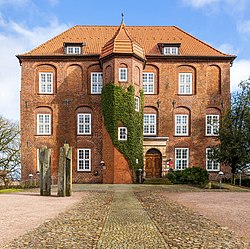 Agathenburg Castle | |
 Coat of arms | |
Location of Agathenburg within Stade district  | |
 Agathenburg  Agathenburg | |
| Coordinates: 53°33′50″N9°31′47″E / 53.56389°N 9.52972°E | |
| Country | Germany |
| State | Lower Saxony |
| District | Stade |
| Municipal assoc. | Horneburg |
| Government | |
| • Mayor | Gerd Allers |
| Area | |
• Total | 11.32 km2 (4.37 sq mi) |
| Elevation | 16 m (52 ft) |
| Population (2022-12-31) [1] | |
• Total | 1,365 |
| • Density | 120/km2 (310/sq mi) |
| Time zone | UTC+01:00 (CET) |
| • Summer (DST) | UTC+02:00 (CEST) |
| Postal codes | 21684 |
| Dialling codes | 04141 |
| Vehicle registration | STD |
Agathenburg (in High German, in Low Saxon: Gothenborg) is a municipality in the district of Stade, Lower Saxony, Germany. It was formerly known as Lieth.
