
The Prince-Archbishopric of Bremen, also Archbishopric of Bremen, — not to be confused with the former Archdiocese of Bremen, and the modern Archdiocese of Hamburg, founded in 1994 — was an ecclesiastical principality (787–1566/1648) of the Holy Roman Empire, which after its definitive secularization in 1648, became the hereditary Duchy of Bremen. The prince-archbishopric, which was under the secular rule of the archbishop, consisted of about a third of the diocesan territory. The city of Bremen was de facto and de jure not part of the prince-archbishopric. Most of the prince-archbishopric lay rather in the area to the north of the city of Bremen, between the Weser and Elbe rivers. Even more confusingly, parts of the prince-archbishopric belonged in religious respect to the neighbouring diocese of Verden, making up 10% of its diocesan territory.

Stade, officially the Hanseatic City of Stade is a city in Lower Saxony in northern Germany. First mentioned in records in 934, it is the seat of the district which bears its name. It is located roughly 45 km (28 mi) to the west of Hamburg and belongs to that city's wider metropolitan region. Within the area of the city are the urban districts of Bützfleth, Hagen, Haddorf and Wiepenkathen, each of which have a council of their own with some autonomous decision-making rights.

Bremen-Verden, formally the Duchies of Bremen and Verden, were two territories and immediate fiefs of the Holy Roman Empire, which emerged and gained imperial immediacy in 1180. By their original constitution they were prince-bishoprics of the Archdiocese of Bremen and Bishopric of Verden.

Kranenburg is a municipality in the district Stade, Lower Saxony, Germany, lying on the river Oste. It consists of the villages Kranenburg and Brobergen and is part of the Samtgemeinde Oldendorf-Himmelpforten. It has a population of 772 as at December 31, 2003, of which 546 in Kranenburg and 226 in Brobergen.

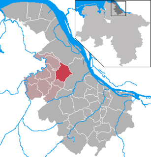
Himmelpforten is a municipality west of Hamburg (Germany) in the district of Stade in Lower Saxony. It is located on the Horsterbeck creek. Himmelpforten is also part and the seat of the Samtgemeinde Oldendorf-Himmelpforten.

Zeven [] is a town in the district of Rotenburg, in Lower Saxony, Germany. It has a population of around 14,000. The nearest large towns are Bremerhaven, Bremen and Hamburg. It is situated approximately 22 km northwest of Rotenburg, and 40 km northeast of Bremen. Zeven is also the seat of the Samtgemeinde Zeven.

Land Wursten is a former Samtgemeinde in the district of Cuxhaven, in Lower Saxony, Germany. It was situated approximately 20 km (12 mi) southwest of Cuxhaven, and 15 km (9.3 mi) north of Bremerhaven. Its seat was in the village Dorum. It was disbanded in January 2015, when its member municipalities merged into the new municipality Wurster Nordseeküste.

Flögeln is a village and a former municipality in the district of Cuxhaven, in Lower Saxony, Germany. Since 1 January 2015 it is part of the town Geestland.

Mittelstenahe is a municipality in the district of Cuxhaven, in Lower Saxony, Germany.

Stinstedt is a municipality in the district of Cuxhaven, in Lower Saxony, Germany.

Ostereistedt is a municipality in the district of Rotenburg, in Lower Saxony, Germany.

Vorwerk is a municipality in the district of Rotenburg, in Lower Saxony, Germany.

Düdenbüttel is a municipality in the district of Stade, Lower Saxony, Germany.

Engelschoff is a municipality in the district of Stade, Lower Saxony, Germany.

Großenwörden is a municipality in the district of Stade, Lower Saxony, Germany.
Hammah is a municipality in the district of Stade, in Lower Saxony, Germany.

Wischhafen is a municipality in the district of Stade, in Lower Saxony, Germany.

Himmelpforten Convent was founded as a monastery of nuns following the Cistercian Rule during the 13th century in Himmelpforten, in today's Lower Saxony, Germany. During the 16th century, it was converted into use as a Lutheran Damsels' Convent. The Himmelpforten Convent was founded before 1255 and finally dissolved in 1647. The convent complex was built between 1300 and 1330. After 1645 the buildings, including the abbey, increasingly decayed, until they were little by little demolished. The dilapidated abbey was demolished in 1737 and replaced by today's St. Mary's Church which partially covers the foundations of the former abbey.
The Saint Mary's Church is a Lutheran parish church used and owned by the Lutheran parish in Himmelpforten, Lower Saxony, Germany. The Himmelpforten parish forms part of the Stade deanery (Kirchenkreis) within the Stade diocese of the Lutheran Church of Hanover. The church was completed in 1738 and covers the eastern half of the foundations of the demolished abbey church of the former Himmelpforten Convent.

The Neuenwalde Convent is a Lutheran damsels' convent in Neuenwalde, a locality of Geestland, Lower Saxony, Germany.


