Related Research Articles

The Georges River, also known as Tucoerah River, is an intermediate tide-dominated drowned valley estuary, located to the south and west of Sydney, New South Wales, Australia.
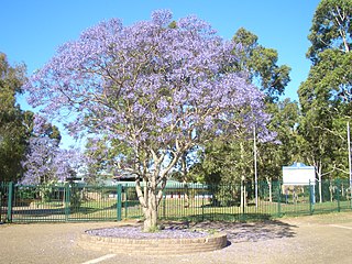
Holsworthy is a suburb in south-western Sydney, in the state of New South Wales, Australia 31 kilometres south-west of the Sydney central business district, in the local government area of the City of Liverpool.

The Main North Line is a major railway in New South Wales, Australia. It runs through the Central Coast, Hunter and New England regions. The line was the original main line between Sydney and Brisbane, however this required a change of gauge at Wallangarra. As of 1988, the line closed progressively north of Armidale with services gradually withdrawn till 2004, with the main route between Sydney and Brisbane now the North Coast line.

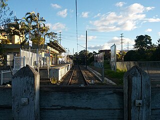
Liverpool railway station is a heritage-listed railway station located on the Main South line, serving the Sydney suburb of Liverpool in Australia. It is served by Sydney Trains T2 Inner West & Leppington, T3 Bankstown and T5 Cumberland services. It was added to the New South Wales State Heritage Register on 2 April 1999.

The South Coast railway line is a commuter and goods railway line in New South Wales, Australia. Beginning at the Illawarra Junction, the line primarily services the Illawarra and South Coast regions of New South Wales, and connects Sydney and Bomaderry through Wollongong and Kiama.

Wattle Grove is a suburb of Sydney, in the state of New South Wales, Australia. Wattle Grove is located 30 kilometres south-west of the Sydney central business district in the local government area of the City of Liverpool.

Moorebank is a suburb of Sydney, in the state of New South Wales, Australia. Moorebank is located 27 kilometres south-west of the Sydney central business district in the local government area of the City of Liverpool.

Canberra railway station is located on the Bombala railway line in the Australian Capital Territory, Australia. It is located in the Canberra suburb of Kingston.
The Unanderra–Moss Vale railway line is a cross country railway line in New South Wales, Australia. The line branches from the Illawarra line at Unanderra and winds west up the Illawarra escarpment to join the Main South line at Moss Vale. The line is one of the most scenic in New South Wales, and for the first 20 km after leaving Unanderra has an almost continuous grade 1 in 30 providing extensive views over the Illawarra coastline.

The Ropes Creek Line is a closed railway line in the western suburbs of Sydney, Australia.

The Bombala railway line is a branch railway line in the south of New South Wales, Australia. The northern part of it forms part of the main line from Sydney to Canberra, but the southern part is closed. It branches off the Main South line at Joppa Junction, south of Goulburn, and was opened in stages to Tarago, Bungendore, Queanbeyan, Michelago, Cooma, Nimmitabel and Bombala.

The Richmond Vale Railway was a 4 ft 8 1⁄2 in colliery railway line in the Hunter Region of New South Wales, Australia, servicing coal mines at Minmi, Stockrington, Pelaw Main and Richmond Main. It was over 26 km (16 mi) long and passed through three tunnels, and was the last commercially operated railway in Australia to use steam locomotives.

The Z20 class is a class of steam locomotive built for and operated by the New South Wales Government Railways of Australia.
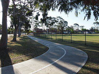
Bike paths in Sydney, New South Wales, Australia, vary widely, with the majority either shared cycle and pedestrian paths or on road paths, and a small number of separated cycleways. In 2009 the Sydney Morning Herald reported that "Sydney's cycleways are not so much an organised network as a fragmented collection of winding paths and half-finished ideas. Most were built or designed when cycling was viewed as a pleasant pastime rather than a practical form of travel and are now poorly suited to commuting."
Steele Barracks was an Australian Army base in the Sydney suburb of Moorebank in New South Wales, near Liverpool. It was the home of the Royal Australian Engineers School of Military Engineering (SME), which was established there in 1940, as well as the RAE Museum, and the RAE Golf Club. It was also the location of the Regional Headquarters for the NSW Brigade of the Australian Army Cadets before it was moved to Holsworthy Barracks.
The Maldon – Dombarton railway line is a partially constructed railway line in New South Wales, Australia. Construction commenced in December 1983 with the project being cancelled in June 1988. Following a feasibility study, contracts for pre-construction works were awarded in December 2012. The Government of New South Wales is currently running a Registration of Interest process, seeking market interest to construct, operate and maintain the proposed line.

Heathcote Road is a major arterial road in the south of Sydney, New South Wales, Australia. It runs from Newbridge Road in Liverpool to the Princes Highway in Heathcote.
The Carlingford railway line was a railway line in Sydney, Australia. It was opened from Clyde to Subiaco in January 1885, then by means of the construction of a bridge across the Parramatta River, to Carlingford in April 1896. It closed on 5 January 2020 with much of the line to be converted to light rail as part of the Parramatta Light Rail network, while a short section of the line was retained for use by Sydney Trains.
Milperra Bridge is a road bridge that carries Newbridge Road across the Georges River, located between Bankstown and Liverpool, in south-western Sydney, New South Wales, Australia. The bridge is located adjacent to Henry Lawson Drive and the Bankstown Airport; and Newbridge Road serves as a continuation of Canterbury and Milperra Roads.

The Argyle Street railway bridge is a heritage-listed railway bridge on the Main Southern railway line (146.037 km) at Moss Vale, Wingecarribee Shire, New South Wales, Australia. It was designed and built by the New South Wales Government Railways in 1914 with steel supplied by Dorman Long of Middlesbrough, England. The property is owned by RailCorp, an agency of the Government of New South Wales. It was added to the New South Wales State Heritage Register on 2 April 1999.
References
- 1 2 "The Liverpool to Holdsworth Military Railway" (PDF). Royal Australian Historical Society.
- ↑ "Transport in Liverpool: The Coming of the railway" (PDF). City of Liverpool.
- 1 2 Lost Railways: Holsworthy Line Visit Sydney
- ↑ "NEW BRIDGE AT MOSS VALE". The Daily Telegraph (2411). New South Wales, Australia. 9 April 1887. p. 6 – via National Library of Australia.
- ↑ Oakes, John (William John); Australian Railway Historical Society. New South Wales Division (1997), Sydney's forgotten military railways, Australian Railway Historical Society, New South Wales Division, ISBN 978-0-909650-41-4
- ↑ Forgotten Harris Park rail bridge in jeopardy Liverpool Champion 1 November 2016
- ↑ Harris Creek Historical Railway Bridge Royal Australian Historical Society
- ↑ Qube's Moorebank intermodal hub a major infrastructure boost ABC News 12 June 2015
| |||||||||||||
| |||||||||||||
| |||||||||||||
| |||||||||||||