Hometown | |
---|---|
Census-designated place (CDP) | |
Coordinates: 38°31′58″N81°51′40″W / 38.53278°N 81.86111°W | |
Country | United States |
State | West Virginia |
County | Putnam |
Area | |
• Total | 0.802 sq mi (2.08 km2) |
• Land | 0.802 sq mi (2.08 km2) |
• Water | 0 sq mi (0 km2) |
Population | |
• Total | 668 |
• Density | 830/sq mi (320/km2) |
Time zone | UTC-5 (Eastern (EST)) |
• Summer (DST) | UTC-4 (EDT) |
ZIP code | 25109 |
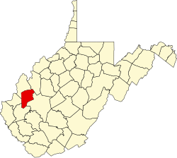
Hometown is a census-designated place (CDP) located along the Kanawha River on West Virginia Route 62 in Putnam County, West Virginia, United States. As of the 2010 census, its population was 668. [2] Hometown has six streets that are intersected by one street. There is an elementary school. The red house on the left in the photo was constructed for Thomas M. Brown and Ella Mae Criner Brown in the early 1920s, and was the first house built at Hometown.
Putnam County is a county in the U.S. state of West Virginia. As of the 2020 census, the population was 57,440. Its county seat is Winfield, its largest incorporated city is Hurricane, and its largest community is the census-designated place of Teays Valley. Putnam County is part of the Huntington–Ashland, WV-KY-OH Metropolitan Statistical Area, across the Kanawha River from Charleston, West Virginia.
Preston County is a county located in the U.S. state of West Virginia. As of the 2020 Census, the population was 34,216. Its county seat is Kingwood. The county was formed from Monongalia County in 1818 and named for Virginia Governor James Patton Preston.
McDowell County is a county in the U.S. state of West Virginia. As of the 2020 census, the population was 19,111. Its county seat is Welch. McDowell County is the southernmost county in the state. It was created in 1858 by the Virginia General Assembly and named for Virginia Governor James McDowell. It became a part of West Virginia in 1863, when several Union-affiliated counties seceded from the state of Virginia during the American Civil War. McDowell County is located in the Cumberland Mountains, part of the Appalachia region.
Lewis County is a county in the U.S. state of West Virginia. As of the 2020 census, the population was 17,033. Its county seat is Weston. The county was formed in 1816 from Harrison County.
Jefferson County is located in the Shenandoah Valley in the Eastern Panhandle of West Virginia. It is the easternmost county of the U.S. state of West Virginia. As of the 2020 census, the population was 57,701. Its county seat is Charles Town. The county was founded in 1801, and today is part of the Washington metropolitan area.
Prince George County is a county located in the Commonwealth of Virginia. As of the 2020 census, the population was 43,010. Its county seat is Prince George.
Isle of Wight County is a county located in the Hampton Roads region of the U.S. state of Virginia. It was named after the Isle of Wight, England, south of the Solent, from where many of its early colonists had come. As of the 2020 census, the population was 38,606. Its county seat is Isle of Wight, an unincorporated community.
Hanover County is a county in the Commonwealth of Virginia. As of the 2020 census, the population was 109,979. Its county seat is Hanover.
Giles County is a county located in the U.S. state of Virginia on the West Virginia state line. As of the 2020 census, the population was 16,787. Its county seat is Pearisburg.
Shinnston is a city and former coal town in Harrison County, West Virginia, United States, along the West Fork River. In 1778, Levi Shinn constructed his log home along what is now Route 19; today it is the oldest standing structure in north-central West Virginia. As of the 2020 census, Shinnston had a population of 2,332.
Charles Town is a city in and the county seat of Jefferson County, West Virginia, United States. The population was 6,534 at the 2020 census. The city is named for its founder Charles Washington, youngest brother of President George Washington. It is part of the northwestern fringes of the Washington metropolitan area.
Kermit is a town in Mingo County, West Virginia, United States. The population was 406 at the 2010 census. Kermit is located along the Tug Fork, opposite Warfield, Kentucky. The Norfolk Southern Railway's Kenova District runs through town.
Franklin is a town in and the county seat of Pendleton County, West Virginia, United States. The population was 486 at the 2020 census. Franklin was established in 1794 and named for Francis Evick, an early settler.
Kingwood is a city in and the county seat of Preston County, West Virginia, United States. The population was 2,980 at the 2020 census. The city sits within the Allegheny Mountains above the Cheat River valley. It is part of the Morgantown metropolitan area.
New Martinsville is a city in and the county seat of Wetzel County, West Virginia, United States, along the Ohio River. The population was 5,186 at the 2020 census.
Lubeck is a census-designated place (CDP) in Wood County, West Virginia, United States. It is part of the Parkersburg-Marietta-Vienna, WV-OH Metropolitan Statistical Area. The population was 1,311 at the 2010 census. Though first named Watertown, postmaster Theodore Frederick Henry Slevogt in 1856 changed the name to Lubeck after his hometown in Germany.
Springfield is a census-designated place (CDP) in northwestern Hampshire County in the U.S. state of West Virginia. As of the 2010 census, Springfield had a population of 477. Springfield is located north of Romney along West Virginia Route 28 at its junction with Green Spring Road and Springfield Pike.
Green Spring is a census-designated place (CDP) and railroad town in Hampshire County, West Virginia, United States. As of the 2010 census, its population was 218. Green Spring is located north of Springfield on Green Spring Road near the confluence of the North and South Branches of the Potomac River. Green Spring is also the location of the South Branch Valley Railroad's terminus with the old Baltimore & Ohio Railroad mainline. Green Spring is the site of a one-lane low-water toll bridge that connects Green Spring Road to Maryland Route 51 in Oldtown, Allegany County, Maryland. This bridge is one of only 17 privately owned toll bridges in the United States. The toll for the bridge is currently US$1.50.
Berwind is a town on the Dry Fork in McDowell County, West Virginia, United States. As of the 2010 census, its population is 278. The town is named for Edward Julius Berwind, owner of the Berwind Company, and was originally a company town. It was later incorporated in 1905. Berwind is the hometown of Vern Bickford, a starting pitcher in Major League Baseball who played with the Braves in Boston (1948-1952) and Milwaukee (1953), and for the Baltimore Orioles (1954). Berwind is also encompassed by the Berwind census designated place.
Carolina is a census-designated place (CDP) in Marion County, West Virginia, United States. Carolina is 2 miles (3.2 km) north-northwest of Worthington. Carolina has a post office with ZIP code 26563. As of the 2010 census, its population was 411.