
Matucana is a town in Central Peru, capital of the province Huarochirí in the region Lima. It's located to the East of Lima at 2,378 m (7,802 ft) above sea level, along the Central Road at km 74.
Huanza District is one of thirty-two districts of the province Huarochirí in Peru.

San Lorenzo de Quinti District is one of thirty-two districts of the province Huarochirí in Peru.
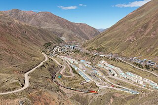
Matucana District is one of thirty-two districts of the Huarochirí Province in Peru.

San Mateo District is one of thirty-two districts of the province Huarochirí in Peru.
Markapukyu is an archaeological site in Peru. It is situated in the Pasco Region, Pasco Province, Yarusyacán District, at a height of 3,787 metres (12,425 ft).

Putka is a mountain in the Cordillera Central in the Andes of Peru, about 5,100 metres (16,732 ft) high. It is slocated in the Lima Region, Huarochirí Province, Chicla District.
Quñuq P'ukru is a mountain in the Cordillera Central in the Andes of Peru, about 5,000 m (16,404 ft) high. It is situated in the Lima Region, Huarochirí Province, Chicla District.
Pachanqutu or Phanchaqutu is a mountain in the Paryaqaqa or Waruchiri mountain range in the Andes of Peru, about 5,400 metres (17,717 ft) high. It is situated in the Lima Region, Huarochirí Province, San Mateo District, and in the Junín Region, Yauli Province, Suitucancha District. It lieson the western border of the Nor Yauyos-Cochas Landscape Reserve. Pachanqutu lies near Tunshu, southeast of Paka (Paca), south of Sullcon and Americo, and west of the branch of Antachaire.
Qullqi is a 5,038-metre-high (16,529 ft) mountain in the Andes of Peru. It is situated in the Lima Region, Huarochirí Province, Huanza District. Qullqi lies east of the Qiwlla River (Quiula) and west of the Qullqi valley (Collque). One of the nearest places is Qullqi (Collque) southeast of the mountain.
Suyruqucha is a 5,252-metre-high (17,231 ft) mountain in the Cordillera Central in the Andes of Peru and the name of a little lake near the mountain. The peak of the mountain lies in the Lima Region, Huarochirí Province, on the border of the districts of Huarochirí, San Damian and San Mateo. It is situated southeast of Uqhu.
Llawa P'ukru is a mountain in the Andes of Peru, about 5,200 m (17,060 ft) high. It is situated in the Lima Region, Huarochirí Province, Chicla District. Llawa P'ukru lies southwest of Sillaqaqa and Inka Kancha, east of Qunchupata and southeast of Quriqucha.
Suyruqucha is a mountain in the Paryaqaqa or Waruchiri mountain range in the Andes of Peru, about 5,500 metres (18,045 ft) high. It is located in the Junín Region, Jauja Province, Canchayllo District, in the Yauli Province, Suitucancha District, and in the Lima Region, Huarochiri Province, Quinti District. It lies on the western border of the Nor Yauyos-Cochas Landscape Reserve. It is situated northwest of Qullqip'ukru. Wararayuq lies west of it.
Nina Ukru is a mountain in the Paryaqaqa or Waruchiri mountain range in the Andes of Peru, about 5,400 metres (17,717 ft) high. It is situated in the Lima Region, Huarochirí Province, Quinti District. Nina Ukru lies southwest of Qullqip'ukru and west of Paryaqaqa.
Parya Chaka is a mountain in the south of the Paryaqaqa or Waruchiri mountain range in the Andes of Peru, about 5,000 m (16,404 ft) high. It is also the name of a lake near the mountain. The mountain is located in the Lima Region, Huarochirí Province, Quinti District, and in the Yauyos Province, Tanta District. It is situated southwest of Paryaqaqa. It is situated within the borders of the Nor Yauyos-Cochas Landscape Reserve.
Wiqu is a mountain in the Paryaqaqa or Waruchiri mountain range in the Andes of Peru, about 5,200 m (17,060 ft) high. It is located in the Lima Region, Huarochirí Province, Quinti District, and in the Yauyos Province, Tanta District. Wiqu lies southwest of Paryaqaqa and northeast of Parya Chaka.
Yana Yana is a 5,303-metre-high (17,398 ft) mountain in the Cordillera Central in the Andes of Peru. It is situated in the Lima Region, Huarochiri Province, on the border of the districts of Carampoma, Matucana and San Mateo, north of the Rimac River. Yana Yana lies southeast of Qarwa Ranra.
Qarwa Ranra is a mountain in the La Viuda mountain range in the Andes of Peru, about 5,000 metres (16,404 ft) high. It is situated in the Lima Region, Huarochirí Province, on the border of the districts of Carampoma and Matucana. It lies northwest of Yana Yana.
Lichiqucha is a mountain at a small lake of that name in the Andes of Peru which reaches an altitude of approximately 5,000 m (16,000 ft). It is located in the Junín Region, Yauli Province, Yauli District, and in the Lima Region, Huarochirí Province, Chicla District. Lichiqucha lies southwest of Wayrakancha.


