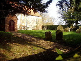
Cheddington is a village and civil parish in the Aylesbury Vale district of Buckinghamshire. The parish has an area of 1,429 acres (578 ha). The village is about 6 miles north-east of Aylesbury and three miles north of Tring in Hertfordshire. The hamlet of Cooks Wharf has grown up where the main road into the village from Pitstone crosses the Grand Union Canal.
Hedgerley is a village and civil parish in South Bucks district in Buckinghamshire, England. The parish is centred 3 miles (4.8 km) south-east of Beaconsfield and 2.5 miles (4.0 km) south-west of Gerrards Cross. The parish has incorporated the formerly separate parish of Hedgerley Dean since 1934.

Norwood Green is a place in the London Borough of Ealing in London, England. It is a suburban development centred 10.7 miles (17.2 km) west of Charing Cross and 4 miles (6.4 km) ENE of Heathrow Airport.
Prestbury is a village and civil parish in Cheshire, England. About 1.5 miles (3 km) north of Macclesfield, at the 2001 census, it had a population of 3,324, increasing slightly to 3,471 at the 2011 Census. Alongside fellow "Cheshire Golden Triangle" villages Wilmslow and Alderley Edge, it is one of the most sought after and expensive places to live outside London. The ecclesiastical parish is almost the same as the former Prestbury local government ward which consisted of the civil parishes of Prestbury, Adlington and Mottram St Andrew.
Ashmansworth is a village and civil parish in the Basingstoke and Deane district of the English county of Hampshire.
Charlton was the name of a small village or large hamlet in Gloucestershire, England in its heyday having a Bethel Chapel and Sunday School, it was demolished in the late 1940s. Its site is part of the helicopter-used runway and safety margins of Bristol Filton Airport. It was between Filton and what is today the Cribbs Causeway out-of-town commercial and retail area immediately north of Bristol. In contemporary terms to the north lay fields then Over Court Deer Park, which is today Bristol Golf Club and a short section of the M5 motorway.

Godshill is a village and civil parish and in New Forest National Park in Hampshire, England. It is about 1 1⁄2 miles (2.4 km) east of the town of Fordingbridge and 10 miles (16 km) south of the city of Salisbury.

Burley is a village and civil parish in the New Forest, Hampshire, England, with a cycle hire centre and cycle shop, cider farm, tea rooms, gift shops, art galleries and a pick-your-own farm.

Bramshaw is a small village and civil parish in Hampshire, England. It lies just inside the New Forest. The name Bramshaw means Bramble Wood. Until 1895, Bramshaw was divided into two parts, one half in Wiltshire, and one half in Hampshire. The village of Bramshaw is stretched out for several miles along the B3079 road, with the church to the north, the hamlet of Brook to the south and Stock's Cross at its centre.
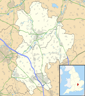
Hyde is a civil parish in the county of Bedfordshire. It lies just south-east of Luton.

Sibdon Carwood is a hamlet and small parish in Shropshire, England. To its east is the small market town of Craven Arms.

Ogdens is a small hamlet south of Hyde Common near Frogham in the New Forest area of Hampshire, England.

Ickwell is a hamlet in Bedfordshire, England.

Stokeinteignhead is a village and civil parish in the Teignbridge district of Devon, England, above the southern bank of the estuary of the River Teign. The parish has a short boundary on the estuary, and is otherwise surrounded, clockwise from the north, by the parishes of Shaldon, Torbay, Coffinswell and Haccombe with Combe. It is twinned with the French commune of Trévières, Calvados.

Preston on Stour is a village and civil parish in Warwickshire, England. It is situated some four kilometres south of the town of Stratford-on-Avon. The population of the civil parish as at the 2011 census was 244. As its name suggests, the village stands on the River Stour, which flows flows northward, just east of the village centre. The A3400 main road parallels the river about one kilometre further east.

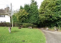
Blissford is a hamlet in the civil parish of Hyde situated in the New Forest National Park in Hampshire, England. Its nearest town is Fordingbridge, which lies approximately 2 miles (2.5 km) west from the village. The hamlet lies just to the north of the small village of Frogham. Blissford is situated on low ground around Blissford Cross and towards Ditchend Brook where the ford can be found. References to Blissford appear in records in the early 16th century. The houses in the hamlet are surrounded by patches of woodland and pasture, and there is also a small settlement of mobile homes sited on higher ground.

Frogham is a small village in the New Forest National Park of Hampshire, England. It is in the civil parish of Hyde. Its nearest town is Fordingbridge, which lies approximately 1.8 miles (2.5 km) north-west from the village.

Furze Hill is a hamlet situated in the New Forest National Park of Hampshire, England. It is in the civil parish of Ellingham, Harbridge and Ibsley. Its nearest town is Fordingbridge, which lies approximately 3.1 miles (5.2 km) north-west from the hamlet.

Stuckton is a hamlet in the New Forest National Park of Hampshire, England. Its nearest town is Fordingbridge, which lies approximately 1 mile (1.7 km) north-west from the village.