Ogdens

Last updated

Ogdens
Huckles Brook near Ogdens Farm - geograph.org.uk - 1111568.jpg
Huckles Brook near Ogdens Farm
Hampshire UK location map.svg
Red pog.svg
Ogdens
Location within Hampshire
OS grid reference SU178121
Civil parish
District
Shire county
Region
Country England
Sovereign state United Kingdom
Post town FORDINGBRIDGE
Postcode district SP6
Dialling code 01425
Police Hampshire
Fire Hampshire
Ambulance South Central
EU Parliament South East England
List of places
UK
England
Hampshire
50°54′37″N1°44′48″W / 50.9103°N 01.7466°W / 50.9103; -01.7466 Coordinates: 50°54′37″N1°44′48″W / 50.9103°N 01.7466°W / 50.9103; -01.7466

Ogdens is a small hamlet south of Hyde Common near Frogham in the New Forest area of Hampshire, England.

Hamlet (place) Small human settlement in a rural area

A hamlet is a small human settlement. In different jurisdictions and geographies, hamlets may be the size of a town, village or parish, be considered a smaller settlement or subdivision or satellite entity to a larger settlement. The word and concept of a hamlet have roots in the Anglo-Norman settlement of England, where the old French hamlet came to apply to small human settlements. In British geography, a hamlet is considered smaller than a village and distinctly without a church or other place of worship.

Hyde, Hampshire village and civil parish in New Forest, Hampshire, England

Hyde is a village and civil parish in the New Forest near Fordingbridge in Hampshire, England.

Frogham, Hampshire village in the United Kingdom

Frogham is a small village in the New Forest National Park of Hampshire, England. It is in the civil parish of Hyde. Its nearest town is Fordingbridge, which lies approximately 1.8 miles (2.5 km) north-west from the village.

Ogdens is a hamlet in the civil parish of Hyde. It is situated in the valley of Latchmore Brook (or Huckles Brook). [1] Most of the settlement is surrounded by the heathland and woodland of the New Forest. [1] The hamlet is very rural with a few post-war dwellings, mixed in with older houses scattered on tracks and farmland. [1] There is a car park at Ogdens allowing access to the heathland of the New Forest. [2] Nearby is Ogdens Purlieu, a boggy area of heathland between Ogdens and Dockens Water.

Civil parish Territorial designation and lowest tier of local government in England

In England, a civil parish is a type of administrative parish used for local government, they are a territorial designation which is the lowest tier of local government below districts and counties, or their combined form, the unitary authority. Civil parishes can trace their origin to the ancient system of ecclesiastical parishes which historically played a role in both civil and ecclesiastical administration; civil and religious parishes were formally split into two types in the 19th century and are now entirely separate. The unit was devised and rolled out across England in the 1860s.

Latchmore Brook

The Latchmore Brook is a significant stream in the New Forest, Hampshire, England. It rises from the elevated gravel plateaus in the north of the Forest, north of Fritham, and drains into the River Avon north of Ibsley.

New Forest area of southern England

The New Forest is one of the largest remaining tracts of unenclosed pasture land, heathland and forest in Southern England, covering southwest Hampshire and southeast Wiltshire.

The hamlet is named after Ogden Rooke, a local landowner who possessed Ogdens Purlieu in the latter half of the 17th century. [3] Purlieu is a Norman-French word meaning "the outskirts of a forest" – a place free from forest laws.

Related Research Articles

Purlieu is a term used of the outlying parts of a place or district. It was a term of the old Forest law, and meant, as defined by John Manwood, Treatise of the Lawes of the Forest,

a certain territory of ground adjoining unto the forest [which] was once forest-land and afterwards disafforested by the perambulations made for the severing of the new forests from the old

Wokefield village in the United Kingdom

Wokefield is a civil parish in the West Berkshire district of Berkshire, England, south of the borough of Reading. The parish includes the hamlets of Grazeley Green, Goddard's Green and Bloomfield Hatch, and the 18th-century mansion of Wokefield Park. It includes part of the former parish of Sulhamstead Bannister Upper End and Grazeley. To the north are Burghfield, and Burghfield Common. to the east are Grazeley and Shinfield and to the south are Stratfield Mortimer and Mortimer Common. It lies between 40m and 95m above sea level.

Dibden Purlieu village in United Kingdom

Dibden Purlieu is a village situated on the edge of the New Forest in Hampshire, England. The village merges with the nearby town of Hythe. It is in the civil parish of Hythe and Dibden.

Aylesbeare Village and civil parish in Devon, England

Aylesbeare is a village and civil parish in the East Devon district of Devon, England, 8 miles (13 km) east of Exeter. According to the 2001 census the parish, which includes the hamlet of Nutwalls, had a population of 527. Known for the Site of Special Scientific Interest on Aylesbeare Common that is managed by the Royal Society for the Protection of Birds, Aylesbeare was in the news during 1978 as the scene of the disappearance of Genette Tate.

Godshill, Hampshire village in United Kingdom

Godshill is a village and civil parish and in New Forest National Park in Hampshire, England. It is about 1 12 miles (2.4 km) east of the town of Fordingbridge and 10 miles (16 km) south of the city of Salisbury.

Burley, Hampshire village in United Kingdom

Burley is a village and civil parish in the New Forest, Hampshire, England, with a cycle hire centre and cycle shop, cider farm, tea rooms, gift shops, art galleries and a pick-your-own farm.

Hale, Hampshire village in the United Kingdom

Hale is a small village and civil parish in Hampshire, England. It lies on the border of the New Forest, overlooking the valley of the River Avon. The village is about 3.5 miles (5.6 km) north-east of the town of Fordingbridge, and about 8 miles (13 km) south of the city of Salisbury. Within the parish stands Hale House, a large 18th-century mansion which was the country house of architect Thomas Archer, who also rebuilt Hale church in 1717.

Habberley, Worcestershire village in United Kingdom

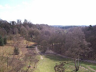
Habberley was one of the hamlets of the ancient parish of Kidderminster in the county of Worcestershire, England. It is now divided so that part of it is an area of the town of Kidderminster and part of it is within the civil parish of Kidderminster Foreign.

Piethorne Brook river in the United Kingdom

Piethorne Brook is a watercourse in Greater Manchester. It is a tributary of the River Beal.

Denny Lodge civil parish in the New Forest in Hampshire, England, United Kingdom

Denny Lodge is a large civil parish in the New Forest in Hampshire, England. It covers a large area of heathland and woodland encompassing much of the eastern side of the New Forest, but contains no towns, villages, churches, or schools.

Blissford human settlement in United Kingdom

Blissford is a hamlet in the civil parish of Hyde situated in the New Forest National Park in Hampshire, England. Its nearest town is Fordingbridge, which lies approximately 2 miles (2.5 km) west from the village. The hamlet lies just to the north of the small village of Frogham. Blissford is situated on low ground around Blissford Cross and towards Ditchend Brook where the ford can be found. References to Blissford appear in records in the early 16th century. The houses in the hamlet are surrounded by patches of woodland and pasture, and there is also a small settlement of mobile homes sited on higher ground.

Furze Hill human settlement in United Kingdom

Furze Hill is a hamlet situated in the New Forest National Park of Hampshire, England. It is in the civil parish of Ellingham, Harbridge and Ibsley. Its nearest town is Fordingbridge, which lies approximately 3.1 miles (5.2 km) north-west from the hamlet.

Hungerford, Hampshire human settlement in United Kingdom

Hungerford is a hamlet in the New Forest National Park of Hampshire, England. Its nearest town is Fordingbridge, which lies approximately 2 miles (3.4 km) north-west of the village.

North Gorley human settlement in United Kingdom

North Gorley is a hamlet in the New Forest National Park of Hampshire, England. Its nearest town is Fordingbridge, which lies approximately 2 miles (3.2 km) north of the hamlet.

Stuckton human settlement in United Kingdom

Stuckton is a hamlet in the New Forest National Park of Hampshire, England. Its nearest town is Fordingbridge, which lies approximately 1 mile (1.7 km) north-west from the village.

Wootton, New Forest human settlement in United Kingdom

Wootton is a hamlet in the civil parish of New Milton in Hampshire, England. It is in the south of the New Forest.

References

  1. 1 2 3 Hyde Parish Village Design Statement Archived July 31, 2012, at the Wayback Machine , page 9 [ dead link ]
  2. Norman Henderson, (2007), A Walk Around the New Forest: In Thirty-Five Circular Walks, pages 121. Frances Lincoln Ltd
  3. New Forest Walks, page 386

Commons-logo.svg Media related to Ogdens at Wikimedia Commons