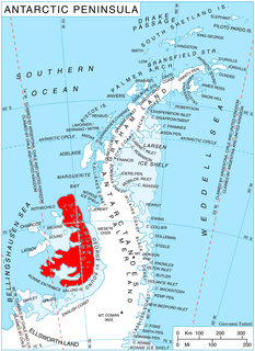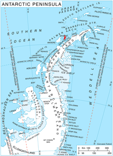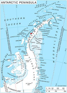
Rose Valley Glacier is a glacier on Varna Peninsula, eastern Livingston Island in the South Shetland Islands, Antarctica situated northeast of Saedinenie Snowfield, northwest of Debelt Glacier and north of Panega Glacier. It extends 5.2 km in southeast-northwest direction and 3.7 km in southwest-northeast direction, and drains the northeast slopes of Vidin Heights to flow into Lister Cove and McFarlane Strait between Pomorie Point and Inott Point.

Yakoruda Glacier is a glacier on the west slopes of Dryanovo Heights, Greenwich Island in the South Shetland Islands, Antarctica situated west of Teteven Glacier and northwest of Murgash Glacier. It extends 3.5 km in north-south direction and 2.5 km in east-west direction, is bounded by Greaves Peak, Hrabar Nunatak and Crutch Peaks to the north, Lloyd Hill to the east and Kerseblept Nunatak to the south, and drains westwards into Berende Cove, McFarlane Strait.

Mangasuli is a village located in Northern Karnataka, India. It is located in the Athani taluk of Belgaum district in Karnataka.

Kasabova Glacier is the 6 km long and 3.5 km wide glacier on Davis Coast in Graham Land on the Antarctic Peninsula. Draining the slopes of Mount Bris, Chubra Peak, Sredorek Peak and Chanute Peak in Korten Ridge, the glacier flows northwestwards to enter Orléans Strait at the head of Lanchester Bay.

Sestrimo Glacier is the 11 km long and 4 km wide glacier on the northwest side of Trinity Peninsula in Graham Land on the Antarctic Peninsula. Situated southwest of Ogoya Glacier, west-northwest of Broad Valley and north of Cugnot Ice Piedmont. Draining the north slopes of Windy Gap, and flowing northwards east of Mount D'Urville and west of Argentino (Guerrero) Peak to enter Lafond Bay in Bransfield Strait south of Cockerell Peninsula.

Yozola Glacier is the 5 km long and 1.7 km wide glacier in the Sofia University Mountains situated in the northern portion of Alexander Island in Antarctica, and draining north-northwestwards between Mount Braun and Balan Ridge to flow into Palestrina Glacier.

Pirogov Glacier is a 5 km long and 1.5 km wide glacier situated south of Djerassi Glacier, west of the head of Mackenzie Glacier and northwest of Balanstra Glacier on Brabant Island in the Palmer Archipelago, Antarctica. It drains the south-southwest slopes of Mount Parry and flows westwards to enter Dallmann Bay south of Minot Point.

Thamyris Glacier is a 3 km long and 2.8 km wide glacier draining the east slopes of the Trojan Range on Anvers Island in the Palmer Archipelago, Antarctica. Situated east of Iliad Glacier, south of Rhesus Glacier and northwest of Kleptuza Glacier. Flowing northeastwards into Fournier Bay south of Predel Point and north of Madzharovo Point.

Lipen Glacier is a 5 km long and 3.5 km wide glacier draining the east slopes of the Trojan Range on Anvers Island in the Palmer Archipelago, Antarctica. Situated east of Iliad Glacier and north of Rhesus Glacier. Flowing northeastwards into the head of Patagonia Bay east of Gourdon Peninsula and west of Thompson Peninsula.

Mitev Glacier is the 2.9 km long and 2.5 km wide glacier on Brabant Island in the Palmer Archipelago, Antarctica situated east of Laennec Glacier. It drains the north slopes of Avroleva Heights and flows northeastwards to enter Hill Bay west of Petroff Point.

Grigorov Glacier is the 1.8 km long and 1.3 km wide glacier on the south side of Stavertsi Ridge on Albena Peninsula, Brabant Island in the Palmer Archipelago, Antarctica. It drains the east slopes of Mount Cabeza and flows southeastwards to enter Hill Bay west of Kostur Point.

Pirin Glacier is the 5.7 km long and 6 km wide glacier situated next east of Chavdar Peninsula on Davis Coast on the Antarctic Peninsula. Situated west of Wright Ice Piedmont, north of Gregory Glacier and east of Samodiva Glacier. Draining north-northwestwards from Boulton Peak to enter Curtiss Bay east of Seaplane Point.

Poduene Glacier is the 3.3 km long and 2.4 km wide glacier on Pefaur (Ventimiglia) Peninsula, Danco Coast on the west side of Antarctic Peninsula, situated west of Agalina Glacier. It drains the north slopes of Mount Zeppelin, and flows northwestwards into Gerlache Strait east of Eckener Point.

Nesla Glacier is the 6.2 km long and 2 km wide glacier on Magnier Peninsula, Graham Coast on the west side of Antarctic Peninsula, situated southwest of Muldava Glacier and north of Kolosh Glacier. It drains the west slopes of Lisiya Ridge west of Mount Perchot, and flows westwards into Bigo Bay next north of the terminus of Kolosh Glacier.

Kolosh Glacier is the 6.7 km long and 3.6 km wide glacier on Magnier Peninsula, Graham Coast on the west side of Antarctic Peninsula, situated south of Nesla Glacier. It drains the west slopes of Lisiya Ridge north of Mount Bigo, and flows northwestwards into Bigo Bay next south of the terminus of Nesla Glacier.

Rusalka Glacier is the 8 km long and 4.6 km wide glacier on Velingrad Peninsula, Graham Coast on the west side of Antarctic Peninsula, situated northeast of Hoek Glacier. It drains the west slopes of Mount Paulcke, and flows northwestwards into Dimitrov Cove in Harrison Passage.

Drama Glacier is the 10 km long and 1.5 km wide glacier on the east side of southern Sentinel Range in Ellsworth Mountains, Antarctica, which is situated north of Carey Glacier and Gabare Glacier, east of the east-northeast ridge of Mount Landolt, and south of Razboyna Glacier. It is draining east-northeastwards to join Rutford Ice Stream northeast of Long Peak.

The South African Railways Class 7A 4-8-0 of 1896 was a steam locomotive from the pre-Union era in the Cape of Good Hope.

Lardeya Ice Piedmont is the glacier extending 8.6 nautical miles in north-south direction and 4 nautical miles in east-west direction on the east side of Sentinel Range in Ellsworth Mountains, Antarctica. It is draining the northeast slopes of Flowers Hills to flow into Rutford Ice Stream to the east-northeast and Ellen Glacier to the north.

Anchialus Glacier is the 8.5 km long and 3.4 km wide glacier in Sostra Heights on the east side of northern Sentinel Range in Ellsworth Mountains, Antarctica. It is situated north of lower Embree Glacier, east of Sabazios Glacier, south of lower Newcomer Glacier and northwest of Vit Ice Piedmont. The glacier drains the northeast slopes of Mount Malone and the west slopes of Bracken Peak, flows northwards and joins Newcomer Glacier east of Mount Lanning.


