
Kirovohrad Oblast, also known as Kirovohradshchyna, is an oblast (province) in central Ukraine. The administrative center of the oblast is the city of Kropyvnytskyi. Its population is 903,712. It is Ukraine's second least populated oblast, behind Chernivtsi.

Mykolaiv Oblast, also referred to as Mykolaivshchyna, is an oblast (province) of Ukraine. The administrative center of the oblast is the city of Mykolaiv. At the most recent estimate, the population of the oblast stood at 1,091,821.

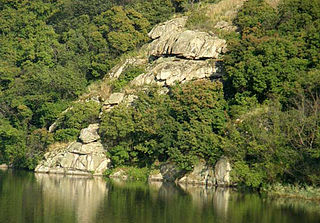
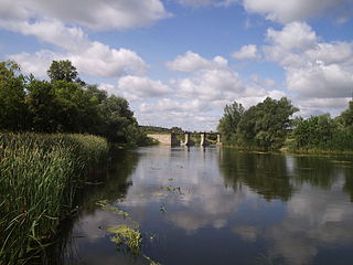
The Southern Bug, also called Southern Buh, and sometimes Boh River, is a navigable river located in Ukraine. It is the second-longest river in Ukraine.

Mykolaiv is a city and a hromada (municipality) in southern Ukraine. Mykolaiv is the administrative center of Mykolaiv Raion (district) and Mykolaiv Oblast (province). The city of Mykolaiv, which provides Ukraine with access to the Black Sea, is the location of the most downriver bridge crossing of the Southern Bug river. This city is one of the main shipbuilding centers of the Black Sea. Aside from three shipyards within the city, there are a number of research centers specializing in shipbuilding such as the State Research and Design Shipbuilding Center, Zoria-Mashproekt and others. As of 2022, the city has a population of 470,011. Mykolaiv holds the honorary title Hero City of Ukraine.

The Ros is a river in Ukraine, a right tributary of the Dnieper. The Ros finds its source in the village of Ordyntsi in Pohrebyshche Raion, Vinnytsia Oblast. It is 346 kilometres (215 mi) long, and has a drainage basin of 12,600 square kilometres (4,900 sq mi). Larger settlements on the river are Bila Tserkva, Bohuslav, and Korsun-Shevchenkivskyi.

The Styr is a right tributary of the Pripyat, with a length of 494 kilometres (307 mi). Its basin area is 13,100 square kilometres (5,100 sq mi) and located in the historical region of Volhynia.

The Seym or Seim is a river that flows westward in Russia and Ukraine. It is 748 kilometres (465 mi) long and its basin area about 27,500 square kilometres (10,600 sq mi). It is the largest tributary of the Desna.

The Oster is a river in the northern Ukrainian oblast of Chernihiv. The river is a left tributary of the Desna River. It is approximately 199 km long and its basin area is 2,950 km2. It is connected by canals and streams with the Trubizh River, which flows southwest from Kyiv into the Dnieper River. Important towns and villages on the river include: Nizhyn, Kozelets, Roslavl and Oster.

The Sula is a left tributary of the Dnieper with a total length of 363 kilometres (226 mi) and a drainage basin of 19,600 square kilometres (7,600 sq mi).

The Teteriv is a right tributary of the Dnieper River in Ukraine. It has a length of 365 kilometres (227 mi) and a drainage basin of 15,300 square kilometres (5,900 sq mi).

The Psel or Psyol is a river, a left tributary of the Dnieper, which flows through Russia and Ukraine.

The Horyn or Haryn is a tributary of the Pripyat, which flows through Ukraine and Belarus. The Horyn is 659 kilometres (409 mi) long, and has a drainage basin of 27,700 square kilometres (10,700 sq mi). It has a maximum width of 80 m, and a maximum depth of 16 m. An important tributary of the Horyn River is the Sluch.

The Sluch or Southern Sluch is a river in Ukraine. It is a right tributary of the Horyn. It has a length of 451 kilometres (280 mi) and a drainage basin of 13,800 square kilometres (5,300 sq mi). The Sluch takes its source in the Ukrainian oblast of Khmelnytskyi. It then flows through the Zhytomyr and Rivne oblasts, and briefly along the Ukrainian-Belarusian border before finally emptying into the Horyn.

Rákóczi's War of Independence (1703–1711) was the first significant attempt to topple the rule of the Habsburgs over Hungary. The war was conducted by a group of noblemen, wealthy and high-ranking progressives and was led by Francis II Rákóczi and resigned soldiers and peasants fought alongside the noblemen. The insurrection was unsuccessful, ending with the Treaty of Szatmár; however, the Hungarian nobility managed to partially satisfy Hungarian interests.
Inhul River Park is a regional landscape park in Mykolaiv region of Ukraine.
The Aidar is a river in Luhansk Oblast, Ukraine and Belgorod Oblast, Russia. A left tributary of the Seversky Donets, it is 264 km (164 mi) long and has a basin area of 7,420 square kilometres (2,860 sq mi). The slopes of the valley are partitioned with ravines and gorges. In the spring, snow melt accounts for approximately 70% of the flow. The average flow module is 1.7 litres • sec / km². The river freezes in December.

The Vysun, Vulsun or Isun is a river of Ukraine, flowing through the Mykolaiv Oblast. It is a right tributary of the Inhulets. It has a length of 201 km and begins in the Dnieper Upland and flows south through Prychornomorskoy Lowland, through the district center of Kazanka. It covers a basin of 2670 km2. During season it is powered mainly by snowmelt.
Kamianets, formerly Novhorodka is a rural settlement in Kropyvnytskyi Raion, Kirovohrad Oblast, Ukraine. It is located on the Kamianka, a left tributary of the Inhul in the drainage basin of the Southern Bug. Kamianets hosts the administration of Novhorodka settlement hromada, one of the hromadas of Ukraine. Population: 5,525.
Ustynivka is a rural settlement in Kropyvnytskyi Raion of Kirovohrad Oblast in Ukraine. It is located on the Berezivka, a left tributary of the Inhul in the drainage basin of the Southern Bug. Ustynivka hosts the administration of Ustynivka settlement hromada, one of the hromadas of Ukraine. Population: 3,233.
Molodizhne is a rural settlement in Kropyvnytskyi Raion, Kirovohrad Oblast, Ukraine. It is located on the left bank of the Berezivka, a left tributary of the Inhul in the basin of the Southern Bug. Molodizhne belongs to Dolynska urban hromada, one of the hromadas of Ukraine. Population: 1,091.


