
The Dnieper, also called Dnepr or Dnipro, is one of the major transboundary rivers of Europe, rising in the Valdai Hills near Smolensk, Russia, before flowing through Belarus and Ukraine to the Black Sea. Approximately 2,200 km (1,400 mi) long, with a drainage basin of 504,000 square kilometres (195,000 sq mi), it is the longest river of Ukraine and Belarus and the fourth-longest river in Europe, after the Volga, Danube, and Ural rivers.

Dnipropetrovsk Oblast, is an oblast (province) in simultaneously southern, eastern and central Ukraine, the most important industrial region of the country. It was created on February 27, 1932. Dnipropetrovsk Oblast has a population of about 3,096,485, approximately 80% of whom live centering on administrative centers: Dnipro, Kryvyi Rih, Kamianske, Nikopol and Pavlohrad. The Dnieper River runs through the oblast.
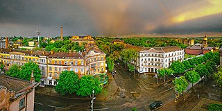
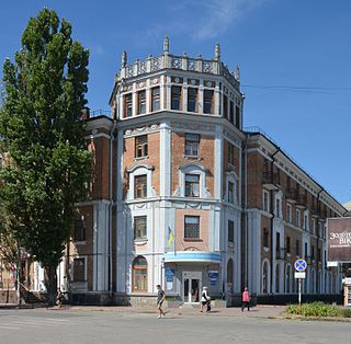
Kryvyi Rih, also known as Krivoy Rog, is a city in central Ukraine. It hosts the administration of Kryvyi Rih Raion and its subordinate Kryvyi Rih urban hromada in Dnipropetrovsk Oblast. The city is part of the Kryvyi Rih Metropolitan Region. Its population is estimated at 603,904, making it the seventh-most populous city in Ukraine and the second largest by area. Kryvyi Rih is claimed to be the longest city in Europe.

Kherson Oblast, also known as Khersonshchyna, is an oblast (province) in southern Ukraine. It is located just north of Crimea. Its administrative center is Kherson, on the northern or right bank of the Dnieper river, which bisects the oblast. The oblast has an area of 28,461 km2 and a population of 1,001,598. It is considered the 'fruit basket' of the country, as much of its agricultural production is dispersed throughout the country, with production peaking during the summer months.
Nikopol is a city and municipality (hromada) in Nikopol Raion in the south of Ukraine, on the right bank of the Dnieper River, about 63 km south-east of Kryvyi Rih and 48 km south-west of Zaporizhzhia. Population: 105.160.

Kryvyi Rih Iron Ore Basin, commonly known by the portmanteau Kryvbas is an important economic and historical region stretched between central and southern Ukraine around the city of Kryvyi Rih, specializing in iron ore mining, steel industry and some uranium ore mining in the past 20th century. It is arguably the main iron ore region of Eastern Europe.

The Kakhovka Reservoir was a water reservoir on the Dnieper River in Ukraine. It was created in 1956 by construction of the Kakhovka Dam at Nova Kakhovka. It was one of several reservoirs in the Dnieper reservoir cascade.

The North Crimean Canal, formerly known as the North Crimean Canal of the Lenin's Komsomol of Ukraine in Soviet times, is a land improvement canal for irrigation and watering of Kherson Oblast in southern Ukraine and the Crimean Peninsula. The canal has multiple branches throughout Kherson Oblast and Crimea, and is normally active from March until December.
Canals in Ukraine are mostly for irrigation or water supply. Most of them are supervised by the Canal Administration of the State Agency of water resources of Ukraine. As the rest of water resources canals compose the Water Fund of Ukraine and are included in the Water Cadastre (register) of Ukraine.

The Kakhovka Dam was a dam on the Dnieper River in Kherson Oblast, Ukraine, completed in 1956 and destroyed in 2023, which provided water for the Kakhovka Hydroelectric Station. The primary purposes of the dam were hydroelectric power generation, irrigation, and navigation. It was the sixth and last dam in the Dnieper reservoir cascade.

The Saksahan is a river in Ukraine, in the southeastern part of the Dnieper Upland. It is a left tributary of the Inhulets, joining the Inhulets in the city of Kryvyi Rih.

Novovorontsovka is a rural settlement in Beryslav Raion, Kherson Oblast, southern Ukraine. It hosts the administration of Novovorontsovka settlement hromada, one of the hromadas of Ukraine. Novovorontsovka is located on the right bank of the Kakhovka Reservoir, an artificial reservoir on the Dnieper. It has a population of 5,951.

Vysokopillia or Vysokopillya is a rural settlement in Beryslav Raion, Kherson Oblast, southern Ukraine. It hosts the administration of Vysokopillia settlement hromada, one of the hromadas of Ukraine. Vysokopillia is located between the valleys of the Dnieper and Inhulets rivers, 12 kilometres (7.5 mi) east of the Inhulets. It has a population of 3,801.

Liubymivka is a rural settlement in Kakhovka Raion, Kherson Oblast, southern Ukraine. It is adjacent to the city of Kakhovka and is located on the left bank of the Dnieper, which is dammed there creating the Kakhovka Reservoir. Liubymivka hosts the administration of Liubymivka settlement hromada, one of the hromadas of Ukraine. It has a population of 5,449.

Kalynivske is a rural settlement in Beryslav Raion, Kherson Oblast, Ukraine. It is located on the left bank of the Inhulets River, a right tributary of the Dnieper. Kalynivske hosts the administration of Kalynivske settlement hromada, one of the hromadas of Ukraine. It has a population of 1,057.
Karierne is a rural settlement in Beryslav Raion, Kherson Oblast, southern Ukraine. It is located in the steppe, 2 kilometres (1.2 mi) from the right bank of the Inhulets. Karierne belongs to Velyka Oleksandrivka settlement hromada, one of the hromadas of Ukraine. It has a population of 323.
Haidamatske is a rural settlement in Kropyvnytskyi Raion of Kirovohrad Oblast in Ukraine. It is located on the right bank of the Inhulets, a right tributary of the Dnieper. Yelyzavethradka belongs to Oleksandrivka settlement hromada, one of the hromadas of Ukraine. Population: 1,112.

Nova Praha is a rural settlement in Oleksandriia Raion, Kirovohrad Oblast, Ukraine. It is located on the banks of the Beshka, a right tributary of the Inhulets in the basin of the Dnieper. Nova Praha hosts the administration of Nova Praha settlement hromada, one of the hromadas of Ukraine. Population: 6,266.

Russian occupiers carried out a series of artillery fire and air raids in the city of Kryvyi Rih during the Russian invasion of Ukraine.

The Kakhovka Dam was breached in the early hours of 6 June 2023, causing extensive flooding along the lower Dnieper river, also called the Dnipro, in Kherson Oblast. The dam was under the control of the Russian military, which had seized it in the early days of the Russian invasion of Ukraine. Many experts have concluded that Russian forces likely blew up a segment of the dam to hinder the planned Ukrainian counter-offensive. Russian authorities have denied the accusation.


