Isabela, Negros Occidental

Last updated
Isabela
Municipality of Isabela
Camangcamang, Isabela, Negros Occidental.jpg
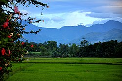
Barangay Camangcamang with Mabinay Mountains seen in the distance
Flag of Isabela, Negros Occidental.png
Nickname: 
The Sweet Heart of Negros
Ph locator negros occidental isabela.png
Map of Negros Occidental with Isabela highlighted
OpenStreetMap
Isabela, Negros Occidental
Philippines location map (square).svg
Red pog.svg
Isabela
Location within the Philippines
Coordinates: 10°12′N122°59′E / 10.2°N 122.98°E / 10.2; 122.98
Country Philippines
Region Negros Island Region
Province Negros Occidental
District 5th district
Named for Isabella II of Spain
Barangays 30 (see Barangays)
Government
[1]
  Type Sangguniang Bayan
   Mayor Irene C. Montilla
   Vice Mayor Juan Miguel C. Montilla
   Representative Emilio Bernardino L. Yulo III
   Municipal Council
Members
   Electorate 41,301 voters (2022)
Area
[2]
  Total
178.76 km2 (69.02 sq mi)
Elevation
52 m (171 ft)
Highest elevation
651 m (2,136 ft)
Lowest elevation
12 m (39 ft)
Population
 (2020 census) [3]
  Total
64,516
  Density360/km2 (930/sq mi)
   Households
15,685
Economy
   Income class 2nd municipal income class
   Poverty incidence
23.96
% (2021) [4]
   Revenue 285.9 million (2022)
   Assets 473.8 million (2022)
   Expenditure 228 million (2022)
   Liabilities 86.09 million (2022)
Service provider
  ElectricityNegros Occidental Electric Cooperative (NOCECO)
Time zone UTC+8 (PST)
ZIP code
6128
PSGC
IDD : area code +63(0)34
Native languages Hiligaynon
Ati
Tagalog
Website www.isabela.gov.ph

Isabela, officially the Municipality of Isabela, is a municipality in the province of Negros Occidental, Philippines. According to the 2020 census, it has a population of 64,516 people. [3]

Contents

Isabela is known for BISCOM (Binalbagan Isabela Sugar Company) located in nearby Binalbagan town.

History

In 1951, the barrios of Magallon, Odiong, and Guinpanaan were separated from Isabela and formed into the town of Magallon (now Moises Padilla). [5]

Geography

Isabela is 80 kilometres (50 mi) from Bacolod (via La Castellana) or 71 kilometres (44 mi) (via Hinigaran), 35 kilometres (22 mi) from Guihulngan, 14 kilometres (8.7 mi) from Binalbagan, and 19 kilometres (12 mi) from Hinigaran.

Barangays

Isabela is politically subdivided into 30 barangays. Each barangay consists of puroks and some have sitios.

Climate

Climate data for Isabela, Negros Occidental
MonthJanFebMarAprMayJunJulAugSepOctNovDecYear
Mean daily maximum °C (°F)30
(86)
31
(88)
32
(90)
33
(91)
32
(90)
30
(86)
29
(84)
29
(84)
29
(84)
29
(84)
30
(86)
30
(86)
30
(87)
Mean daily minimum °C (°F)22
(72)
22
(72)
22
(72)
24
(75)
25
(77)
25
(77)
25
(77)
24
(75)
24
(75)
24
(75)
23
(73)
23
(73)
24
(74)
Average precipitation mm (inches)38
(1.5)
29
(1.1)
55
(2.2)
65
(2.6)
141
(5.6)
210
(8.3)
212
(8.3)
176
(6.9)
180
(7.1)
180
(7.1)
130
(5.1)
70
(2.8)
1,486
(58.6)
Average rainy days9.07.211.113.525.628.428.927.326.927.721.813.8241.2
Source: Meteoblue (modeled/calculated data, not measured locally) [6]

Demographics

Population census of Isabela
YearPop.±% p.a.
1903 12,836    
1918 19,653+2.88%
1939 43,509+3.86%
1948 33,743−2.78%
1960 29,769−1.04%
1970 33,636+1.23%
1975 37,400+2.15%
1980 39,704+1.20%
YearPop.±% p.a.
1990 47,010+1.70%
1995 49,019+0.79%
2000 48,719−0.13%
2007 58,819+2.63%
2010 59,523+0.43%
2015 62,146+0.82%
2020 64,516+0.74%
Source: Philippine Statistics Authority [7] [8] [9] [10]

Economy

Poverty incidence of Isabela

10
20
30
40
50
60
2000
59.48
2003
43.56
2006
36.10
2009
33.84
2012
27.30
2015
26.84
2018
28.00
2021
23.96

Source: Philippine Statistics Authority [11] [12] [13] [14] [15] [16] [17] [18]

Festival

"Tigkalagkalag" is celebrated on the evening of Nov. 2 every year in the town of Isabela. [19] The Pana-ad victory of Tigkalagkalag (Kalag-Kalag) festival is expected to boost the attraction of this unique festival that began in Purok Manacup beside the public cemetery in Isabela town where people would have fun during the night of All Souls Day that was capped with a beauty pageant called Search for the White Lady, this is the same of San Juan Balete Drive {Lost Soul}. It spun off into the municipal festival under former Mayor Renato Malabor, when the town was searching for a festival that was going to be its tourism plank.

Tigkalalag festival of Isabela turned what otherwise are morbid concepts of coffins, candelabras and crashing tombs into a whimsical, tightly designed, skillfully-choreographed presentation that sent it howling to success in yearly competition of all the festivals of Negros Occidental. Tigkalalag is Hiligaynon for All Souls' Day.

Notable personalities

References

  1. Municipality of Isabela | (DILG)
  2. "2015 Census of Population, Report No. 3 – Population, Land Area, and Population Density" (PDF). Philippine Statistics Authority. Quezon City, Philippines. August 2016. ISSN   0117-1453. Archived (PDF) from the original on May 25, 2021. Retrieved July 16, 2021.
  3. 1 2 '"`UNIQ--templatestyles-00000009-QINU`"'Census of Population (2020). "Region VI (Western Visayas)". Total Population by Province, City, Municipality and Barangay. Philippine Statistics Authority . Retrieved 8 July 2021.
  4. '"`UNIQ--templatestyles-0000000C-QINU`"' "PSA Releases the 2021 City and Municipal Level Poverty Estimates". Philippine Statistics Authority. 2 April 2024. Retrieved 28 April 2024.
  5. "An act creating the municipality of Magallon in the province of Negros Occidental". LawPH.com. Retrieved 2011-04-09.
  6. "Isabela: Average Temperatures and Rainfall". Meteoblue. Retrieved 7 May 2020.
  7. '"`UNIQ--templatestyles-0000002B-QINU`"'Census of Population (2015). "Region VI (Western Visayas)". Total Population by Province, City, Municipality and Barangay. Philippine Statistics Authority . Retrieved 20 June 2016.
  8. '"`UNIQ--templatestyles-0000002D-QINU`"'Census of Population and Housing (2010). "Region VI (Western Visayas)" (PDF). Total Population by Province, City, Municipality and Barangay. National Statistics Office . Retrieved 29 June 2016.
  9. '"`UNIQ--templatestyles-0000002F-QINU`"'Censuses of Population (1903–2007). "Region VI (Western Visayas)". Table 1. Population Enumerated in Various Censuses by Province/Highly Urbanized City: 1903 to 2007. National Statistics Office.
  10. "Province of". Municipality Population Data. Local Water Utilities Administration Research Division. Retrieved 17 December 2016.
  11. "Poverty incidence (PI):". Philippine Statistics Authority. Retrieved December 28, 2020.
  12. "Estimation of Local Poverty in the Philippines" (PDF). Philippine Statistics Authority. 29 November 2005.
  13. "2003 City and Municipal Level Poverty Estimates" (PDF). Philippine Statistics Authority. 23 March 2009.
  14. "City and Municipal Level Poverty Estimates; 2006 and 2009" (PDF). Philippine Statistics Authority. 3 August 2012.
  15. "2012 Municipal and City Level Poverty Estimates" (PDF). Philippine Statistics Authority. 31 May 2016.
  16. "Municipal and City Level Small Area Poverty Estimates; 2009, 2012 and 2015". Philippine Statistics Authority. 10 July 2019.
  17. "PSA Releases the 2018 Municipal and City Level Poverty Estimates". Philippine Statistics Authority. 15 December 2021. Retrieved 22 January 2022.
  18. "PSA Releases the 2021 City and Municipal Level Poverty Estimates". Philippine Statistics Authority. 2 April 2024. Retrieved 28 April 2024.
  19. "Municipality of Isabela". Negros Occidental Provincial Government. Retrieved 6 March 2013.