Kabankalan

Last updated

Kabankalan
City of Kabankalan
KabankalanCityGovernmentCenter.jpg
Kabankalan City Government Center (City Hall)
Flag of Kabankalan, Negros Occidental.png
Kabankalan City seal.svg
Nickname: 
The Rising City of the South
Ph locator negros occidental kabankalan.png
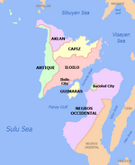
Map of Negros Occidental with Kabankalan highlighted
OpenStreetMap
Kabankalan
Philippines location map (square).svg
Red pog.svg
Kabankalan
Location within the Philippines
Coordinates: 9°59′N122°49′E / 9.98°N 122.82°E / 9.98; 122.82
Country Philippines
Region Western Visayas
Province Negros Occidental
District 6th district
Founded March 14, 1907
CityhoodAugust 2, 1997
Barangays 32 (see Barangays)
Government
[1]
  Type Sangguniang Panlungsod
  MayorBenjie M. Miranda
   Vice Mayor Miguel M. Zayco
   Representative Mercedes K. Alvarez
   City Council
Members
   Electorate 104,994 voters (2022)
Area
[2]
  Total697.35 km2 (269.25 sq mi)
Elevation
228 m (748 ft)
Highest elevation
1,455 m (4,774 ft)
Lowest elevation
0 m (0 ft)
Population
 (2020 census)
  Total200,198
  Density290/km2 (740/sq mi)
   Households
45,285
Economy
   Income class 1st city income class
   Poverty incidence
28.57
% (2018) [3]
   Revenue 1,398 million (2020)
   Assets 5,211 million (2020)
   Expenditure 1,042 million (2020)
   Liabilities 979.8 million (2020)
Service provider
  ElectricityNegros Occidental Electric Cooperative (NOCECO)
Time zone UTC+8 (PST)
ZIP code
6111
PSGC
IDD : area code +63(0)34
Native languages Hiligaynon
Karolanos
Tagalog
Cebuano
Website www.kabankalancity.gov.ph

Kabankalan, officially the City of Kabankalan (Hiligaynon : Dakbanwa sang Kabankalan; Cebuano : Dakbayan sa Kabankalan; Filipino : Lungsod ng Kabankalan), is a 1st class component city in the province of Negros Occidental, Philippines. According to the 2020 census, it has a population of 200,198 people [4] making it the second most populous city in Negros Occidental next to Bacolod.

Contents

Kabankalan is also the second city with the highest gross and net income in Negros Occidental next to Bacolod. In terms of land area, Kabankalan City is the largest city in the province of Negros Occidental and is the second largest city in the entire Negros Island next to Bayawan of Negros Oriental with a total area of 697.35 km2

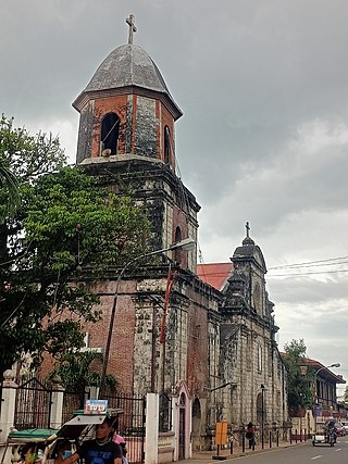
The city hosts three major festivals: the Kabankalan Sinulog every third Sunday of January (celebrated together with Cebu City), Udyakan sa Kabankalan and the Charter Anniversary. Kabankalan is also known for its Mag-aso Falls and the Balicaocao Resort. Also located in the city is the main campus of the Central Philippines State University (CPSU).

Kabankalan City won the major award as the "Best Performing City" in Region VI in the 2011 Regional Search for Excellence in Local Governance (EXCEL). The award was given during the Pagdayaw 2011 program held at the Iloilo Grand Hotel in December 2011. [5]

History

Aerial view of Kabankalan, 1938 Landing Fields - Philippines - Negros Island - NARA - 68161338.jpg
Aerial view of Kabankalan, 1938

According to historians, the first inhabitants of Kabankalan were people who came from neighboring towns. They derived the name Kabankalan from the word "bangkal" ( Nauclea orientalis ), a tree that is abundant in the place. The settlers established the Barangay form of government, with which every group has its own leader, called the Capitan.

In 1566 the Christianization of the Island of Negros began with the foundation of the mission of Binalbagan (1575), Tanjay (1580) and Ilog (1584) by the Augustinian missionaries. In 1622, at the request of Bishop Pedro de Arce of Cebu, the Recollects came to evangelize Negros. The spiritual administration of Binalbagan including that of Kabankalan was ceded to them. When the mission of Ilog was turned over to the Jesuits, it had four towns, Ilog being the chief town. The next was Kabankalan which already appears in a document dated 1630 as the center of encomienda of Admiral Cristobal de Lugo y Montalvo. The third was either Jima or Sima. The fourth was probably Su-ay. [6] The Jesuits who served Kabankalan were Fr. Esteban Jayme. After the expulsion of the Jesuits from the Philippines in 1767, the Dominican missionaries came to continue the spiritual administration of Negros with Father Manuel Diez assigned in Kabankalan in 1769. During the Spanish regime, Spaniards taught the people the Spanish language and introduced to them the Roman Catholic religion.

In 1830, the three Capitanes- Polito Moreno, Vicente Rojas and Mariano Vingal-petitioned the government to transfer their barangay located at the Hilabangan River towards the area of Orong and established a town. They elected a migrant from Tigbauan, Iloilo-Leocadio Tayum y Gregorio- their new head, who served for one year. In 1856, 500 commissaries and policeman of Governor Emilio Saravia stationed in the poblacion attacked the stronghold “made of trunk” of the local chief Manyabog at Carol-an who endured the Spanish artillery for a long time. They disbanded only when a stray bullet killed Manyabog. Seeing their leader killed, they set themselves on fire with their houses. The tribal suicide resulted in the deaths 300 of Manyabog's men, while seven died on the opposite side. Prior to the actual revolt in 1898, clandestine activities had already been in the offing, the leaders of the revolution such as Aniceto Lacson joining the Katipunan and others arming themselves. By mid-1896, arms were unloaded in Binicuil, Kabankalan for the hacienderos of Kabankalan, Ilog, Himamaylan, Su-ay and Cauayan but they refrained to join the revolt knowing that they were not prepared and had no confidence in victory. It was not until November 7, 1898, that Kabankalan took up arms after Bacolod was taken over from the Spanish authorities. The Cantonal Republic of Negros was declared on November 5, 1898.

Kabankalan Lion's Arch KabankalanCityLionsArch.jpg
Kabankalan Lion's Arch

When the Americans came, they introduced a democratic form of government. During this time, a lot of improvements came to the town and new modern techniques of farming were introduced by the Americans to the local farmers that improved their products. On April 2, 1903, the Philippine Commission passed Act No. 716 reducing the 34 municipalities of the Province of Negros Occidental to 21 whereby the municipality of Cavancalan was merged to Ilog. On March 14, 1907, Philippine Commission passed Act. No. 1612 increasing the number of municipalities in Negros Occidental from 21 to 22 by separating from Ilog the former municipality of Cavancalan and reconstituting the same under the name Kabankalan. In mid-1907, a group of rebels called "Pulahanes" led by Papa Isio, raided the town and burned down all the houses. However, the people of Kabankalan quickly recovered and rebuilt the town from the destruction caused by the dissidents. Lorenzo Zayco was elected Municipal President in a special election and took his oath of office, along with other elected officials on January 2, 1908. Pre War-Kabankalan saw the emerging development of the sugar industry. Sugar mills were put up in Hacienda Bearin and Hacienda San Isidro.

During the Second World War, Kabankalan was made a garrison town by Japanese Imperial Forces. Sugar mills were destroyed, school buildings were demolished and houses razed to ground. During this time, a recognized guerrilla unit and the local troops of the Philippine Commonwealth Army were formed to oppose the foreign aggression and many people fled to the mountains to avoid Japanese military abuse. When the Americans returned to the island to aid Filipino soldiers under the Commonwealth Army and Constabulary, and the recognized guerrillas, they helped the people be freed from Japanese occupation. Post war era concentrated on rehabilitation efforts that saw the establishment of two Sugar Mills-Dacongcogon and SONEDCO-placing Kabankalan at the crossroad of agro industrial development and setting the ground as a hub of business and trade in southern Negros. With the growth of the sugar industry, banks and other financial institutions and commercial establishments put up branches and offices in Kabankalan. The establishment of two sugar mills in the 1960s and early 1970s gave the town a boost into the list of the top improving towns of Negros.

Cityhood

The town of Kabankalan was declared by then President Fidel V. Ramos as a chartered city on August 2, 1997, under Republic Act No. 8297.

Geography

Mag-aso Falls, Kabankalan, Negros Occidental Mag-asoFallsKabankalanNegrosOcc.jpg
Mag-aso Falls, Kabankalan, Negros Occidental

Kabankalan occupies the central portion of the Southern Negros Island and its geographically located at 10° north and 122° east. It is bounded on the north by the City of Himamaylan, on the northwest by Panay Gulf, on the southwest by the Municipality of Ilog and on the southeast by the Province of Negros Oriental. It is 88 kilometres (55 mi) away from Bacolod City, 127 kilometres (79 mi) from Dumaguete, and 99 kilometres (62 mi) from the southernmost town of Hinoba-an. With an area of 697.95 square kilometers, it is the largest city in Negros Occidental and the second largest in the whole Negros Island, after Bayawan (which has an area of 699.08 square kilometers).

Transportation

Kabankalan is over an hour's drive south of Bacolod City by private car while public utility vehicles reach the place in about two hours. The city, which serves as the hub of economic activities in southern Negros, is also the take-off point for various destinations down south, and links the province to Dumaguete, capital of Negros Oriental, via the Kabankalan-Mabinay Highway. Its location roughly halfway between Bacolod and Dumaguete made it to supposedly host the regional center of the then Negros Island Region, along with neighbouring Mabinay to its southeast in Negros Oriental. Once completed, the Kabankalan City Domestic Airport will be the second active airport in the province (after the Bacolod-Silay International Airport). [7]

Climate

Climate data for Kabankalan
MonthJanFebMarAprMayJunJulAugSepOctNovDecYear
Mean daily maximum °C (°F)30
(86)
31
(88)
32
(90)
33
(91)
32
(90)
30
(86)
29
(84)
29
(84)
29
(84)
29
(84)
30
(86)
30
(86)
30
(87)
Mean daily minimum °C (°F)22
(72)
22
(72)
22
(72)
24
(75)
25
(77)
25
(77)
25
(77)
24
(75)
24
(75)
24
(75)
23
(73)
23
(73)
24
(74)
Average precipitation mm (inches)38
(1.5)
29
(1.1)
55
(2.2)
65
(2.6)
141
(5.6)
210
(8.3)
212
(8.3)
176
(6.9)
180
(7.1)
180
(7.1)
130
(5.1)
70
(2.8)
1,486
(58.6)
Average rainy days9.07.211.113.525.628.428.927.326.927.721.813.8241.2
Source: Meteoblue [8]

Kabankalan has Type 3 climate condition which means dry season is from December to May while the rainy season is from June to November. Average temperature is 26 degrees Celsius (80 degrees Fahrenheit).

Barangays

Kabankalan City is politically subdivided into 32 barangays. Each barangay consists of puroks and some have sitios.

Demographics

Population census of Kabankalan
YearPop.±% p.a.
1903 12,671    
1918 17,113+2.02%
1939 29,315+2.60%
1948 47,817+5.59%
1960 59,341+1.82%
1970 72,567+2.03%
1975 89,695+4.34%
1980 92,109+0.53%
1990 127,000+3.26%
1995 139,282+1.74%
2000 149,769+1.57%
2007 166,970+1.51%
2010 167,666+0.15%
2015 181,977+1.57%
2020 200,198+1.89%
Source: Philippine Statistics Authority [9] [10] [11] [12]
Aerial view of the city, with the Kabankalan Cathedral in the center. KabankalanAerialCathedral.jpg
Aerial view of the city, with the Kabankalan Cathedral in the center.

Major languages are Hiligaynon, followed by Cebuano (both of those languages are used interchangeably in to day-to-day activities) with English and Filipino being used as second languages.

The city is the only place where the Karol-an language is used. Due to its geographical area of usage, the Karol-an language is classified as a vulnerable language, making its conservation a top priority, as it is vital to the culture and arts of Kabankalan natives.

Kabankalan City, along with the cities of Sipalay, Escalante, Cadiz, Sagay and San Carlos and the municipalities of Hinoba-an, Don Salvador Benedicto, La Castellana, Moises Padilla, Toboso and Calatrava, are the only places in Negros Occidental who are bilingual speakers, as the people in those areas can speak and understand both Cebuano (Bisaya) and Hiligaynon (Ilonggo) at the same time, due to the influx of Cebuano-speaking settlers in those areas.

Economy

Related Research Articles

<span class="mw-page-title-main">Negros Oriental</span> Province in Central Visayas, Philippines

Negros Oriental, officially the Province of Negros Oriental, is a province in the Philippines located in the Central Visayas region. Its capital is the city of Dumaguete. It occupies the southeastern half of the large island of Negros, and borders Negros Occidental, which comprises the northwestern half. It also includes Apo Island, a popular dive site for both local and foreign tourists.

<span class="mw-page-title-main">Negros Occidental</span> Province in Western Visayas, Philippines

Negros Occidental, officially the Province of Negros Occidental (Hiligaynon: Kapuoran sang Nakatungdang Negros (Negros Occidental; Tagalog: Lalawigan ng Kanlurang Negros, is a province in the Philippines located in the Western Visayas region. Its capital is the city of Bacolod, of which it is geographically situated and grouped under by the Philippine Statistics Authority, but remains politically independent from the provincial government. It occupies the northwestern half of the large island of Negros, and borders Negros Oriental, which comprises the southeastern half. Known as the "Sugarbowl of the Philippines", Negros Occidental produces more than half the nation's sugar output.

<span class="mw-page-title-main">Western Visayas</span> Administrative region of the Philippines

Western Visayas is an administrative region in the Philippines, numerically designated as Region VI. It consists of six provinces and two highly urbanized cities. The regional center is Iloilo City. The region is dominated by the native speakers of four Visayan languages: Hiligaynon, Kinaray-a, Aklanon and Capiznon. The land area of the region is 20,794.18 km2 (8,028.68 sq mi), and with a population of 7,954,723 inhabitants, it is the second most populous region in the Visayas after Central Visayas.

<span class="mw-page-title-main">Dumaguete</span> Capital of Negros Oriental, Philippines

Dumaguete, officially the City of Dumaguete, is a 2nd class component city and capital of the province of Negros Oriental, Philippines. According to the 2020 census, it has a population of 134,103 people. It is the most populous city and the smallest city by land area in Negros Oriental.

<span class="mw-page-title-main">Ilog, Negros Occidental</span> Municipality in Negros Occidental, Philippines

Ilog, officially the Municipality of Ilog, is a 2nd class municipality in the province of Negros Occidental, Philippines. According to the 2020 census, it has a population of 59,855 people.

<span class="mw-page-title-main">Candoni</span> Municipality in Negros Occidental, Philippines

Candoni, officially the Municipality of Candoni, formerly known as Tabla Valley, is a 4th class municipality in the province of Negros Occidental, Philippines. According to the 2020 census, it has a population of 23,751 people.

<span class="mw-page-title-main">Binalbagan</span> Municipality in Negros Occidental, Philippines

Binalbagan, officially the Municipality of Binalbagan, is a 1st class municipality in the province of Negros Occidental, Philippines. According to the 2020 census, it has a population of 71,407 people.

<span class="mw-page-title-main">Calatrava, Negros Occidental</span> Municipality in Negros Occidental, Philippines

Calatrava, officially the Municipality of Calatrava, is a 1st class municipality in the province of Negros Occidental, Philippines. According to the 2020 census, it has a population of 82,540 people.

<span class="mw-page-title-main">Cauayan, Negros Occidental</span> Municipality in Negros Occidental, Philippines

Cauayan, officially the Municipality of Cauayan, is a 1st class municipality and the most populous municipality in the province of Negros Occidental, Philippines. According to the 2020 census, it has a population of 108,480 people.

<span class="mw-page-title-main">Escalante, Negros Occidental</span> Component city in Negros Occidental, Philippines

Escalante, officially the City of Escalante, is a 4th class component city in the province of Negros Occidental, Philippines. According to the 2020 census, it has a population of 96,159 people.

<span class="mw-page-title-main">Himamaylan</span> Component city in Negros Occidental, Philippines

Himamaylan, officially the City of Himamaylan, is a 3rd class component city in the province of Negros Occidental, Philippines. According to the 2020 census, it has a population of 116,240 people.

<span class="mw-page-title-main">Hinoba-an</span> Municipality in Negros Occidental, Philippines

Hinoba-an, officially the Municipality of Hinoba-an, is a 1st class municipality in the province of Negros Occidental, Philippines. According to the 2020 census, it has a population of 60,865 people.

<span class="mw-page-title-main">Isabela, Negros Occidental</span> Municipality in Negros Occidental, Philippines

Isabela, officially the Municipality of Isabela, is a 2nd class municipality in the province of Negros Occidental, Philippines. According to the 2020 census, it has a population of 64,516 people.

<span class="mw-page-title-main">La Carlota, Negros Occidental</span> Component city in Negros Occidental, Philippines

La Carlota, officially the City of La Carlota,, is a 4th class component city in the province of Negros Occidental, Philippines. According to the 2020 census, it has a population of 66,664 people. making it the least populous city in the province.

<span class="mw-page-title-main">Moises Padilla</span> Municipality in Negros Occidental, Philippines

Moises Padilla, officially the Municipality of Moises Padilla, is a 3rd class municipality in the province of Negros Occidental, Philippines. According to the 2020 census, it has a population of 43,462 people.

<span class="mw-page-title-main">Pulupandan</span> Municipality in Negros Occidental, Philippines

Pulupandan, officially the Municipality of Pulupandan, is a 3rd class municipality in the province of Negros Occidental, Philippines. According to the 2020 census, it has a population of 30,117 people.

<span class="mw-page-title-main">Sipalay</span> Component city in Negros Occidental, Philippines

Sipalay, officially the City of Sipalay, is a 4th class component city in the province of Negros Occidental, Philippines. According to the 2020 census, it has a population of 72,448 people. It is the top tourist destination in the province of Negros Occidental.

<span class="mw-page-title-main">Talisay, Negros Occidental</span> Component city in Negros Occidental, Philippines

Talisay, officially the City of Talisay, is a 4th class component city in the province of Negros Occidental, Philippines. According to the 2020 census, it has a population of 108,909 people.

<span class="mw-page-title-main">Toboso, Negros Occidental</span> Municipality in Negros Occidental, Philippines

Toboso, officially the Municipality of Toboso, is a 3rd class municipality in the province of Negros Occidental, Philippines. According to the 2020 census, it has a population of 43,445 people.

<span class="mw-page-title-main">Victorias</span> Component city in Negros Occidental, Philippines

Victorias, officially the City of Victorias, is a 4th class component city in the province of Negros Occidental, Philippines. According to the 2020 census, it has a population of 90,101 people.

References

  1. City of Kabankalan | (DILG)
  2. "2015 Census of Population, Report No. 3 – Population, Land Area, and Population Density" (PDF). Philippine Statistics Authority. Quezon City, Philippines. August 2016. ISSN   0117-1453. Archived (PDF) from the original on May 25, 2021. Retrieved July 16, 2021.
  3. "PSA Releases the 2018 Municipal and City Level Poverty Estimates". Philippine Statistics Authority. December 15, 2021. Retrieved January 22, 2022.
  4. Census of Population (2020). "Region VI (Western Visayas)". Total Population by Province, City, Municipality and Barangay. Philippine Statistics Authority . Retrieved July 8, 2021.
  5. Kabankalan City is best performing city in WVisayas - PIA
  6. (Cuesta, 1980)
  7. Bayoran, Gilbert (January 20, 2014). "Zayco: Kabankalan airport work still on". The Daily Star. Retrieved November 25, 2015.
  8. "Kabankalan: Average Temperatures and Rainfall". Meteoblue. Retrieved May 7, 2020.
  9. Census of Population (2015). "Region VI (Western Visayas)". Total Population by Province, City, Municipality and Barangay. Philippine Statistics Authority . Retrieved June 20, 2016.
  10. Census of Population and Housing (2010). "Region VI (Western Visayas)" (PDF). Total Population by Province, City, Municipality and Barangay. National Statistics Office . Retrieved June 29, 2016.
  11. Censuses of Population (1903–2007). "Region VI (Western Visayas)". Table 1. Population Enumerated in Various Censuses by Province/Highly Urbanized City: 1903 to 2007. National Statistics Office.{{cite encyclopedia}}: CS1 maint: numeric names: authors list (link)
  12. "Province of". Municipality Population Data. Local Water Utilities Administration Research Division. Retrieved December 17, 2016.
  13. "Poverty incidence (PI):". Philippine Statistics Authority. Retrieved December 28, 2020.
  14. "Estimation of Local Poverty in the Philippines" (PDF). Philippine Statistics Authority. November 29, 2005.
  15. "2003 City and Municipal Level Poverty Estimates" (PDF). Philippine Statistics Authority. March 23, 2009.
  16. "City and Municipal Level Poverty Estimates; 2006 and 2009" (PDF). Philippine Statistics Authority. August 3, 2012.
  17. "2012 Municipal and City Level Poverty Estimates" (PDF). Philippine Statistics Authority. May 31, 2016.
  18. "Municipal and City Level Small Area Poverty Estimates; 2009, 2012 and 2015". Philippine Statistics Authority. July 10, 2019.
  19. "PSA Releases the 2018 Municipal and City Level Poverty Estimates". Philippine Statistics Authority. December 15, 2021. Retrieved January 22, 2022.