According to the 2024 census, it has a population of 122,771 people. [1]
Contents
- Etymology
- History
- Early history
- Cityhood
- Geography
- Barangays
- Climate
- Demographics
- Language
- Economy
- Government
- Local government
- Elected officials
- Education
- Primary and elementary schools
- Secondary schools
- Higher educational institutions
- References
- External links
Tabuk | |
|---|---|
| City of Tabuk | |
 Tabuk-Enrile Road | |
 Flag  Seal | |
 Map of Kalinga with Tabuk highlighted | |
 Interactive map of Tabuk | |
 Tabuk Location within the Philippines | |
| Coordinates: 17°24′25″N121°26′33″E / 17.4069°N 121.4425°E | |
| Country | Philippines |
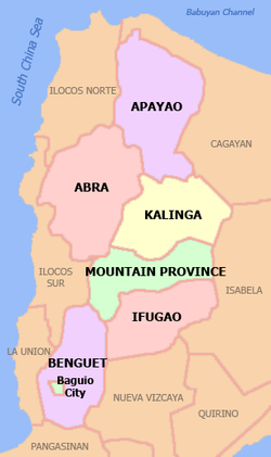
| Region | Cordillera Administrative Region |
| Province | Kalinga |
| District | Lone district |
| Founded | June 16, 1950 |
| Cityhood | June 23, 2007 (Lost cityhood in 2008 and 2010) |
| Affirmed Cityhood | February 15, 2011 |
| Barangays | 43 (see Barangays) |
| Government | |
| • Type | Sangguniang Panlungsod |
| • Mayor | Darwin C. Estrañero |
| • Vice Mayor | Dick G. Bal-o |
| • Representative | Allen Jesse C. Mangaoang |
| • City Council | Members |
| • Electorate | 74,572 voters (2025) |
| Area | |
• Total | 700.25 km2 (270.37 sq mi) |
| Elevation | 293 m (961 ft) |
| Highest elevation | 1,338 m (4,390 ft) |
| Lowest elevation | 44 m (144 ft) |
| Population (2024 census) [4] | |
• Total | 122,771 |
| • Density | 175.32/km2 (454.09/sq mi) |
| • Households | 25,731 |
| Economy | |
| • Income class | 5th city income class |
| • Poverty incidence | 14.54 |
| • Revenue | ₱ 1,743 million (2022) |
| • Assets | ₱ 4,534 million (2022) |
| • Expenditure | ₱ 1,415 million (2022) |
| • Liabilities | ₱ 1,343 million (2022) |
| Service provider | |
| • Electricity | Kalinga - Apayao Electric Cooperative (KAELCO) |
| Time zone | UTC+8 (PST) |
| ZIP code | 3800 |
| PSGC | |
| IDD : area code | +63 (0)74 |
| Native languages | Kalinga Ga'dang Ilocano Tagalog |
| Website | tabukcity.gov.ph |
Tabuk, officially the City of Tabuk (Ilocano : Siudad ti Tabuk; Filipino : Lungsod ng Tabuk), is a component city and capital of the province of Kalinga, Philippines. According to the 2024 census, it has a population of 122,771 people, [6] making it the most populous in the province and second in the region after Baguio City.