Kabugao

Last updated

Kabugao
Municipality of Kabugao
Dibagat river.JPG
Landscape in Barangay Dibagat
Ph locator apayao kabugao.png
Map of Apayao with Kabugao highlighted
OpenStreetMap
Kabugao
Philippines location map (square).svg
Red pog.svg
Kabugao
Location within the Philippines
Coordinates: 18°01′26″N121°11′00″E / 18.0239°N 121.1833°E / 18.0239; 121.1833
Country Philippines
Region Cordillera Administrative Region
Province Apayao
District Lone district
Founded 1950
Barangays 21 (see Barangays)
Government
[1]
  Type Sangguniang Bayan
   Mayor Bensmar B. Ligwang (PRP)
   Vice Mayor Fabulous B. Tucjang (NPC)
   Representative Eleanor Bulut-Begtang
   Municipal Council
Members
   Electorate 11,773 voters (2022)
Area
[2]
  Total935.12 km2 (361.05 sq mi)
Elevation
262 m (860 ft)
Highest elevation
689 m (2,260 ft)
Lowest elevation
78 m (256 ft)
Population
 (2020 census) [3]
  Total16,215
  Density17/km2 (45/sq mi)
   Households
3,506
Economy
   Income class 1st municipal income class
   Poverty incidence
35.34
% (2018) [4]
   Revenue 241.7 million (2020)
   Assets 416.7 million (2020)
   Expenditure 183.6 million (2020)
   Liabilities 66.38 million (2020)
Service provider
   Electricity Kalinga - Apayao Electric Cooperative (KAELCO)
Time zone UTC+8 (PST)
ZIP code
3809
PSGC
IDD : area code +63(0)74
Native languages Isnag
Itawis
Ilocano
Tagalog

Kabugao, officially the Municipality of Kabugao (Ilocano : Ili ti Kabugao; Tagalog : Bayan ng Kabugao), is a 1st class municipality and de jure capital of the province of Apayao, Philippines. According to the 2020 census, it has a population of 16,215 people. [3]

Contents

Kabugao is 606 kilometres (377 mi) from Manila.

History

On July 12, 1915, Governor General Francis Burton Harrison issued Executive Order No. 45, transferring the capital of then sub-province of Apayao from Tauit to Kabugao, to be effective on August 1. [5]

Kabugao was occupied for a year by the Japanese during the Second World War. [6] It was captured in December 1942, after the USAFIP NL retreated from the town.[ citation needed ]

Cityhood

In the 19th Congress of the Philippines, house bills were filed by various representatives which seek to automatically convert Kabugao and other capital towns of provinces with no current component cities, independent component cities, or highly urbanized cities into cities. [7] [8] [9]

Geography

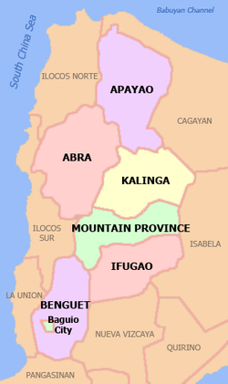
According to the Philippine Statistics Authority, the municipality has a land area of 935.12 square kilometres (361.05 sq mi) [10] constituting

Barangays

Kabugao is politically subdivided into 21 barangays. [11] Each barangay consists of puroks and some have sitios.

PSGC Barangay Population ±% p.a.
2020 [3] 2010 [12]
148104001 Badduat 6.6% 1,065 1,000 0.63%
148104002 Baliwanan 2.9% 467 478 −0.23%
148104004 Bulu 2.5% 401 298 3.01%
148104007 Cabetayan 3.7% 597 556 0.71%
148104005 Dagara 2.7% 437 484 −1.02%
148104006 Dibagat 3.8% 616 797 −2.54%
148104008 Karagawan 4.2% 676 676Steady2.svg 0.00%
148104009 Kumao 3.5% 575 557 0.32%
148104010 Laco 2.6% 427 410 0.41%
148104011 Lenneng (Liyyeng) 15.9% 2,572 2,396 0.71%
148104012 Lucab 3.5% 565 660 −1.54%
148104013 Luttuacan 6.3% 1,014 786 2.58%
148104014 Madatag 5.0% 818 766 0.66%
148104015 Madduang 3.9% 626 423 4.00%
148104016 Magabta 1.2% 191 215 −1.18%
148104017 Maragat 1.7% 276 503 −5.82%
148104018 Musimut 5.2% 842 822 0.24%
148104019 Nagbabalayan 3.0% 482 511 −0.58%
148104020 Poblacion 19.5% 3,154 3,217 −0.20%
148104021 Tuyangan 1.4% 223 334 −3.96%
148104022 Waga 1.2% 191 281 −3.79%
Total16,21516,215Steady2.svg0.00%

Climate

Climate data for Kabugao, Apayao
MonthJanFebMarAprMayJunJulAugSepOctNovDecYear
Mean daily maximum °C (°F)25
(77)
26
(79)
29
(84)
31
(88)
31
(88)
31
(88)
30
(86)
30
(86)
29
(84)
28
(82)
27
(81)
25
(77)
29
(83)
Mean daily minimum °C (°F)20
(68)
20
(68)
21
(70)
23
(73)
24
(75)
24
(75)
24
(75)
24
(75)
24
(75)
23
(73)
22
(72)
21
(70)
23
(72)
Average precipitation mm (inches)133
(5.2)
87
(3.4)
68
(2.7)
44
(1.7)
127
(5.0)
134
(5.3)
160
(6.3)
162
(6.4)
134
(5.3)
192
(7.6)
194
(7.6)
260
(10.2)
1,695
(66.7)
Average rainy days18.113.313.311.819.720.922.822.820.316.618.421.7219.7
Source: Meteoblue [13]

Demographics

Population census of Kabugao
YearPop.±% p.a.
1918 3,448    
1939 4,646+1.43%
1948 4,545−0.24%
1960 5,961+2.29%
1970 7,358+2.13%
1975 8,720+3.46%
1980 9,600+1.94%
1990 11,198+1.55%
1995 12,710+2.40%
2000 13,985+2.07%
2007 14,529+0.53%
2010 16,170+3.97%
2015 15,537−0.76%
2020 16,215+0.84%
Source: Philippine Statistics Authority [14] [12] [15] [16]

In the 2020 census, Kabugao had a population of 16,215. [3] The population density was 17 inhabitants per square kilometre (44/sq mi).

Economy

Government

Local government

Kabugao, belonging to the lone congressional district of the province of Apayao, is governed by a mayor designated as its local chief executive and by a municipal council as its legislative body in accordance with the Local Government Code. The mayor, vice mayor, and the councilors are elected directly by the people through an election which is being held every three years.

Elected officials

Members of the Municipal Council
(2022–2025) [24]
PositionName
GovernorElias C. Bulut Jr.
MayorBensmar B. Ligwang
Vice-MayorFabulous Tucjang
CouncilorsBenjie Ace Talimbatog
Gregorio B. Ligwang
Venancio Culdong
Pedro Dandan
Felipe Irving
Vandolf Alitan
Arellano C. Culdong Jr.
LNB PresidentFrederick C. Amid
IPMRJames S. Amid
SK Federation PresidentJazreal Jamila C. Enciso

Education

In 1948, Rev. Louis Saunders of an evangelical Protestant sect, The Disciples of Christ, opened the Apayao Christian Academy, Kabugao's first secondary school. In 1950, amidst rivalry among churches, the Catholics started its own secondary school, Our Blessed Lady of Lourdes. [6]

Dibagat

A typical home in Barangay Dibagat Dibagat home.JPG
A typical home in Barangay Dibagat

Dibagat is inhabited by the Isnag and the Ilocano.[ citation needed ] There is a small grass airstrip built by SIL in 1985.[ citation needed ] Dibagat is accessible only by canoe or by specialized aircraft.[ citation needed ]

Related Research Articles

<span class="mw-page-title-main">Apayao</span> Province in Cordillera, Philippines

Apayao, officially the Province of Apayao, is a landlocked province in the Philippines in the Cordillera Administrative Region in Luzon. Kabugao serves as its capital. The provincial capitol and its associated offices are located at the New Government Center in Luna.

<span class="mw-page-title-main">Luna, Apayao</span> Municipality in Apayao, Philippines

Luna, officially the Municipality of Luna, is a 2nd class municipality in the province of Apayao, Philippines. According to the 2020 census, it has a population of 21,297 people. It currently serves as the de facto capital of Apayao where the provincial capitol and related offices is located the New Apayao Government Center. Kabugao remains as the de jure capital.

<span class="mw-page-title-main">Pudtol</span> Municipality in Apayao, Philippines

Pudtol, officially the Municipality of Pudtol,, is a 4th class municipality in the province of Apayao, Philippines. According to the 2020 census, it has a population of 15,491 people.

<span class="mw-page-title-main">Santa Marcela, Apayao</span> Municipality in Apayao, Philippines

Santa Marcela, officially the Municipality of Santa Marcela, is a 4th class municipality in the province of Apayao, Philippines. According to the 2020 census, it has a population of 13,317 people.

<span class="mw-page-title-main">San Quintin, Abra</span> Municipality in Abra, Philippines

San Quintin, officially the Municipality of San Quintin, is a 5th class municipality in the province of Abra, Philippines. According to the 2020 census, it has a population of 5,705 people.

<span class="mw-page-title-main">Tineg</span> Municipality in Abra, Philippines

Tineg, officially the Municipality of Tineg, is a 2nd class municipality in the province of Abra, Philippines. According to the 2020 census, it has a population of 4,977 people.

<span class="mw-page-title-main">Siquijor, Siquijor</span> Capital of Siquijor, Philippines

Siquijor, officially the Municipality of Siquijor, is a 4th class municipality and capital of the province of Siquijor, Philippines. According to the 2020 census, it has a population of 28,915 people.

<span class="mw-page-title-main">San Jose de Buenavista</span> Capital of Antique, Philippines

San Jose de Buenavista, officially the Municipality of San Jose de Buenavista, is a 1st class municipality and capital of the province of Antique, Philippines. According to the 2020 census, it has a population of 65,140 people, making it the most populous municipality in the province of Antique. It is often called simply San Jose.

<span class="mw-page-title-main">Santa Praxedes, Cagayan</span> Municipality in Cagayan, Philippines

Santa Praxedes, officially the Municipality of Santa Praxedes, is a 5th class municipality in the province of Cagayan, Philippines. According to the 2020 census, it has a population of 4,434 people.

<span class="mw-page-title-main">Bontoc, Mountain Province</span> Capital of the Mountain Province, Philippines

Bontoc, officially the Municipality of Bontoc, is a 2nd class municipality and capital of the province of Mountain Province, Philippines. According to the 2020 census, it has a population of 24,104 people.

<span class="mw-page-title-main">Calanasan</span> Municipality in Apayao, Philippines

Calanasan, officially the Municipality of Calanasan,, is a 1st class municipality in the province of Apayao, Philippines. According to the 2020 census, it has a population of 12,550 people.

<span class="mw-page-title-main">Conner, Apayao</span> Municipality in Apayao, Philippines

Conner, officially the Municipality of Conner,, is a 2nd class municipality in the province of Apayao, Philippines. According to the 2020 census, it has a population of 27,552 people.

<span class="mw-page-title-main">Flora, Apayao</span> Municipality in Apayao, Philippines

Flora, officially the Municipality of Flora, is a 3rd class municipality in the province of Apayao, Philippines. According to the 2020 census, it has a population of 17,944 people.

<span class="mw-page-title-main">Nabunturan</span> Capital of Davao de Oro, Philippines

Nabunturan, officially the Municipality of Nabunturan, is a 1st class municipality and capital of the province of Davao de Oro, Philippines. According to the 2020 census, it has a population of 84,340 people.

<span class="mw-page-title-main">Tabuk, Kalinga</span> Capital of Kalinga, Philippines

Tabuk, officially the City of Tabuk, is a 5th class component city and capital of the province of Kalinga, Philippines. According to the 2020 census, it has a population of 121,033 people.

<span class="mw-page-title-main">Tanudan</span> Municipality in Kalinga, Philippines

Tanudan, officially the Municipality of Tanudan is a 4th class municipality in the province of Kalinga, Philippines. According to the 2020 census, it has a population of 8,746 people.

<span class="mw-page-title-main">San Jose, Dinagat Islands</span> Capital of Dinagat Islands, Philippines

San Jose, officially the Municipality of San Jose, is a 4th class municipality and capital of the province of Dinagat Islands, Philippines. According to the 2020 census, it has a population of 26,375 people.

<span class="mw-page-title-main">Atok, Benguet</span> Municipality in Benguet, Philippines

Atok, officially the Municipality of Atok,, is a 4th class municipality in the province of Benguet, Philippines. According to the 2020 census, it has a population of 19,218 people.

<span class="mw-page-title-main">Bokod, Benguet</span> Municipality in Benguet, Philippines

Bokod, officially the Municipality of Bokod,, is a 4th class municipality in the province of Benguet, Philippines. According to the 2020 census, it has a population of 14,435 people.

<span class="mw-page-title-main">Lagawe</span> Capital of Ifugao, Philippines

Lagawe, officially the Municipality of Lagawe is a 4th class municipality and capital of the province of Ifugao, Philippines. According to the 2020 census, it has a population of 18,876 people.

References

  1. Municipality of Kabugao | (DILG)
  2. "2015 Census of Population, Report No. 3 – Population, Land Area, and Population Density" (PDF). Philippine Statistics Authority. Quezon City, Philippines. August 2016. ISSN   0117-1453. Archived (PDF) from the original on May 25, 2021. Retrieved July 16, 2021.
  3. 1 2 3 4 Census of Population (2020). "Cordillera Administrative Region (CAR)". Total Population by Province, City, Municipality and Barangay. Philippine Statistics Authority . Retrieved July 8, 2021.
  4. "PSA Releases the 2018 Municipal and City Level Poverty Estimates". Philippine Statistics Authority. December 15, 2021. Retrieved January 22, 2022.
  5. Executive Orders, 1915. Manila: Bureau of Printing. 1916. pp. 91–92. Retrieved August 2, 2022.
  6. 1 2 "The Manolay cult: The genesis and dissolution of millenarian sentiments among the Isneg of Northern Luzon" (PDF). Asian Studies. University of the Philippines Diliman . Retrieved July 31, 2022.
  7. Yap, Eric (June 30, 2022). "AN ACT AUTOMATICALLY CONVERTING THE CAPITAL TOWN OF PROVINCES WITH NO COMPONENT CITIES, INDEPENDENT COMPONENT CITIES OR HIGHLY URBANIZED CITIES WITHIN ITS TERRITORIAL JURISDICTION, INTO A COMPONENT CITY" (PDF). House of Representatives of the Philippines. Retrieved April 1, 2023.
  8. Palma, Wilter (August 9, 2022). "AN ACT AUTOMATICALLY CONVERTING THE CAPITAL TOWN OF PROVINCES WITH NO COMPONENT CITIES, INDEPENDENT COMPONENT CITIES, OR HIGHLY URBANIZED CITIES WITHIN ITS TERRITORIAL JURISDICTION, INTO A COMPONENT CITY" (PDF). House of Representatives of the Philippines. Retrieved April 1, 2023.
  9. Daza, Paul (August 11, 2022). "AN ACT CONVERING INTO COMPONENT CITIES THE CAPITAL TOWNS OF PROVINCES WITHOUT A CITY, AMENDING FOR THE PURPOSE SECTION 450 OF REPUBLIC ACT NO. 7610, AS AMENDED BY REPUBLIC ACT NO. 9009, OTHERWISE KNOWN AS THE LOCAL GOVERNMENT CODE OF 1991, AND FOR OTHER PURPOSES" (PDF). House of Representatives of the Philippines. Retrieved April 1, 2023.
  10. "Province: Apayao". PSGC Interactive. Quezon City, Philippines: Philippine Statistics Authority . Retrieved November 12, 2016.
  11. "Municipal: Kabugao". PSGC Interactive. Quezon City, Philippines: Philippine Statistics Authority . Retrieved January 8, 2016.
  12. 1 2 Census of Population and Housing (2010). "Cordillera Administrative Region (CAR)" (PDF). Total Population by Province, City, Municipality and Barangay. National Statistics Office . Retrieved June 29, 2016.
  13. "Kabugao: Average Temperatures and Rainfall". Meteoblue. Retrieved March 8, 2020.
  14. Census of Population (2015). "Cordillera Administrative Region (CAR)". Total Population by Province, City, Municipality and Barangay. Philippine Statistics Authority . Retrieved June 20, 2016.
  15. Censuses of Population (1903–2007). "Cordillera Administrative Region (CAR)". Table 1. Population Enumerated in Various Censuses by Province/Highly Urbanized City: 1903 to 2007. National Statistics Office.{{cite encyclopedia}}: CS1 maint: numeric names: authors list (link)
  16. "Province of Apayao". Municipality Population Data. Local Water Utilities Administration Research Division. Retrieved December 17, 2016.
  17. "Poverty incidence (PI):". Philippine Statistics Authority. Retrieved December 28, 2020.
  18. "Estimation of Local Poverty in the Philippines" (PDF). Philippine Statistics Authority. November 29, 2005.
  19. "2003 City and Municipal Level Poverty Estimates" (PDF). Philippine Statistics Authority. March 23, 2009.
  20. "City and Municipal Level Poverty Estimates; 2006 and 2009" (PDF). Philippine Statistics Authority. August 3, 2012.
  21. "2012 Municipal and City Level Poverty Estimates" (PDF). Philippine Statistics Authority. May 31, 2016.
  22. "Municipal and City Level Small Area Poverty Estimates; 2009, 2012 and 2015". Philippine Statistics Authority. July 10, 2019.
  23. "PSA Releases the 2018 Municipal and City Level Poverty Estimates". Philippine Statistics Authority. December 15, 2021. Retrieved January 22, 2022.
  24. "2019 National and Local Elections" (PDF). Commission on Elections. Retrieved March 12, 2022.

Commons-logo.svg Media related to Kabugao at Wikimedia Commons