Dumarao

Last updated
Dumarao
Municipality of Dumarao
Iloilo-Capiz Road, Dumarao (Capiz; 10-20-2022).jpg
Flag of Dumarao, Capiz.png
Ph locator capiz dumarao.png
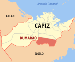
Map of Capiz with Dumarao highlighted
Dumarao
Interactive map of Dumarao
Philippines location map (square).svg
Red pog.svg
Dumarao
Location within the Philippines
Coordinates: 11°15′47″N122°41′16″E / 11.2631°N 122.6878°E / 11.2631; 122.6878
Country Philippines
Region Western Visayas
Province Capiz
District 2nd district
Founded 1581
Barangays 33 (see Barangays)
Government
[1]
  Type Sangguniang Bayan
   Mayor Mateo C. Hachuela (1Capiz)
   Vice Mayor Gleah Rose B. Hachuela (1Capiz)
   Representative Jane T. Castro (Lakas)
   Municipal Council
Members
  • Dave Rainier G. Basiliano
  • Fernando P. Dorado, Jr.
  • Remelo M. Valenzuela
  • Karen G. Hallarda
  • Marcelo A. Irisari
  • Giovanne H. Hare
  • Sixto M. Castilla, Jr.
  • Alicia F. Farinas
   Electorate 32,218 voters (2025)
Area
[2]
  Total
232.56 km2 (89.79 sq mi)
Elevation
92 m (302 ft)
Highest elevation
577 m (1,893 ft)
Lowest elevation
0 m (0 ft)
Population
 (2024 census) [3]
  Total
51,633
  Density222.02/km2 (575.03/sq mi)
   Households
12,775
Economy
   Income class 2nd municipal income class
   Poverty incidence
21.22
% (2021) [4]
   Revenue 260 million (2022)
   Assets 509.5 million (2022)
   Expenditure 192.3 million (2022)
   Liabilities 65.16 million (2022)
Service provider
  ElectricityCapiz Electric Cooperative (CAPELCO)
Time zone UTC+8 (PST)
ZIP code
5812
PSGC
IDD : area code +63(0)36
Native languages Karay-a
Capisnon
Hiligaynon
Ati
Tagalog
Website dumarao.com

Dumarao, officially the Municipality of Dumarao (Capiznon/Hiligaynon: Banwa sang Dumarao; Tagalog : Bayan ng Dumarao), is a municipality in the province of Capiz, Philippines. According to the 2024 census, it has a population of 51,633 people. [5]

Contents

History

It was founded in 1581 and established by Spaniards under the advocacy of Our Lady of Snows. [6]

Dumarao traces its earliest roots to Malay settlers who arrived by balangay and moved inland in search of fertile land. They first lived near the meeting point of the Badbaran and Panay rivers, relying on local forests and waterways for food and transport, before clearing the present town center.

During the revolution, local residents became involved after General Quintin Salas passed through in 1898, which led to arrests and later release of several townsmen.

Under American rule, a public school system was set up, the railway reached the town in 1909, and epidemics and storms marked the era. Political rivalry also began as elections shifted from council choice to popular voting.

Over time, Dumarao’s leaders built programs and projects that shaped the town, aiming for a community focused on growth, better living conditions, and care for its environment.

Geography

It is 45 kilometres (28 mi) from Roxas City.

Barangays

Dumarao is politically subdivided into 33 barangays. [7] Each barangay consists of puroks and some have sitios.

  • Agbatuan
  • Aglalana
  • Aglanot
  • Agsirab
  • Alipasiawan
  • Astorga
  • Bayog
  • Bungsuan
  • Calapawan
  • Codingle
  • Cubi
  • Dacuton
  • Dangula
  • Gibato
  • Guinotos
  • Jambad
  • Janguslob
  • Lawaan
  • Malonoy
  • Nagsulang
  • Ongol Ilawod
  • Ongol Ilaya
  • Poblacion Ilawod
  • Poblacion Ilaya
  • Sagrada Familia
  • Salcedo
  • San Juan
  • Sibariwan
  • Tamulalod
  • Taslan
  • Tina
  • Tinaytayan
  • Traciano / Agsalay

Climate

Climate data for Dumarao, Capiz
MonthJanFebMarAprMayJunJulAugSepOctNovDecYear
Mean daily maximum °C (°F)27
(81)
28
(82)
29
(84)
31
(88)
32
(90)
31
(88)
30
(86)
30
(86)
29
(84)
29
(84)
29
(84)
27
(81)
29
(85)
Mean daily minimum °C (°F)23
(73)
23
(73)
23
(73)
24
(75)
25
(77)
25
(77)
24
(75)
24
(75)
24
(75)
24
(75)
24
(75)
23
(73)
24
(75)
Average precipitation mm (inches)61
(2.4)
39
(1.5)
46
(1.8)
48
(1.9)
90
(3.5)
144
(5.7)
152
(6.0)
145
(5.7)
163
(6.4)
160
(6.3)
120
(4.7)
90
(3.5)
1,258
(49.4)
Average rainy days12.39.09.910.018.525.027.426.025.924.917.914.2221
Source: Meteoblue [8]

Demographics

Population census of Dumarao
YearPop.±% p.a.
1903 5,479    
1918 7,428+2.05%
1939 14,298+3.17%
1948 16,308+1.47%
1960 19,231+1.38%
1970 22,422+1.55%
1975 27,338+4.06%
1980 29,934+1.83%
1990 36,801+2.09%
1995 38,037+0.62%
2000 40,303+1.25%
2007 42,603+0.77%
2010 43,986+1.17%
2015 46,157+0.92%
2020 49,506+1.49%
2024 51,633+1.02%
Source: Philippine Statistics Authority [9] [10] [11] [12] [13]

In the 2024 census, the population of Dumarao was 51,633 people, [14] with a density of 220 inhabitants per square kilometre or 570 inhabitants per square mile.

Economy

Poverty incidence of Dumarao

10
20
30
40
50
60
2000
59.02
2003
36.83
2006
41.20
2009
26.72
2012
33.40
2015
20.79
2018
8.19
2021
21.22

Source: Philippine Statistics Authority [15] [16] [17] [18] [19] [20] [21] [22]

Education

The Dumarao Schools District Office governs all educational institutions within the municipality. It oversees the management and operations of all private and public, from primary to secondary schools. [23]

Primary and elementary schools
Secondary schools

Notable personalities

References

  1. Municipality of Dumarao | (DILG)
  2. "2015 Census of Population, Report No. 3 – Population, Land Area, and Population Density" (PDF). Philippine Statistics Authority. Quezon City, Philippines. August 2016. ISSN   0117-1453. Archived (PDF) from the original on May 25, 2021. Retrieved July 16, 2021.
  3. "2024 Census of Population (POPCEN) Population Counts Declared Official by the President". Philippine Statistics Authority. 17 July 2025. Retrieved 18 July 2025.
  4. "PSA Releases the 2021 City and Municipal Level Poverty Estimates". Philippine Statistics Authority. 2 April 2024. Retrieved 28 April 2024.
  5. "2024 Census of Population (POPCEN) Population Counts Declared Official by the President". Philippine Statistics Authority. 17 July 2025. Retrieved 18 July 2025.
  6. "About Dumarao". dumarao.com. Retrieved December 10, 2025.
  7. "Province: Capiz". PSGC Interactive. Quezon City, Philippines: Philippine Statistics Authority . Retrieved 25 August 2025.
  8. "Dumarao: Average Temperatures and Rainfall". Meteoblue. Retrieved 2 May 2020.
  9. "2024 Census of Population (POPCEN) Population Counts Declared Official by the President". Philippine Statistics Authority. 17 July 2025. Retrieved 18 July 2025.
  10. Census of Population (2015). "Region VI (Western Visayas)". Total Population by Province, City, Municipality and Barangay. Philippine Statistics Authority . Retrieved 20 June 2016.
  11. Census of Population and Housing (2010). "Region VI (Western Visayas)" (PDF). Total Population by Province, City, Municipality and Barangay. National Statistics Office . Retrieved 29 June 2016.
  12. Censuses of Population (1903–2007). "Region VI (Western Visayas)". Table 1. Population Enumerated in Various Censuses by Province/Highly Urbanized City: 1903 to 2007. National Statistics Office.
  13. "Province of Capiz". Municipality Population Data. Local Water Utilities Administration Research Division. Retrieved 17 December 2016.
  14. "2024 Census of Population (POPCEN) Population Counts Declared Official by the President". Philippine Statistics Authority. 17 July 2025. Retrieved 18 July 2025.
  15. "Poverty incidence (PI):". Philippine Statistics Authority. Retrieved December 28, 2020.
  16. "Estimation of Local Poverty in the Philippines" (PDF). Philippine Statistics Authority. 29 November 2005.
  17. "2003 City and Municipal Level Poverty Estimates" (PDF). Philippine Statistics Authority. 23 March 2009.
  18. "City and Municipal Level Poverty Estimates; 2006 and 2009" (PDF). Philippine Statistics Authority. 3 August 2012.
  19. "2012 Municipal and City Level Poverty Estimates" (PDF). Philippine Statistics Authority. 31 May 2016.
  20. "Municipal and City Level Small Area Poverty Estimates; 2009, 2012 and 2015". Philippine Statistics Authority. 10 July 2019.
  21. "PSA Releases the 2018 Municipal and City Level Poverty Estimates". Philippine Statistics Authority. 15 December 2021. Retrieved 22 January 2022.
  22. "PSA Releases the 2021 City and Municipal Level Poverty Estimates". Philippine Statistics Authority. 2 April 2024. Retrieved 28 April 2024.
  23. "Masterlist of Schools" (PDF). Department of Education. January 15, 2021. Retrieved December 10, 2025.