La Libertad, Negros Oriental Last updated December 14, 2025 Municipality in Negros Oriental, Philippines
Municipality in Negros Island Region, Philippines
La Libertad, officially the Municipality of La Libertad (Cebuano : Lungsod sa La Libertad ; Tagalog : Bayan ng La Libertad ), is a municipality in the province of Negros Oriental , Philippines. According to the 2024 census, it has a population of 42,721 people. [ 5]
History Before and during the Spanish conquest of the Philippines , the Municipality of La Libertad was inhabited by indigenous tribes, mostly Negritos . Several families from neighboring villages and distant provinces began to settle, with one of the first pioneers being Pedro Absin. [ 6]
Early settlers in the region established communities that later became part of present-day La Libertad. Many of them engaged in farming and fishing. [ 6]
The fertile valleys of Hinoba-an drew several families who immigrated there in the later part of the Spanish period . The area was known for its fertile soil, which supported local farming activities.
La Libertad was severely affected by the 2012 Visayas earthquake , which caused landslides that killed 51 people. [ 7]
Geography The Tañon Strait lies to the east of this municipality. La Libertad is located 105 km (65 mi) north of Dumaguete , the capital city of Negros Oriental . [ 6]
La Libertad is politically subdivided into 29 barangays . Each barangay is further divided into puroks , and some also include sitios .
PSGC Barangay Population ±% p.a. 2024 [ 8] 2010 [ 9] 074613001 Aniniaw 2.4% 1,015 1,106 ▾ −0.59% 074613002 Aya 2.5% 1,052 953 ▴ 0.68% 074613003 Bagtic 3.5% 1,497 1,344 ▴ 0.74% 074613004 Biga-a 2.2% 927 1,101 ▾ −1.17% 074613005 Busilak 3.2% 1,369 1,176 ▴ 1.04% 074613006 Cangabo 2.8% 1,182 1,245 ▾ −0.35% 074613007 Cantupa 3.2% 1,348 1,048 ▴ 1.74% 074613029 Elecia (Talostos) 3.9% 1,657 1,561 ▴ 0.41% 074613008 Eli 3.8% 1,629 1,273 ▴ 1.70% 074613009 Guihob 4.3% 1,843 2,048 ▾ −0.72% 074613010 Kansumandig 3.2% 1,350 1,242 ▴ 0.57% 074613011 Mambulod 1.5% 662 632 ▴ 0.32% 074613012 Mandapaton 3.8% 1,603 1,927 ▾ −1.25% 074613013 Manghulyawon 3.7% 1,578 1,398 ▴ 0.83% 074613014 Manluminsag 1.9% 808 776 ▴ 0.28% 074613015 Mapalasan 1.5% 660 557 ▴ 1.17% 074613016 Maragondong 2.1% 891 930 ▾ −0.29% 074613017 Martilo 5.0% 2,134 2,038 ▴ 0.32% 074613018 Nasungan 4.4% 1,868 1,558 ▴ 1.25% 074613019 Pacuan 6.5% 2,777 2,478 ▴ 0.78% 074613020 Pangca 1.1% 488 652 ▾ −1.96% 074613021 Pisong 3.1% 1,341 1,325 ▴ 0.08% 074613022 Pitogo 3.4% 1,441 1,216 ▴ 1.17% 074613023 Poblacion North 5.9% 2,507 2,319 ▴ 0.53% 074613024 Poblacion South 3.2% 1,371 1,338 ▴ 0.17% 074613025 San Jose 4.0% 1,689 1,703 ▾ −0.06% 074613026 Solonggon 6.0% 2,565 2,235 ▴ 0.95% 074613027 Tala-on 2.1% 907 806 ▴ 0.81% 074613028 Talayong 2.2% 930 919 ▴ 0.08% Total 42,721 38,904 ▴ 0.64%
Climate Climate data for La Libertad, Negros Oriental Month Jan Feb Mar Apr May Jun Jul Aug Sep Oct Nov Dec Year Mean daily maximum °C (°F) 29 30 31 32 31 30 30 30 30 30 29 29 30 Mean daily minimum °C (°F) 23 22 23 24 25 25 25 25 25 24 24 23 24 Average precipitation mm (inches) 42 34 40 61 124 188 190 191 189 186 124 73 1,442 Average rainy days 10.0 8.5 9.5 12.8 22.3 26.8 28.4 27.9 27.3 27.6 20.5 13.1 234.7 Source: Meteoblue [ 10]
Demographics Population census of La Libertad Year ±% p.a. 1903 3,732 — 1939 17,795 +4.43% 1948 18,770 +0.59% 1960 25,335 +2.53% 1970 29,693 +1.60% 1975 31,460 +1.17% 1980 30,730 −0.47% 1990 29,958 −0.25% 1995 32,456 +1.51% 2000 35,122 +1.71% 2007 37,007 +0.72% 2010 38,904 +1.84% 2015 38,602 −0.15% 2020 41,089 +1.32% 2024 42,721 +0.94% Source: Philippine Statistics Authority [ 19] [ 20] [ 9] [ 21] [ 22]
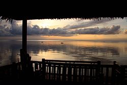
Tourism The municipality is known for its white sandy beach of Solangon. The nearby Mt. Panciao is often visited for hiking and exploration.
Government Elected municipal officials (2010–2013):
Mayor: Emmanuel Iway Vice Mayor: Lawrence Limkaichong Councilors: Nancy Temonio Laturnas Ronald Opada Ronie Bulabon Emelia Luz Medes Leonida Rios Jellenito Cayetano Bertoldo Burlasa Jovito Sabanal ABC President: Ronald Gallosa SK Federation President: PJ Arriesgado Date Position Name 1919–1922 President Isaac Dionaldo Vice-president Narciso Absin Secretary Francisco Bautista Councilors Pio Banogon Luciano Libo-on Ireneo Villaespin Felipe Absin Andres Absin Fabio Torres Leon Bonda-on Brigido Sabanal 1922–1924 President Isaac Dionaldo Vice-president Fabio Torres Secretary Roberto Estoconing Councilors Margarito Gallosa Pedro Timtim Isaias Emperado Antonio Torres Pastor Carinal Marcelo Libo-on Bregido Sabanal Benedicto Libo-on 1925 President Isaac Dionaldo Vice-president Fabio Torres Secretary Roberto Estoconing Councilors Antonio E. Torres Pedrom Timtim Pator Carinal Margarito Gallosa Marcelo Libo-on Brigido Sabanal Daniel Donaldo Benedicto Libo-on, Sr. 1926–1927 President Fabio Torres Vice-president Daniel Dionaldo Secretary Roberto Estoconing Councilors Brigido Sabanal Antonio E. Torres Leopoldo Dionaldo Aquilino Ricarte Pedro E. Torres Teodoro Absin Felix Camero
References ↑ Municipality of La Libertad | (DILG) ↑ "2015 Census of Population, Report No. 3 – Population, Land Area, and Population Density" (PDF) . Philippine Statistics Authority . Quezon City, Philippines. August 2016. ISSN 0117-1453 . Archived (PDF) from the original on May 25, 2021. Retrieved July 16, 2021 . ↑ "2024 Census of Population (POPCEN) Population Counts Declared Official by the President" . Philippine Statistics Authority. 17 July 2025. Retrieved 18 July 2025 . ↑ "PSA Releases the 2021 City and Municipal Level Poverty Estimates" . Philippine Statistics Authority. 2 April 2024. Retrieved 28 April 2024 . ↑ "2024 Census of Population (POPCEN) Population Counts Declared Official by the President" . psa.gov.ph . July 17, 2024. Retrieved November 14, 2025 . 1 2 3 Sadan, Ahmad (6 September 2025). "Negros Oriental" . Negros Oriental Provincial Government . ↑ "Quake causes severe damage in La Libertad, Negros Oriental" . ABS-CBN News . 7 February 2012. Retrieved 12 March 2013 . ↑ Census of Population (2020). "Region VII (Central Visayas)" . Total Population by Province, City, Municipality and Barangay . Philippine Statistics Authority . Retrieved 8 July 2021 . 1 2 Census of Population and Housing (2010). "Region VII (Central Visayas)" (PDF) . Total Population by Province, City, Municipality and Barangay . National Statistics Office . Retrieved 29 June 2016 . ↑ "La Libertad: Average Temperatures and Rainfall" . Meteoblue. Retrieved 6 May 2020 . ↑ "Poverty incidence (PI):" . Philippine Statistics Authority. Retrieved December 28, 2020 . ↑ "Estimation of Local Poverty in the Philippines" (PDF) . Philippine Statistics Authority. 29 November 2005. ↑ "2003 City and Municipal Level Poverty Estimates" (PDF) . Philippine Statistics Authority. 23 March 2009. ↑ "City and Municipal Level Poverty Estimates; 2006 and 2009" (PDF) . Philippine Statistics Authority. 3 August 2012. ↑ "2012 Municipal and City Level Poverty Estimates" (PDF) . Philippine Statistics Authority. 31 May 2016. ↑ "Municipal and City Level Small Area Poverty Estimates; 2009, 2012 and 2015" . Philippine Statistics Authority. 10 July 2019. ↑ "PSA Releases the 2018 Municipal and City Level Poverty Estimates" . Philippine Statistics Authority. 15 December 2021. Retrieved 22 January 2022 . ↑ "PSA Releases the 2021 City and Municipal Level Poverty Estimates" . Philippine Statistics Authority. 2 April 2024. Retrieved 28 April 2024 . ↑ "2024 Census of Population (POPCEN) Population Counts Declared Official by the President" . Philippine Statistics Authority. 17 July 2025. Retrieved 18 July 2025 . ↑ Census of Population (2015). "Region VII (Central Visayas)" . Total Population by Province, City, Municipality and Barangay . Philippine Statistics Authority . Retrieved 20 June 2016 . ↑ Censuses of Population (1903–2007). "Region VII (Central Visayas)" . Table 1. Population Enumerated in Various Censuses by Province/Highly Urbanized City: 1903 to 2007 National Statistics Office . ↑ "Province of" . Municipality Population Data . Local Water Utilities Administration Research Division. Retrieved 17 December 2016 . External links
Places adjacent to La Libertad, Negros Oriental
This page is based on this
Wikipedia article Text is available under the
CC BY-SA 4.0 license; additional terms may apply.
Images, videos and audio are available under their respective licenses.