Jacksonville, Iowa | |
|---|---|
 Jacksonville, looking east along 1000th street | |
 Jacksonville, Iowa | |
| Coordinates: 41°38′42″N95°09′06″W / 41.64500°N 95.15167°W | |
| Country | United States |
| State | Iowa |
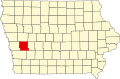
| County | Shelby |
| Area | |
• Total | 0.097 sq mi (0.25 km2) |
| • Land | 0.097 sq mi (0.25 km2) |
| • Water | 0 sq mi (0.00 km2) |
| Elevation | 1,303 ft (397 m) |
| Population (2020) | |
• Total | 29 |
| • Density | 294.9/sq mi (113.85/km2) |
| Time zone | UTC-6 (Central (CST)) |
| • Summer (DST) | UTC-5 (CDT) |
| ZIP code | 51537 [3] |
| Area code | 712 |
| GNIS feature ID | 2583483 [2] |
Jacksonville is an unincorporated community and census-designated place in Jackson Township, Shelby County, Iowa, in the United States. As of the 2020 Census the population of Jacksonville was 29.