
Mount Joy Township is a township in northwestern Lancaster County, Pennsylvania, United States. The population was 9,873 at the 2010 census.
Gbehlay-Geh District is one of 17 districts located in Nimba County, Liberia. In 2008, the population was 32,176.
Gbeapo District is one of 10 districts of River Gee County, Liberia. As of 2008, the population was 10,934.
Butaw District (Buto) is one of 16 districts of Sinoe County, Liberia. As of 2008, the population was 3,892.
Greenville District is one of 16 districts of Sinoe County, Liberia. As of 2008, the population was 16,434, making it the most populous district in the county.
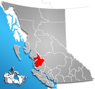
Central Coast Regional District is a regional district in British Columbia, Canada. It has a total land area of 24,559.5 km². When it was created in 1968, it was named Ocean Falls Regional District, after the then-largest town in the region, the company town of Ocean Falls, which has since become a ghost town. The district name was confirmed in 1974, but changed to Central Coast Regional District in 1976.

Highway 316 is a highway in the Canadian province of Saskatchewan. It runs from Highway 16 near Clavet to Highway 5. Highway 316 is about 17 km (11 mi.) long. This area is an industrial commercial area along Highway #316 which extends from Clavet north to the PCS Patience Lake Mine which is just 10 miles from the city of Saskatoon. Highway 316 is a primary weight highway, and also runs near the Canadian National Railway line which goes from Saskatoon through Clavet. In 1941, the Canadian Pacific Railway ran from Saskatoon through Cheviot and on south eastward.

The Gwa'Sala-Nakwaxda'xw Nations are a union of two Kwakwaka'wakw peoples in a band government based on northern Vancouver Island in British Columbia, Canada, whose main reserve community is near the town of Port Hardy in the Queen Charlotte Strait region of the Central Coast region of British Columbia, Canada. The band government is a member of the Kwakiutl District Council and, for treaty negotiation purposes, the Winalagalis Treaty Group which includes three other members of the Kwakiutl District Council.
The Malacca Banks are sandbanks (shoals) below the sea surface, in the Gulf of Khambhat in Gujarat, India. They lie to the west and southwest of the port of Surat and are a system of four irregular ridges running roughly from north to south parallel with the entrance channels to the Gulf. They extend from 21°10′00″N72°25′00″E to 20°20′00″N72°10′00″E.
The Tahltan First Nation, also known as the Tahltan Indian Band, is a band government of the Tahltan people. Their main community and reserves are located at Telegraph Creek, British Columbia. Their language is the Tahltan language, which is an Athabaskan language also known as Nahanni, is closely related to Kaska and Dunneza. Their Indian and Northern Affairs Canada band number is 682. The Tahltan First Nation is joined with the Iskut First Nation in a combined tribal council-type organization known as the Tahltan Nation.

Mt. Izla, also Mountain of Nisibis, or briefly in the 9th century, Mt. Kashyari, is a low mountain or ridge near Nisibis in what once was Sassanid Persia, but is now southeastern Turkey, along the border with Syria. The ridge is the location of dozens of ancient monasteries which were built in the early centuries of Christianity. In modern times, all of the monasteries are in ruins except for that of Saint Melke, Mor Malke Monastery.
Chedepo District is one of 10 districts of River Gee County, Liberia. As of 2008, the population was 10,518.
Glaro District is one of 10 districts of River Gee County, Liberia. As of 2008, the population was 4,992.
Tuobo District is one of 10 districts of River Gee County, Liberia. As of 2008, the population was 4,868.
Boe & Quilla District is one of 17 sub-district of Nimba County, Liberia. As of 2008, the population was 18,262. The clans of Boe & Quilla district: Boe, Gosenter, Quella, Sarlay.
Garr Bain District is one of 17 districts of Nimba County, Liberia. As of 2008, the population was 61,225.
Gbi & Doru District is one of 17 districts of Nimba County, Liberia. As of 2008, the population was 8,131.

Madina is a suburb of Accra and in the La Nkwantanang Madina Municipal District, a district in the Greater Accra Region of southeastern Ghana. Madina is next to the University of Ghana and houses the Institute of Local Government. Madina is the twelfth most populous settlement in Ghana, in terms of population, with a population of 137,162 people. Madina is contained in the Madina electoral constituency of the republic of Ghana.
Gbehlay-Geh District is one of 17 districts located in Nimba County, Liberia. In 2008, the population was 32,176.


