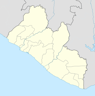
Monrovia is the capital city of the West African country of Liberia. Located on the Atlantic Coast at Cape Mesurado, Monrovia had a population of 1,010,970 as of the 2008 census. With 29% of the total population of Liberia, Monrovia is the country's most populous city.

Grand Cape Mount is a county in the northwestern portion of the West African nation of Liberia. One of 15 counties that constitute the first-level of administrative division in the nation, it has five districts. Robertsport serves as the capital with the area of the county measuring 5,162 square kilometres (1,993 sq mi). As of the 2008 Census, it had a population of 129,817, making it the eighth most populous county in Liberia. The county is bordered by Gbarpolu County to the northeast and Bomi County to the southeast. The northern part of Grand Cape Mount borders the nation of Sierra Leone, while to the west lies the Atlantic Ocean.

Bomi is a county in the northwestern portion of the West African nation of Liberia established in 1984. One of 15 counties that comprise the first-level of administrative division in the nation, it has four districts. Tubmanburg serves as the capital with the area of the county measuring 1,942 square kilometres (750 sq mi). As of the 2008 Census, it had a population of 82,036, making it the twelfth most populous county in Liberia. Bomi is bordered by Grand Cape Mount County to the west, Gbarpolu County to the north, Montserrado County to the southeast, and the Atlantic Ocean to the south.

Bong is a county in the north-central portion of the West African nation of Liberia. One of 15 counties that comprise the first-level of administrative division in the nation, it has twelve districts. Gbarnga serves as the capital. The area of the county measures 8,772 square kilometres (3,387 sq mi). As of the 2008 Census, it had a population of 328,919, making it the third-most populous county in Liberia. The county was organized in 1964 and is important for its mining industry.

Margibi is a county on the north to central coast of Liberia. One of 15 counties that constitute the first-level of administrative division in the nation, it has five districts. Kakata serves as the capital with the area of the county measuring 2,616 square kilometres (1,010 sq mi). As of the 2008 Census, it had a population of 199,689, making it the sixth most populous county in Liberia.

Sinoe is one of Liberia's 15 counties and it has 17 districts. Greenville is the county's capital. As of the 2008 Census, it had a population of 104,932, making it one of the least populous counties in Liberia. Sinoe has the third-largest area of all Liberia's counties; it has the second least-dense population after Gbarpolu County. The County was originally a colony in the name Mississippi-in-Africa, under auspices of a chapter of the American Colonization Society as it was created with slaves from Mississippi to Liberia.

River Gee is a county in the southern portion of Liberia. One of 15 counties that constitute the first-level of administrative division in the nation, it has six districts. Fish Town serves as the capital with the area of the county measuring 5,113 square kilometres (1,974 sq mi). As of the 2008 Census, it had a population of 66,789, making it the third-least populous county in Liberia. It was created in 2000.

The House of Representatives is the lower chamber of the bicameral legislative branch of Liberia, and together with the Senate comprises the Legislature of Liberia. The number of seats is fixed by law at 73, with each county being apportioned a number of seats based on its percentage of the national population. House members represent single-member districts within the counties drawn up by the National Elections Commission and serve six-year terms. The House meets at the Capitol Building in Monrovia.

Bensonville is the capital city of Montserrado County, Liberia. As of the 2008 national census, its population stood at 4,089. Bensonville is located 20 miles away from the national capital, Monrovia, which is also located in Montserrado County. It is a commercial center for the surrounding agricultural area.
Careysburg District is one of four districts located in Montserrado County, Liberia. Bensonville is the capital, and the total district population is 28,463.
Greater Monrovia is one of four districts located in Montserrado County, Liberia. It contains the country's capital Monrovia. It recorded a population of 970,824 in the 2008 census.
Todee District is one of four districts located in Montserrado County, Liberia. There was a former Armed Forces of Liberia base there housing the Tubman Military Academy and Second Infantry Battalion in 1984 and there have been discussions post-2003 of rebuilding the base.
Greenville District is one of 16 districts of Sinoe County, Liberia. As of 2008, the population was 16,434, making it the most populous district in the county.
Kpayan District is one of 16 districts of Sinoe County, Liberia. As of 2008, the population was 10,043.
Dewoin District is one of four districts of Bomi County, Liberia. As of 2008 the population was 12,782.

The Ministry of Foreign Affairs is the government ministry of Liberia responsible for directing Liberia's external relations and the management of its international diplomatic missions. The ministry is located in Monrovia, Liberia's capital.
Sanquin District 2 is one of 16 districts of Sinoe County, Liberia. As of 2008, the population was 3,405.
Commonwealth is a district in Montserrado County in Liberia. The population was 11,876 in 2008, according to Population and Housing Census.


