Liberia, officially the Republic of Liberia, is a country on the West African coast. It is bordered by Sierra Leone to its northwest, Guinea to its north, Ivory Coast to its east, and the Atlantic Ocean to its south and southwest. It has a population of around 5.5 million and covers an area of 43,000 square miles (111,369 km2). The official language is English. Over 20 indigenous languages are spoken, reflecting the country's ethnic and cultural diversity. The capital and largest city is Monrovia.

Montserrado County is a county in the northwestern portion of the West African nation of Liberia containing its national capital, Monrovia. One of 15 counties that comprise the first-level of administrative division in the nation, it has 17 sub political districts. As of the 2022 Census, it had a population of 1,920,914, making it the most populous county in Liberia. The area of the county measures 738.5 square miles (1,913 km2), the smallest in the country. Bensonville serves as the capital.

Maryland County is a county in the southeastern portion of Liberia. One of 15 counties that comprise the first-level of administrative division in the nation, it has two districts. Harper serves as the capital with the area of the county measuring 887 square miles (2,300 km2). As of the 2022 Census, it had a population of 172,202, making it the ninth most populous county in Liberia.

Gbarnga is the capital city of Bong County, Liberia, lying north east of Monrovia. During the First Liberian Civil War, it was the base for Charles Taylor's National Patriotic Front of Liberia. Cuttington College, a private, Episcopal-affiliated institution, is located near the town. Its campus was once home to the Africana Museum, which was destroyed during the civil war.

Nimba County is a county in northeastern Liberia that shares borders with the Republic of Côte d'Ivoire in the East and the Republic of Guinea in the Northwest. Its capital city is Sanniquellie and its most populous city is Ganta. With the county's area measuring 11,551 square miles (29,920 km2), Nimba is the largest of Liberia's 15 counties. The county has six statutory districts. As of the 2022 Census, it had a population of 621,841, making it the second most populous county in Liberia.

Bomi is a county in the northwestern portion of the West African nation of Liberia. The county was established in 1984. The county's area is 746 square miles (1,900 km2).

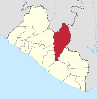
Bong is a county in the north-central portion of the West African nation of Liberia. One of 15 counties that comprise the first-level of administrative division in the nation, it has twelve districts. Gbarnga serves as the capital. The area of the county measures 8,772 square kilometres (3,387 sq mi). As of the 2022 Census, it had a population of 467,502, making it the third-most populous county in Liberia. The county was organized in 1964 and is important for its mining industry.

Margibi is a county on the north to central coast of Liberia. One of 15 counties that constitute the first-level of administrative division in the nation, it has five districts. Kakata serves as the capital with the area of the county measuring 1,010 square miles (2,600 km2). As of the 2022 Census, it had a population of 304,946, making it the fifth most populous county in Liberia.

The House of Representatives is the lower chamber of the bicameral legislative branch of Liberia, and together with the Senate comprises the Legislature of Liberia. The number of seats is fixed by law at 73, with each county being apportioned a number of seats based on its percentage of the national population. House members represent single-member districts within the counties drawn up by the National Elections Commission and serve six-year terms. The House meets at the Capitol Building in Monrovia.

Fuamah District is one of twelve districts located in Bong County, Liberia. it has five third level subdivisions Lorlah,Zuluzaryea,Yarbayon,Bubli and,Zarwakuma

Jorquelleh District is one of twelve districts of Bong County, Liberia.It has five third level subdivisions Jorpoo,Bellequelleh,Jorquelle,Gbarnshay, andSheansuie

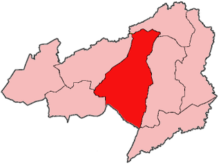
Salala District is one of twelve districts in Bong County, Liberia. Multiple internally displaced person camps are located in the district.It has four third level subdivisions Konoyea,Konowulala,Nyanforquelleh,Kpartolor

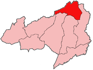
Panta-Kpa District is one of twelve districts located in Bong County, Liberia.It has four third level sub divisions, Wrunah,Panta,Waytua,and Wolota

Sanayea District is one of twelve districts located in Bong County, Liberia.It has six third level sub divisions Menquelleh,Wallahun,Deingmah,Boryermah,Sanoyea,Bonkomu

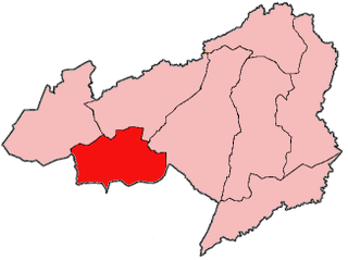
Suakoko District is one of twelve districts located in Bong County, Liberia. Moreover, it is located in the south central portion of Bong County. A majority of the residents in this district are employees with the Phebe hospital and Cuttington University main campus. Others within the area are local laborers with workers and students who come into the area in search for jobs and/or education.

Zota District is one of twelve districts located in Bong County, Liberia.It has four third level subdivisions Upper Kpaquelleh,Zota,Lower Kpaquelleh,andGwilapolu

Jewel Cianeh Taylor is a Liberian politician who served as the 30th vice president of Liberia from 2018 to 2024. She was married to convicted warlord and former president Charles Taylor from 1997 to 2006 and was first lady of Liberia during his presidency. In 2005, Jewel Taylor was elected to the Senate of Liberia for Bong County as a member of the National Patriotic Party. She was Chair of the Senate Health and Social Welfare Committee on Gender, Women and Children.

The Saint John River is one of the six main rivers in the West African nation of Liberia. With its headwaters in neighboring Guinea, the river flows generally southwest through Liberia and empties into the Atlantic Ocean at Bassa Cove near Edina in Grand Bassa County. The 282 km (175 mi) river has a drainage basin covering 16,157 km2 (6,238 sq mi).

Bong Town is a populated place in the Bong County of Liberia.

The People's Unification Party (PUP), also known as the Native People's Party, is a political party in Liberia.


