Related Research Articles
The Cocopah are Native Americans who live in Baja California, Mexico, and Arizona, United States.
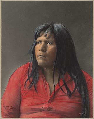
The Quechan, or Yuma, are a Native American tribe who live on the Fort Yuma Indian Reservation on the lower Colorado River in Arizona and California just north of the Mexican border. Despite their name, they are not related to the Quechua people of the Andes. Members are enrolled into the Quechan Tribe of the Fort Yuma Indian Reservation. The federally recognized Quechan tribe's main office is located in Winterhaven, California. Its operations and the majority of its reservation land are located in California, United States.

Yuma is a city in and the county seat of Yuma County, Arizona, United States. The city's population was 95,548 at the 2020 census, up from the 2010 census population of 93,064.
John Joel Glanton was an early settler of Arkansas Territory. He was also a Texas Ranger and a soldier in the Mexican–American War, and the leader of a notorious gang of scalp-hunters in Northern Mexico and the Southwestern United States during the mid-19th century. Contemporary sources also describe him as a murderous outlaw and prominent participant in the Texas Revolution. He appears as a violent figure in the works of the prominent Western writers Larry McMurtry and Cormac McCarthy.

The Juan Bautista de Anza National Historic Trail is a 1,210-mile (1,950 km) trail extending from Nogales on the U.S.-Mexico border in Arizona, through the California desert and coastal areas in Southern California and the Central Coast region to San Francisco. The trail commemorates the 1775–1776 land route that Spanish commander Juan Bautista de Anza took from the Sonora y Sinaloa Province of New Spain in Colonial Mexico through to Las Californias Province. The goal of the trip was to establish a mission and presidio on the San Francisco Bay. The trail was an attempt to ease the course of Spanish colonization of California by establishing a major land route north for many to follow. It was used for about five years before being closed by the Quechan (Yuma) Indians in 1781 and kept closed for the next 40 years. It is a National Historic Trail administered by the National Park Service and was also designated a National Millennium Trail.
The Yuma Expedition was a U.S. Army military operation from 8 February 1852 to October 1852 in the Yuma War.
The Gila Expedition or Morehead War was an 1850 California militia attack on the Quechan, in retaliation for the Glanton Massacre, which had taken place near the confluence of the Gila River and Colorado River in Arizona. It was the beginning of the 1850 to 1853 Yuma War.

Fort Yuma was a fort in California located in Imperial County, across the Colorado River from Yuma, Arizona. It was Established in 1848. It served as a stop on the Butterfield Overland Mail route from 1858 until 1861. The fort was retired from active military service on May 16, 1883, and transferred to the Department of the Interior. The Fort Yuma Indian School and the Saint Thomas Yuma Indian Mission now occupy the site. It is one of the "associated sites" listed as Yuma Crossing and Associated Sites on the National Register of Historic Places in the Yuma Crossing National Heritage Area. In addition, it is registered as California Historical Landmark #806.

Yuma Crossing is a site in Arizona and California that is significant for its association with transportation and communication across the Colorado River. It connected New Spain and Las Californias in the Spanish Colonial period in and also during the Western expansion of the United States. Features of the Arizona side include the Yuma Quartermaster Depot and Yuma Territorial Prison. Features on the California Side include Fort Yuma, which protected the area from 1850 to 1885.

The Great Flood of 1862 was the largest flood in the recorded history of California, Oregon, and Nevada, inundating the western United States and portions of British Columbia and Mexico. It was preceded by weeks of continuous rains and snows that began in Oregon in November 1861 and continued into January 1862. This was followed by a record amount of rain from January 9–12, and contributed to a flood that extended from the Columbia River southward in western Oregon, and through California to San Diego, as well as extending as far inland as the Washington Territory, the Utah Territory, and the western New Mexico Territory.

The Yuma War was the name given to a series of United States military operations conducted in southern California and what is today southwestern Arizona from 1850 to 1853. The Quechan were the primary opponent of the United States Army, though engagements were fought between the Americans and other native groups in the region.
George Alonzo Johnson (1824–1903) was an American entrepreneur and politician.
Steamboats on the Colorado River operated from the river mouth at the Colorado River Delta on the Gulf of California in Mexico, up to the Virgin River on the Lower Colorado River Valley in the Southwestern United States from 1852 until 1909, when the construction of the Laguna Dam was completed. The shallow draft paddle steamers were found to be the most economical way to ship goods between the Pacific Ocean ports and settlements and mines along the lower river, putting in at landings in Sonora state, Baja California Territory, California state, Arizona Territory, New Mexico Territory, and Nevada state. They remained the primary means of transportation of freight until the advent of the more economical railroads began cutting away at their business from 1878 when the first line entered Arizona Territory.
Colorado City is a ghost town in what is now Yuma County, Arizona. It was located on the south bank of the Colorado River at Jaeger's Ferry, 1 mile down river from Fort Yuma.
Arizona City or Arizona is the name of the original settlement at the Yuma Crossing, in what is now Yuma, Arizona, United States.
Jaeger City, or Jaegerville, was a former settlement in what is now Imperial County, California, at Jaeger's Ferry on the Colorado River a mile downstream from Fort Yuma. It was named for L. J. F. Jaeger who ran the ferry there from 1851.
Olive City, or Olivia, was a short-lived town, steamboat landing, and ferry crossing on the Colorado River in what was then Yuma County, Arizona Territory, from 1863 to 1866. It was located on the Arizona bank of the Colorado River, 1 mile above its rival Mineral City and 1/2 mile above the original site of Ehrenberg, Arizona, 3 miles southwest of the location of La Paz. The GNIS location of Olive City (historical) is indicated as being in La Paz County, Arizona, but its coordinates in the present-day now put it across the river just within Riverside County, California. Olive City was named after Olive Oatman who had been, with her sister, survivors of the massacre of her family and a captive of the Yavapai until purchased from them by the Mohave who they lived with for several years.
George A. Johnson & Company was a partnership between three men who pioneered navigation on the Colorado River. Benjamin M. Hartshorne, George Alonzo Johnson and Alfred H. Wilcox. The George A. Johnson & Company was formed in the fall of 1852, and was reorganized as the Colorado Steam Navigation Company in 1869.
Jaeger's Slough, was a former course of the Colorado River, reduced to a slough sometime before 1849. It ran from its head on the north or California) bank of the river, from the main channel, that at that time ran two or three miles northwest and then east of Fort Yuma. The slough rejoined the river at its mouth nearly a mile west of Fort Yuma. The slough can be seen on Lieutenant Amiel Weeks Whipple's 1849 map "Map of a Survey and Reconnaissance of the Vicinity of the Mouth of the Rio Gila". The map shows two Quechan villages along either side of the slough. The slough would have flooded in the high water months of May and June and then been planted with crops as the water receded, the common practice of the native people along the Colorado River.
Antelope Peak Station, a later Butterfield Overland Mail station located 15.14 miles east of Mission Camp, at the foot of Antelope Peak. It replaced Filibusters Camp Station, 6 miles to the west. The Overland Mail Company replaced Filibusters Camp, because Antelope Peak Station had a better water supply. Its location is thought to be 32°42′47″N114°00′54″W. The station was built by John Kilbride in 1857 but did not appear on the stagecoach itinerary until 1859.
References
- ↑ Richard E. Lingenfelter, Steamboats on the Colorado River, 1852-1916, University of Arizona Press, Tucson, 1978 Archived 2016-01-18 at the Wayback Machine , p.15
- ↑ Edwin Corle, Gila, River of the Southwest, U. of Nebraska Press, 1951, pp.187-188, 193, 197
Municipalities and communities of Imperial County, California, United States | ||
|---|---|---|
| Cities |  | |
| CDPs | ||
| Unincorporated communities | ||
| Indian reservations | ||
| Ghost towns | ||
| Footnotes | ‡This populated place also has portions in an adjacent county or counties | |