This article needs additional citations for verification .(September 2008) |
Jamuhar is a village in the Rohtas district of Bihar, India.
This article needs additional citations for verification .(September 2008) |
Jamuhar is a village in the Rohtas district of Bihar, India.

Loha Singh and Tara Singh left Fatehpur Sikri in the period of the Mughal emperor Aurangzeb. They were Sikarwar (Sikriwal) Rajputs. They came with their family and followers to the banks of Kai (Cow) River in Shahabad district 9 kilometres (5.6 mi) east of Sasaram in a forest near the Kaimur Hills. They inhabited the village Jamuhar with the help of their family and followers.[ citation needed ]
Jamuhar is very fertile flat land. It is drained by the Kai (Cow) river originating in the Kaimur Hills Valley.
Jamuhar is mildly cold in the winter (the lowest temperatures being around 5 to 10 °C (41 to 50 °F). Winter months are December and January. It is hot in the summer (with average highs around 35 to 40 °C (95 to 104 °F). April to mid June are the hot months. The monsoon months of June, July, August, and September see good rainfall. October & November and February & March have pleasant climate.
Villages within the Jamuhar panchayat include
Jamuhar has 491 households with a total of 3916 residents. [2]
Jamuhar is served by the Kanya Madhya Vidyalaya middle school and the Jamuhar High School, and is home to several institutions of higher learning:

The celebration of Chhath is a major event of the Jamuhar religious calendar.


The Chhath Pooja in Jamuhar is celebrated on the bank of Canal of Kai River and other Ponds (Talabs).
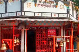
The temple of Lord Shiva was made by all villagers. There is an old Shiv Ling (Budhwa Shiv Ji) also in the temple compound. The Kali Mandir is very old. There are many temples in the village.
The Masjid of Jamuhar named "Makkah Madinih Masjid" is under construction.

Virar is a coastal city in taluka Vasai and district of Palghar, India. It is clubbed into Vasai-Virar city, administered by Vasai-Virar Municipal Corporation. It lies in south part of Palghar District in Vasai Taluka and north to the city of Mumbai. It is an important part of Palghar District, Because Palghar is the outermost part of northern side of Mumbai Metropolitan Region.
Sasaram sometimes also spelled as Sahasram, is an ancient historical city and a municipal corporation region in the Rohtas district of the Bihar state in eastern India, with a history that goes to thousands of years. During the prehistoric age, Buddha walked through this way and lived for some days and then travelled to Gaya to be enlightened with verity and wisdom under the Mahabodhi tree, the city is also known as gateway of "Vihar" to visit rest "Bihar" including Gaya, Rajgriha, and Nalanda.
Nayagarh is both a town and the municipality headquarters of the Nayagarh district in the Indian state of Odisha.
Biaora is a city and municipality in Rajgarh district in the state of Madhya Pradesh, India. biaora is one of the six tehsils of rajgarh district.Biaora was originally ruled by the Bhil kings; the last Bhil king was Dhola Bhil. The primary languages spoken in biaora are Malvi, English and Hindi. It is situated on National Highway NH-3 and Jaipur National Highway.
Kotdwar is a city, municipal corporation in Pauri Garhwal district of Uttarakhand, India. It's just 101 km from Pauri town, the district headquarter. It is the eighth-largest city in Uttarakhand. Its old name was "Khohdwar", which means the gateway of the river Khoh since it is located on the bank of river Khoh. It is situated in the southwestern part of the state and is one of the main entrance points in the state of Uttarakhand.

Rafiganj is a town and a notified area in Aurangabad district in the Indian state of Bihar. It is the district's second-largest town in population after Aurangabad, and also the second-largest town in area. Rafiganj is located 25 km away from the District Administration.
Mohania is a city and corresponding community development block in Kaimur district of Bihar, India. It serves as headquarters for the Mohania sub-division in Kaimur district. It is 17 km (11 mi) by road north of the city of Bhabua, at the intersection of National Highway 19, National Highway 219, and National Highway 319. The bank of the Durgavati River is just to the south of Mohania. The total block population was 218,479, in 32,198 households.
Kudra, formerly known as Jahanabad, is a town and corresponding community development block in Kaimur district in the state of Bihar, India. It is the third largest town in Kaimur district. It is situated about 18 km from District Headquarter Bhabua. As of 2011, the population of Kudra was 30986. The railway station in Kudra is connected to all major railway routes.
Kizhuparamba or Keezhuparamba is a village and Panchayath on the northern boundary of Malappuram District In Kerala State of India.

Gidhaur is a small town in the Jamui District of Bihar. In the early-modern period, it was the centre of the Gidhaur chieftaincy.
Banjari is a small town at the south-western tip of Bihar state, India. It is located on the Sone River, the largest of the Ganges' southern tributaries, in Rohtas district. It is framed by the Kaimur mountain range, to the south-east of Sasaram.
Kanwari, also spelled Kunwari, or Kwari, is a village of 7,000 population, in Hansi-I Tehsil, Hisar-1 Rural Development Block, Hansi and Hisar of Hisar District of Hisar Division in the Haryana state of India. It is part of the saat bas bhaichara grouping of 7 villages. The village has 4 panna/patti (subdivisions), named as Nangalia Panna , upparla Panna , parla Panna , etc. with a total revenue land area of 43903 kanal or 5487 acre as per HALRIS records.
Mahendranagar is a town in Chhireshwarnath Municipality of Dhanusa District in the Janakpur Zone of south-eastern Nepal. The formerly Village Development Committee was converted into municipality merging along with existing VDCs Ramdaiya, Sakhuwa Mahendranagar, Hariharpur and Digambarpur on 18 May 2014. At the time of the 1991 Nepal census it had a population of 10,209 persons living in 1916 individual households. Mahendranagar acts as bridge between Dhalkebar and Janakpur. Basically it is popular for its largest cattle market in the Nepal. It is assumed that 65% of cattle for e.g. buffalo, goats in Kathmandu valley are brought from here. The town is named after late king Mahendra.

Bastipur is a village and a municipality in Rohtas district in the state of Bihar, India.
Bharaul is a small village situated in Bachhwara tehsil and located in Begusarai district of Bihar. It is one of 91 villages in Bachhwara Block along with villages like Rudauli and Arwa. Bharaul and Aagapur Kothi are on river-side of the Balan River opposite of each other. The nearest railway station from Bharaul is Bachhwara Junction which is 5.5 km away from the village. The main language of Bharaul is Maithili. Hindi is also spoken by most of the settlers. Bharaul village has a higher literacy rate compared to Bihar. In 2011, the literacy rate of Bharaul village was 71.64% compared to 63.80% of Bihar. In Bharaul, male literacy stood at 79.37% while female literacy rate was 62.45%.
Murgod/Murugodu is a village in the southern state of Karnataka in India. It is located in the Savadatti taluk of Belagavi district in Karnataka, 491 km from the capital Bengaluru and 54 km from district headquarters Belagavi.
Bharkhar is a village near Mohania in the state of Bihar, India.
Bharauli is a medium-sized village of Ballia district, Sohaon Block on Holy River Ganga. On one end of the village, there is a Krishna Temple (Thakurbadi) and at the other end there is a Ram Temple Durga mandir. There are also three Shiv and Hanuman Temples. Of all the Hindu festivals, Most celebrated festivals are Rama Navami, Durga Puja, Diwali, Chhath observed with acts of worship, offerings to deities, fasting, vigil, rituals, fairs, charity, celebrations, Puja, Homa, aarti etc..
Durgawati is a community development block in Kaimur district in Indian state of Bihar. It is geographically located between 25° 12' 41" north latitude and 83° 31' 51" east longitude. It is located at an altitude of 76 m (249 ft) above mean sea level. Its headquarters is 30.6 km by road north of the district headquarters, Bhabua, on National Highway 19.

Dakneshwori Municipality is located in Saptari District in Madhesh Province of Nepal. It was formed in 2016 occupying current 10 sections (wards) merging previous Kabilasha, Hariraha, Tarhi, Bhuthi, Pato, Aurahi, Brahampur, Gamahariya Parwaha, Patthargada and Banaula VDCs. It occupies an area of 69.11 km2 with a total population of 44,782. Dakneshwori Municipality is named after the famous temple Dakneshwori Bhagwati located at ward no. 5, Pato.
{{cite web}}: Missing or empty |title= (help)