This article needs additional citations for verification .(May 2020) |
Biar Bandh Biarbāndh | |
|---|---|
village | |
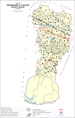 Map showing Biar Bandh (#139) in Sheosagar block. | |
 Biar Bandh Location in Bihar, India  Biar Bandh Biar Bandh (India) | |
| Coordinates: 25°01′31″N83°52′59″E / 25.02534°N 83.88299°E [1] | |
| Country | |
| State | Bihar |
| District | Rohtas |
| Area | |
• Total | 1.72 km2 (0.66 sq mi) |
| Population | |
• Total | 987 |
| • Density | 574/km2 (1,490/sq mi) |
| Languages | |
| • Official | Bhojpuri, Hindi |
| Time zone | UTC+5:30 (IST) |
| Postal code | 821111 |
| ISO 3166 code | IN-BR |
| Vehicle registration | BR-24 |
| Coastline | 0 kilometres (0 mi) |
| Nearest city | Sasaram |
Biar Bandh is a village in Sheosagar block of Rohtas district in Bihar state, India. As of 2011, its population was 987, in 212 families. [2]