Nokha, Rohtas

Last updated

Nokha, Rohtas
Nickname: 
Garh nokha
Nokha block map.png
India Bihar location map.svg
Red pog.svg
Nokha, Rohtas
Location in Bihar, India
Coordinates: 25°06′05″N84°07′22″E / 25.101513°N 84.122756°E / 25.101513; 84.122756
CountryFlag of India.svg  India
State Bihar
District Rohtas
Area
  Total13.45 km2 (5.19 sq mi)
Population
 (2011) [1]
  Total27,302
  Density2,000/km2 (5,300/sq mi)
Time zone UTC+5:30 (IST)
Website rohtas.nic.in

Nokha is a nagar panchayat town and corresponding community development block in Rohtas district in the Indian state of Bihar. As of 2011, the population of the town of Nokha was 27,302 in 4,381 households. [1] The rural population of Nokha block was 146,025, thus bringing the total block population 173,327. [1] The economic situation of this region is mainly dependent on parboiled rice processed by number of rice mills in this area.

Contents

Geography

The entire block of Nokha is situated on the Sasaram Plain. Nokha block contains 15,267 hectares, of which 90.22% is cultivable; of the cultivable area, 83.85% is irrigated. The total area of the town of Nokha is 13.45 square kilometers. [1]

Demographics

As of 2011, the town of Nokha had a population of 27,302. The total population of Nokha block, including urban and rural population, was 173,327. [1]

Population history

The 1991 Indian census recorded a population of 16,350 for Nokha town. In 2001, the population was 22,354, representing a 36.7% increase in the last decade. In 2011, the population of 27,302 marked a ten-year growth rate of 22.1%. [1]

The rural population of Nokha block was 123,408 in 2001. This increased to 146,025 as of the 2011 Census, representing an 18.3% increase. For the block as a whole, rural and urban, the population increased from 145,762 in 2011 to 173,327 in 2011, an 18.9% increase. [1]

Sex ratio

The sex ratio of the town of Nokha was 897 females to every 1000 males. In rural parts of Nokha block, the sex ratio was higher, with 917 females to every 1000 males; the overall sex ratio of Nokha block was 914. All three ratios were about average for their respective category in Rohtas district. In the 0-6 age bracket, the sex ratios were more equal: Nokha town's was 899, while the ratio among rural villages was 945, bringing the overall block ratio to 938. The rural 0-6 sex ratio was somewhat higher than the district average of 933, but the urban ratio was lower than the district average of 914. [1]

Scheduled castes and scheduled tribes membership

The total scheduled castes population of Nokha district was 31,787 (18.34% of the total population), with 3,453 of them living in Nokha town (12.65%). The percentage of the population belonging to scheduled castes was roughly average for Rohtas district. Scheduled tribes population was substantially lower: only 174 people belonged to scheduled tribes in the entire district, with 5 of them residing in Nokha town.

Literacy

The literacy rate of Nokha town was 75.69% in 2011, which was roughly average among Rohtas district's towns. Literacy was higher in men than in women: 84.33% of men but only 66.04% of women could read and write, the corresponding gender gap of 18.29% was slightly higher than the urban average of 13.33% for Rohtas. Literacy was lower in rural areas, with 72.37% of the rural population of Nokha block literate; overall, the block's literacy rate was 72.9%. [1]

Employment

In Nokha block, 22.01% of the workforce was employed as cultivators who owned or leased their own land. 45.87% were agricultural labourers, who worked someone else's land for money. 4.41% were household industry workers, and the remaining 27.71% were classed as other workers. These proportions were all roughly average for Rohtas district. In the town of Nokha, however, most of the workforce was engaged in non-agricultural work, with only 10.73% being cultivators and 17.83% being agricultural labourers. 8.75% was engaged in household industries, and 62.69% were other workers. [1]

Economy

The 2011 census listed the three most important commodities in Nokha town as rice, furniture, and bricks. [1]

Nokha is small city in Rohtas district of Bihar. It is famous in Bihar as a major centre for production of parboiled rice through the number of rice mills. Rice mills used to be major part in its economy. People living here are totally dependent on agriculture for bread and butter. There are multiple schools and colleges, still the level of education is not that much. Students have to migrate to other cities (mainly Patna) to get quality education.

Climate

The climate of the region is sub-tropical and typical of the plains of Northern India, with hot dry summers and cool winters with cold nighttime temperatures. The monsoon is vital for the district as the economy is mainly based on agriculture.

Deforestation has led to climate change and has had an environmental impact, with drought becoming more frequent and temperatures becoming warmer. As recently as the early 1990s, nighttime frost used to be common in the winter, however deforestation in the Kaimur hills has had a negative impact.

Transport

Nokha is well connected with railway and road. This place is well connected with the road, SH-12 passes through Nokha.

Education

As of 2011, the town of Nokha was home to 8 primary schools, 5 middle schools, 5 secondary schools, 1 senior secondary school, and 1 college. [1]

Villages

Nokha block contains 87 villages (81 inhabited and 6 uninhabited), not counting Nokha itself. [1]

Village nameTotal land area (hectares)Population (in 2011)
Dharampura2522,570
Majrarh3692,918
Singwa Dharampur165685
Parsia49296
Parsia Nisf51456
Kaithi2801,663
Panrwa136829
Nonsari4933,410
Bhikharidih1341,050
Sisrit5414,368
Pauni960
Jabra1112,224
Salempur44558
Baligawan1691,070
Tilai3431,922
Faridpur49492
Badjoga2442,178
Rupahtha2071,838
Bishanpura2861,940
Nawadih163255
Hathni4873,484
Barawan79611,427
Kharari3041,820
Biseni Khurd862,192
Shivpur1441,266
Kadwa83711,402
Nawadih136960
Meyari941,343
Kuri2552,914
Mani1401,969
Maudiha2532,369
Chanka861,084
Jakhani175335
Penar1951,646
Rampur Gazi460
Kusahi113729
Rampur1301,791
Sisirta3162,934
Bhawandihri168903
Pipra2382,656
Gopalpur981,604
Gangahar108757
Tarar1651,638
Dharupur2972,548
Ghusia4786,418
Charnarh1202,006
Bhaunra2682,595
Dudhar1201,600
Gamharia1511,358
Baradih71812
Hasnadih771,391
Sotawan2082,354
Sitalpur43527
Tendua511,094
Dera161684
Sariawan1401,680
Kusaha670
Ram Nagar55373
Akrahia33300
Ghetarua55435
Dumra1331,481
Sirkhinda1552,865
Chhabilapur67863
Ghurdihan2261,329
Bishambharpur64512
Chhatauna2231,545
Bhatauli115818
Rampur80925
Gosainpur1971,500
Karan127998
Milki32267
Misrauli24120
Karma1231,122
Khairahan1661,443
Pach Pakhri1801,995
Chorpokhar380
Gamharia1401,055
Salempur390
Lilari3292,617
Majhiyawan2682,196
Itawa83658
Bhaon1731,981
Chanki1852,075
Naran2041,060
Karmahi110
Pachahar49571
Eghara1861,909

Related Research Articles

<span class="mw-page-title-main">Rohtas district</span> District of Bihar in India

Rohtas District is one of the thirty-eight districts of Bihar state, India. It came into existence when Shahabad District was bifurcated into Bhojpur & Rohtas in 1972. Administrative headquarter of the district is Sasaram. Rohtas district has the highest literacy in Bihar. The literacy rate of Rohtas district which is 73.37% as per 2011 census is highest among all 38 districts of Bihar.

Bikramganj is a nagar parishad city and corresponding community development block of Rohtas district, Bihar, India. At the time of the 2011 census, the city of Bikramganj had a population of 48,465, in 7,968 households, while the overall subdistrict had a population of 163,565. The main commodities produced in Bikramganj are rice and pulses. The city of Bikramganj has a slum called Dhangai which, in 2011 had a population of 3,955 in 637 households. Bikramganj is located at 25.2°N 84.25°E. It has an average elevation of 77 metres (252 feet).

<span class="mw-page-title-main">Tilouthu</span> Town in Bihar, India

Tilothu, also spelled Tilauthu or Tilothu, is a village and corresponding community development block in Rohtas district, Bihar, India. It is located 15 km from Dehri-on-Sone on the west bank of the Son River. As of 2011, the population of Tilouthu was 16,402, in 2,745 families, while the corresponding block population was 109,249.

<span class="mw-page-title-main">Dinara, Bihar</span> Village in Bihar, India

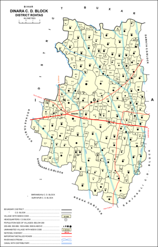
Dinara is a regional market in Rohtas district, Bihar, India, near the National Highway 30. The birthplace of the famous poet Dariya Saheb is just 5 km from Dinara.

<span class="mw-page-title-main">Sheosagar</span> Village in Bihar, India

Sheosagar, also spelled Shiusagar or Shivsagar, is a village and corresponding community development block in Rohtas district of Bihar, India. As of 2011, the village of Sheosagar had a population of 2,065, in 345 households, while the entire block had a population of 176,080. The nearest major city is Sasaram, the capital of Rohtas district.

<span class="mw-page-title-main">Chenari, India</span> Census town in Bihar, India

Chenāri or Chanāri is a census town and corresponding community development block in Rohtas district of Bihar, India. As of 2011, the town of Chenari had a population of 6,569, while Chenari block had a population of 131,528. Major commodities produced in the town of Chenari are chironji, rice, and pulses. The census town of Bhardua is administratively counted as part of Chenari block.

<span class="mw-page-title-main">Rohtas block</span> Place in Bihar, India

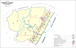
Rohtas is a community development block in Rohtas district of Bihar, India. The block headquarters is in the village of Akbarpur, 5 km east of the historic Rohtas Fort. As of 2011, the population of Rohtas block was 86,049.

<span class="mw-page-title-main">Kārākāt</span> Village in Bihar, India

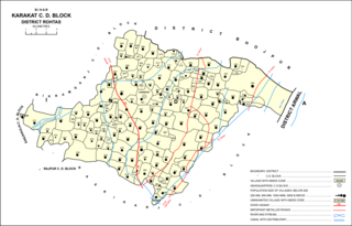
Kārākāt is a village and corresponding Community Development Block in Rohtas district of Bihar, India. As of 2011, the village of Karakat has a population of 2563, in 400 households; the total population of Karakat block is 209,284.

<span class="mw-page-title-main">Rajpur, Rohtas</span> Village in Bihar, India

Rajpur is a village and corresponding community development block in Rohtas district of Bihar, India. As of 2011, the village of Rajpur had a population of 11,780, in 1,778 households, while Rajpur block had a population of 75,213.

<span class="mw-page-title-main">Akorhi Gola</span> Village in Bihar, India

Akorhi Gola is a village and corresponding community development block in Rohtas district of Bihar, India. Located 6 km north of Dehri, Akorhi Gola is known for its blanket weaving industry. As of 2011, the village had a population of 3,810, in 601 households, while the total block population was 120,145.

<span class="mw-page-title-main">Sanjhauli</span> Village in Bihar, India

Sanjhauli, also spelled Sajhauli, is a village and corresponding community development block in Rohtas district of Bihar, India. As of 2011, the village of Sanjhauli had a population of 7,608, in 1,269 households, while the entire block had a population of 62,621. The nearest major city is Bikramganj.

<span class="mw-page-title-main">Suryapura, India</span> Village in Bihar, India

Suryapura, also spelled Surajpura, is a village and corresponding community development block in Rohtas district of Bihar, India. As of 2011, the village of Suryapura had a population of 6,347, in 900 households, while Suryapura block had a population of 57,529, in 8,728 households. It is the least populous of Rohtas's 19 blocks.

<span class="mw-page-title-main">Nauhatta, Rohtas</span> Village in Bihar, India

Nauhatta is a village and corresponding community development block in Rohtas district of Bihar, India. As of 2011, the village of Nauhatta had a population of 5,103, in 909 households, while Nauhatta block had a population of 94,065, in 16,387 households. The nearest city is Dehri.

<span class="mw-page-title-main">Kargahar</span> Village in Bihar, India

Kargahar is a village and corresponding community development block in Rohtas district of Bihar, India. As of 2011, the population of Kargahar was 10,170, in 1,464 households, while the population of Kargahar block was 225,082, in 31,528 households. The nearest city is Sasaram, the district headquarters.

<span class="mw-page-title-main">Garhani</span> Village in Bihar, India

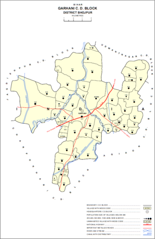
Garhani is a village and corresponding community development block in Bhojpur district of Bihar, India. As of 2011, its population was 5,597, in 959 households. The total block population was 103,262, in 16,427 households.

<span class="mw-page-title-main">Udwantnagar</span> Village in Bihar, India

Udwantnagar is a village and corresponding community development block in Bhojpur district of Bihar, India. As of 2011, its population was 9,000, in 1,496 households. The total block population was 157,809, in 24,336 households.

<span class="mw-page-title-main">Charpokhari</span> Village in Bihar, India

Charpokhari is a village and corresponding community development block in Bhojpur district of Bihar, India. As of 2011, its population was 1,874, in 314 households. The total block population was 101,363, in 15,961 households.

<span class="mw-page-title-main">Tarari, Bihar</span> Village in Bihar, India

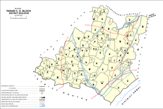
Tarari is a village and corresponding community development block in Bhojpur district of Bihar, India. As of 2011, its population was 3,586, in 393 households. The total block population was 182,631, in 28,316 households.

<span class="mw-page-title-main">Agiaon</span> Village in Bihar, India

Agiaon is a village and corresponding community development block in Bhojpur district of Bihar, India. As of 2011, its population was 4,801, in 835 households. The total block population was 148,373, in 23,117 households.

<span class="mw-page-title-main">Sandesh, Bihar</span> Indian village in Bhojpur district, Bihar

Sandesh is a village and corresponding community development block in Bhojpur district of Bihar, India. As of 2011, its population was 6,874, in 1,037 households. The total block population was 109,712, in 17,011 households.

References

  1. 1 2 3 4 5 6 7 8 9 10 11 12 13 "Census of India 2011: Bihar District Census Handbook - Rohtas, Part A (Village and Town Directory)". Census 2011 India. pp. 25, 33, 44–70, 644–683, 1191–1192, 1286–1299. Retrieved 20 May 2020.