Johnson Village, Colorado

Last updated

Johnson Village, Colorado
Johnson Village, Colorado.JPG
View of Johnson Village with Mount Princeton in the background.
Chaffee County Colorado Incorporated and Unincorporated areas Johnson Village Highlighted 0839800.svg
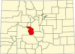
Location of the Johnson Village CDP in Chaffee County, Colorado.
Usa edcp location map.svg
Red pog.svg
Johnson Village
Location of the Johnson Village CDP in the United States.
Coordinates: 38°48′43″N106°06′26″W / 38.81194°N 106.10722°W / 38.81194; -106.10722 (Johnson Village CDP, Colorado) [1]
Country Flag of the United States.svg United States
State Flag of Colorado.svg Colorado
County Chaffee County
Government
[1]
  Type unincorporated community
Area
[2]
  Total
0.299 sq mi (0.774 km2)
  Land0.299 sq mi (0.774 km2)
  Water0 sq mi (0.000 km2)
Elevation
[1]
7,855 ft (2,394 m)
Population
 (2020) [3]
  Total
299
  Density1,000/sq mi (386/km2)
Time zone UTC-7 (MST)
  Summer (DST) UTC-6 (MDT)
ZIP Code [4]
Area code 719
GNIS feature ID 2583254 [1]

Johnson Village is an unincorporated community and a census-designated place (CDP) located in and governed by Chaffee County, Colorado, United States. The population of the Johnson Village CDP was 299 at the United States Census 2020. [3] The Buena Vista post office (Zip Code 81211) serves the area. [4]

Contents

Geography

Johnson Village is located along the west side of the Arkansas River, where the river is bridged by U.S. Highway 24. It is approximately three miles south of the town of Buena Vista. The community consists largely of a strip of retail establishments along either side of U.S. Highway 24, on the west side of Trout Creek Pass. The economy of the town is based largely on pass-through traffic, including tourism, in particular whitewater rafting on the Arkansas River.

The Johnson Village CDP has an area of 191 acres (0.774 km2), all land. [2]

Demographics

The United States Census Bureau initially defined the Johnson Village CDP for the United States Census 2010.

Johnson Village CDP, Colorado
YearPop.±%
2010 246    
2020 299+21.5%
Source: United States Census Bureau

See also

References

  1. 1 2 3 4 U.S. Geological Survey Geographic Names Information System: Johnson Village, Colorado
  2. 1 2 "State of Colorado Census Designated Places - BAS20 - Data as of January 1, 2020". United States Census Bureau . Retrieved December 21, 2020.
  3. 1 2 United States Census Bureau. "Johnson Village CDP, Colorado" . Retrieved April 17, 2023.
  4. 1 2 "Zip Code 81211 Map and Profile". zipdatamaps.com. 2020. Retrieved December 21, 2020.