Related Research Articles
Hayle Kimbro Pool is a wetland on The Lizard, Cornwall. It is situated two miles southeast of Mullion immediately northeast of Predannack airfield at grid reference SW 695 169.
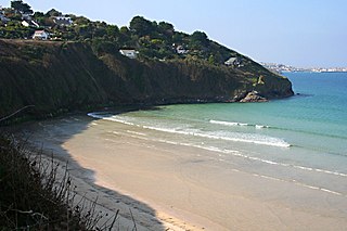
Carrack Gladden is a coastal headland in St Ives Bay at the eastern end of Carbis Bay beach between Hayle and St Ives in west Cornwall.

Hayle is a port town and civil parish in west Cornwall, England, United Kingdom. It is situated at the mouth of the Hayle River and is approximately seven miles (11 km) northeast of Penzance.

Gwinear–Gwithian is a coastal civil parish in west Cornwall, England, United Kingdom. It includes the villages of Connor Downs, Gwinear, Gwithian, Reawla and Rosewarne. The parish is situated approximately two miles (3 km) east of Hayle two miles (3 km) west of Camborne.
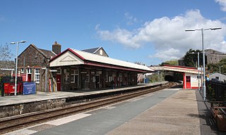
Redruth station serves the town of Redruth, Cornwall, United Kingdom; it is situated on the Cornish Main Line between Truro and Camborne. The station is 309 miles 68 chains down the line from the zero point at London Paddington, measured via Box and Plymouth Millbay.

Camborne and Redruth is a constituency in Cornwall represented in the House of Commons of the UK Parliament since 2024 by Perran Moon of the Labour Party. The seat is on the South West Peninsula of England, bordered by both the Celtic Sea to the northwest and English Channel to the southeast.
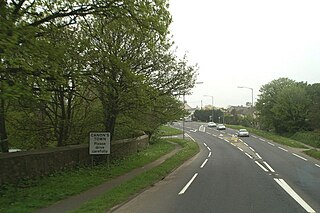
Canon's Town or Canonstown is a hamlet in west Cornwall, England, UK, situated on the A30 road in the civil parish of Ludgvan, between Penzance and Hayle. It is southwest of St Erth railway station. It is in the civil parish of St Erth

Connor Downs is a village in west Cornwall, England, United Kingdom, in the civil parish of Gwinear-Gwithian. It is situated approximately two miles (3 km) east of Hayle and about two miles south-southeast of Gwithian churchtown. The name "Connor" was originally the name of Connerton, the medieval manor of the parish of Gwithian.

The River Hayle is a small river in West Cornwall, England, United Kingdom which issues into St Ives Bay at Hayle on Cornwall's Atlantic coast.

Towan is found in many placenames in Cornwall. However, The Towans usually refers to the three-mile (5 km) stretch of coastal dunes which extends north-east from the estuary of the River Hayle to Gwithian beach with a midpoint near Upton. The South West Coast Path crosses the towans.
There are seventeen disused railway stations on the Cornish Main Line between Plymouth in Devon and Penzance in Cornwall, England. The remains of nine of these can be seen from passing trains. While a number of these were closed following the so-called "Beeching Axe" in the 1960s, many of them had been closed much earlier, the traffic for which they had been built failing to materialise.
The Cornish Way is a cycle route which is part of the National Cycle Network that links Bude to Land's End. The route is via Padstow or St Austell and is 180 miles in length.
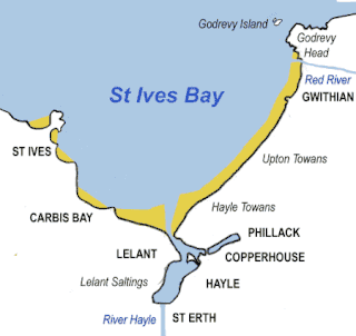
St Ives Bay is a bay on the Atlantic coast of north-west Cornwall, England, United Kingdom. It is in the form of a shallow crescent, some 4 miles or 6 km across, between St Ives in the west and Godrevy Head in the east.
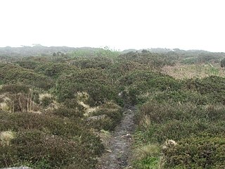
Caer Bran Hill Fort is an archaeological site near Sancreed and Carn Euny Iron Age village, on the Penwith peninsula in Cornwall.
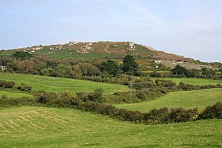
Trencrom Hill is a prominent hill fort, owned by the National Trust, near Lelant, Cornwall. It is crowned by an univallate Neolithic tor enclosure and was re-used as a hillfort in the Iron Age. Cairns or hut circles can be seen in the level area enclosed by the stone and earth banks. The hill overlooks the Hayle Estuary and river, and Mount's Bay and St Michael's Mount can be seen to the south. The hill was recorded as Torcrobm in 1758 which is derived from Cornish "torr crobm", i.e. 'hunched bulge'.
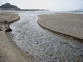
The Red River which discharges into the sea to the west of Marazion is one of two watercourses in Cornwall in southwest England, UK, which share this name.

Relubbus is a hamlet in the parish of St Hilary, west Cornwall, England. It is on the B3280 road between Townshend and Goldsithney; the River Hayle runs through Relubbus.

Wheal Alfred is the site of a former copper and lead mine and a designated Site of Special Scientific Interest (SSSI) in west Cornwall, England, UK. The mine is located 1 mile (1.6 km) east of the town of Hayle and is also a Geological Conservation Review site. The mine is famous to geologists for its important mineral specimens such as mimetite and pyromorphite.
Loggans Moor is a nature reserve and Site of Special Scientific Interest, noted for its biological characteristics, in west Cornwall, England, UK. It is located 1 mile north-east of the town of Hayle, off the A30 road.
SS Lady of the Isles was a passenger vessel built by Harvey and Company, Hayle for the West Cornwall Steam Ship Company in 1875.
References
- ↑ Craig Weatherhill (2017). The Place-Names of the Land's End Peninsula. Penwith Press. p. 123. ISBN 9781999777500.
- ↑ Ordnance Survey: Landranger map sheet 203 Land's End ISBN 978-0-319-23148-7