Kalinkovo

Last updated
Kalinkovo
Municipality
Kalinkovo 01.jpg
Bratislava Region - physical map.png
Red pog.svg
Kalinkovo
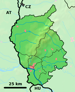
Location of Kalinkovo in the Bratislava Region
Slovakia relief location map.svg
Red pog.svg
Kalinkovo
Kalinkovo (Slovakia)
Coordinates: 48°04′N17°15′E / 48.067°N 17.250°E / 48.067; 17.250
CountrySlovakia
Region Bratislava
District Senec
First mentioned1258
Area
  Total12.91 [1]  km2 (4.98 [1]  sq mi)
Elevation
129 [2]  m (423 [2]  ft)
Population
 (2021)
  Total1,478 [3]
Postal code
900 43 [2]
Area code +421 15 [2]
Car plate SC
Website www.obeckalinkovo.sk

Kalinkovo (Hungarian : Szemet) is a village and municipality in western Slovakia in Senec District in the Bratislava Region. [4] [5]

Contents

History

The village was first mentioned in 1258 as Dénešdi village and later in 1288 as Šemet. [6] In 1948 the name was changed to Kalinkovo that carries today. [7]

Geography

The municipality lies at an altitude of 131 meters and covers an area of 12.912 km². [8] It has a population of 1193 people. [9]

Facilities

The village has a public library, post office, gas distribution network and a football pitch. [9] In the centre of the village is one big church (in comparison with other neighbour villages) called Kostol sv. Františka z Assisi.In this village you can also find a small graveyard with 3 meters tall jesus on the cross statue. [10]

Genealogical resources

The records for genealogical research are available at the state archive "Statny Archiv in Bratislava, Slovakia"

See also

External links/Sources

  1. 1 2 "Hustota obyvateľstva - obce [om7014rr_ukaz: Rozloha (Štvorcový meter)]". www.statistics.sk (in Slovak). Statistical Office of the Slovak Republic. 2022-03-31. Retrieved 2022-03-31.
  2. 1 2 3 4 "Základná charakteristika". www.statistics.sk (in Slovak). Statistical Office of the Slovak Republic. 2015-04-17. Retrieved 2022-03-31.
  3. "Počet obyvateľov podľa pohlavia - obce (ročne)". www.statistics.sk (in Slovak). Statistical Office of the Slovak Republic. 2022-03-31. Retrieved 2022-03-31.
  4. "Obec Kalinkovo | Oficiálne stránky obce | Obec Kalinkovo". Archived from the original on 2014-08-18. Retrieved 2012-11-01.
  5. "Titulná stránka -... - UPVS".
  6. "Obec Kalinkovo | Oficiálne stránky obce | História". www.obeckalinkovo.sk. Archived from the original on 2013-10-21.
  7. "Home". kalinkovo.cestovanie.biz.
  8. "Kalinkovo - Okres Senec - E-OBCE.sk".
  9. 1 2 "Kalinkovo - Súčasnosť obce - Okres Senec - E-OBCE.sk".
  10. "Pamiatky - Kalinkovo (Okres Senec) - informácie, turistika, bývanie, pamiatky".


Related Research Articles

<span class="mw-page-title-main">Cífer</span> Village in Trnava Region, Slovakia

Cífer is a municipality (village) in the Trnava District, Slovakia. It has a population of 4,610.

<span class="mw-page-title-main">Dolné Dubové</span> Municipality in Slovakia

Dolné Dubové is a village and municipality of Trnava District in the Trnava region of Slovakia.

<span class="mw-page-title-main">Dolné Lovčice</span> Municipality in Slovakia

Dolné Lovčice is a village and municipality of Trnava District in the Trnava region of Slovakia.

<span class="mw-page-title-main">Horné Orešany</span> Village in Slovakia

Horné Orešany is a village and municipality of the Trnava District in the Trnava region of Slovakia. It is located 16 km from the district capital Trnava and 48 km from Bratislava. A reservoir, also named Horné Orešany, is located nearby. The village is famous for its wine cultivation. A special type of wine Orešanské červené /The Red one from Orešany/ is a local and national wine speciality.

<span class="mw-page-title-main">Kátlovce</span> Municipality in Slovakia

Kátlovce is a village and municipality of Trnava District in the Trnava region of Slovakia.

<span class="mw-page-title-main">Čerenčany</span> Village in Slovakia

Čerenčany, is a village and municipality in the Rimavská Sobota District of the Banská Bystrica Region of southern Slovakia. During the past several years the village recorded a growth in population, due to which new houses and condominiums were built. The village is gradually taking the name of a satellite village in Rimavská Sobota. Most important sightseeing in the village is classical evangelical church built in 1831.

<span class="mw-page-title-main">Muránska Lehota</span> Municipality in Slovakia

Muránska Lehota is a village and municipality in Revúca District in the Banská Bystrica Region of Slovakia, located in the southern part of the Slovak Ore Mountains. There are two fishing ponds located on the territory of the village known as the "Upper Pond" and the "Lower Pond".

<span class="mw-page-title-main">Sušany</span> Municipality in Slovakia

Sušany is a village in the Poltár District of Slovakia. The village lies in the southern part of the historic area of Malohont, in the valley of the small river Suchá.

<span class="mw-page-title-main">Kociha</span> Municipality in Slovakia

Kociha is a village and municipality in the Rimavská Sobota District of the Banská Bystrica Region of southern Slovakia. Part of the village is the settlement Suchý potok, which is gradually developing as agrotourism settlement. Important sightseeing is late classical evangelical church.

<span class="mw-page-title-main">Hajnáčka</span> Village in Slovakia

Hajnáčka is a village and municipality in the Rimavská Sobota District of the Banská Bystrica Region of southern Slovakia.

<span class="mw-page-title-main">Jesenské, Rimavská Sobota District</span> Village in Slovakia

Jesenské is a village and municipality in the Rimavská Sobota District of the Banská Bystrica Region of southern Slovakia.

Horná Strehová is a village and municipality in the Veľký Krtíš District of the Banská Bystrica Region of southern Slovakia.

Horné Štitáre is a municipality in the Topoľčany District of the Nitra Region, Slovakia. In 2011 it had 491 inhabitants.

Kamanová is a municipality in the Topoľčany District of the Nitra Region, Slovakia. In 2011 it had 601 inhabitants.

<span class="mw-page-title-main">Budmerice</span> Village in Slovakia

Budmerice is a village and municipality in western Slovakia in Pezinok District in the Bratislava region.

Hrubá Borša or Nagyborsa is a village and municipality in western Slovakia in Senec District in the Bratislava Region.

<span class="mw-page-title-main">Chorvátsky Grob</span> Village in Slovakia

Chorvátsky Grob is a village and municipality in western Slovakia in Senec District in the Bratislava region. It has a population of around 6,000 people.

<span class="mw-page-title-main">Kaplna</span> Village in Slovakia

Kaplna is a village and municipality in western Slovakia in Senec District in the Bratislava Region. It is located about ten kilometres north-east of Senec on a road connecting Senec with Trnava.

<span class="mw-page-title-main">Zálesie, Senec District</span> Municipality in Slovakia

Zálesie is a village and municipality in western Slovakia in Senec District in the Bratislava Region.

<span class="mw-page-title-main">Veľkrop</span> Municipality in Slovakia

Veľkrop is a village and municipality in Stropkov District in the Prešov Region of north-eastern Slovakia.