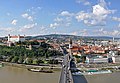
Bratislava Region

Last updated

Bratislava Region
Bratislavský kraj
Hlavne Namestie (35096533142).jpg
Bratislavsky vlajka.svg
Coat of Arms of Bratislava Region.svg
Bratislavsky kraj in Slovakia.svg
Country Slovakia
Capital Bratislava
Government
  BodyCounty Council of Bratislava Region
  Governor Juraj Droba (SaS)
Area
  Total
2,053 km2 (793 sq mi)
Highest elevation
754 m (2,474 ft)
Lowest elevation
123 m (404 ft)
Population
 (2021-01-01) [1]
  Total
719,537
  Density350.5/km2 (907.7/sq mi)
GDP
  Total€30.709 billion (2022)
  Per capita€42,679 (2022)
ISO 3166 code SK-BL
HDI (2022)0.945 [4]
very high · 1st
Website bratislavskykraj.sk

The Bratislava Region [a] is one of the administrative regions of Slovakia. Its capital is Bratislava. The region was first established in 1923 and its present borders exist from 1996. It is the smallest of the eight regions of Slovakia as well as the most urbanized, most developed and most productive by GDP per capita.

Contents

Geography

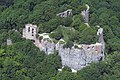
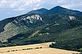
The region is located in the south-western part of Slovakia and has an area of 2052.60 km2. [5] The region is split by the Little Carpathians which start in Bratislava and continue north-eastwards; these mountains separate two lowlands, the Záhorie lowland in the west and the fertile Danubian Lowland in the east, which grows mainly wheat and maize. Major rivers in the region are the Morava River, the Danube and the Little Danube; the last of these, together with the Danube, encircle the Žitný ostrov in the south-east. There are three protected landscape areas in the region: the Little Carpathians, Záhorie and Dunajské luhy. The region borders Trnava Region in the north and east, Győr-Moson-Sopron county in Hungary in the south, Burgenland in Austria in the south-west and Lower Austria in the west.

History

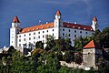
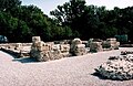
The first known permanent settlement of the area of today's Bratislava was the Linear Pottery Culture, around 5000 BC in the Neolithic era. Around 200 BC, the Celtic Boii tribe established an oppidum on the site of today's Bratislava Castle. The Romans established their camp Gerulata on the right bank of the Danube in the 1st century[ clarification needed ] and remained there until the 4th century. The area was part of the Principality of Nitra and later, in the 9th century, of Great Moravia. From the 10th century onwards, it became part of the Principality of Hungary (later the Kingdom of Hungary) and almost the whole area was part of Pozsony county (the exception being three villages south of Bratislava which were part of Moson county). After the break-up of Austria-Hungary in 1918, region was newly defined in 1923 and present Bratislava region approximately copies its 1923 borders. Bratislava Regio was abolished in 1928 and replaced by a new territorial unit called the "Slovak Land". During the WWII Slovak Republic, Bratislava county was restored, albeit with somewhat modified borders. After the restoration of Czechoslovakia, the pre-breakup status was restored. From 1949 to 1960 a unit named Bratislava Region existed, but it was replaced in 1960 by the Western Slovak Region (except[ clarification needed ] from 1 July 1969 to 28 December 1970; Bratislava was partly separate from 1968, and from 1971 it was a separate region). After abolition of the regions in 1990, the current system was introduced in 1996. Since the administrative regions became autonomous in 2002, it has been governed by the Bratislava Self-Governing Region.

Population

Historical population
YearPop.±%
1970459,975    
1980543,800+18.2%
1991606,351+11.5%
2001599,015−1.2%
2011602,436+0.6%
2021719,537+19.4%
Source: Censuses [6] [7]
Population statistic (10 years) [8]
Year1994200420142024
Count616,871601,132625,167736,385
Difference−2.55%+3.99%+17.79%
Population statistic [8]
Year20232024
Count732,757736,385
Difference+0.49%

It has a population of 736,385 people (31 December 2024). [9]

Although it is the smallest region of Slovakia by area, it does not have the lowest population. The largest city is Bratislava (479,389) and the second largest is Pezinok (24,375). [10]

Ethnicity

Census 2021 (1+ %) [11] [12]
EthnicityNumberFraction
Slovak 626,08587.01%
Not found out59,5368.27%
Hungarian 24,5163.4%
Czech 10,4201.44%
Total719,537

In year 2021 was 719,537 people by ethnicity 626,085 as Slovak, 59,536 as Not found out, 24,516 as Hungarian, 10,420 as Czech, 6252 as Other, 2891 as Rusyn, 2420 as German, 2251 as Ukrainian, 2131 as Russian, 1538 as Romani, 1259 as Croatian, 1104 as Vietnamese, 924 as Polish, 790 as Italian, 761 as Serbian, 746 as Bulgarian, 714 as Jewish, 607 as French, 578 as Romanian, 566 as Moravian, 530 as Austrian, 473 as Chinese, 344 as Albanian, 287 as Greek, 223 as English, 172 as Canadian, 160 as Turkish, 127 as Irish, 119 as Korean, 57 as Iranian and 49 as Silesian.

Religion

Census 2021 (1+ %) [13]
ReligionNumberFraction
Roman Catholic Church 306,70342.63%
None286,73039.85%
Not found out60,2948.38%
Evangelical Church 29,6154.12%
Greek Catholic Church 79331.1%
Total719,537

In year 2021 was 719,537 people by religion 306,703 from Roman Catholic Church, 286,730 from None, 60,294 from Not found out, 29,615 from Evangelical Church, 7933 from Greek Catholic Church, 3788 from Eastern Orthodox Church, 3526 from Ad hoc movements, 3505 from Other, 2551 from Calvinist Church, 2215 from Christian Congregations in Slovakia, 2013 from Other and not ascertained christian church, 1862 from Buddhism, 1609 from Jehovah's Witnesses, 1181 from Islam, 1017 from Baptists Church, 916 from Apostolic Church, 881 from Church of the Brethren, 839 from Jewish community, 705 from Paganism and natural spirituality, 399 from United Methodist Church, 353 from Seventh-day Adventist Church, 274 from Old Catholic Church, 241 from Hinduism, 183 from Czechoslovak Hussite Church, 120 from Bahá'i Community, 75 from Church of Jesus Christ of Latter-day Saints and 9 from New Apostolic Church.

Economy

The economy of the Bratislava Region accounts for about a quarter(EUR 20 billion) of the Slovak GDP. Bratislava has one of the highest GDP per capita at PPP of among whole E.U. €51,200(~$70,000). [14] It is marked by a strong tertiary sector, while the primary sector has a share of only around 1% and the secondary sector around 20%. [15] Important branches include chemical, automobile, machine, electrotechnical and food industries. [16]

Politics

The current governor of the Bratislava region is Juraj Droba (SaS). He won with 20.4&%. In the 2017 election, the regional parliament was elected as well:

County Council of Bratislava region
Coat of Arms of Bratislava Region.svg
Type
Type
HousesCounty Council
Leadership
Governor
Structure
Seats53
Bratislavaparliament(new).svg
Political groups
  Liberal group (27) [b]
  Mayors for region (13) [c]
  Independent group (9)
  Non-affiliated (4) [d]
Elections
Last election
29 October 2022
Meeting place
Urad Bratislavskeho samospravneho kraja - 47582061192.jpg
Governor's office, Bratislava
Website
Council of Bratislava region

2022 elections

Droba (SaS) won the 2022 governor's elections against several other candidates.

Summary of the 29 October 2022 regional election results in Bratislava region
Candidates2022 Results
%Votes
Juraj Droba (Liberal [e] )63.60136 983
Ján Mažgút (Nationalist [f] )13.4228 911
Ivan Bošňák (Centre-right [g] )8.5618 445
Dušan Velič (Centre-right [h] )8.0817 420
Others6.2913 592
Total219 179
  1. (Slovak: Bratislavský kraj , pronounced [ˈbracislawskiːˈkraj] ; German: Pressburger/Bratislavaer Landschaftsverband (until 1919); Hungarian: Pozsonyi kerület)
  2. SaS, PS, Team Bratislava

  3.   I am Slovakia (6)
      STANK (2)
      Tím Ružinov (2)
      Independent (2)
      Voice (1)

  4.   Independent (2)
      Alliance (1)
      Good Choice (1)
  5. SaS , PS, TB
  6. Direction , SNS
  7. Together, Chance, ODS, DS
  8. KDH, , SR, MF

2017 elections

Droba (SaS) won the 2017 governor's elections against several other candidates.

Slovakia Bratislava Region Parliament 2017.svg
Political partySeats won+/-PercentageElectoral leader [17]
Independents 25Increase2.svg 1950,00%Martin Zaťovič
Centre-right coalition [18] 17Decrease2.svg 534,00%Elena Pätoprstá
Coalition led by Smer–SD [19] 6Decrease2.svg 812,00%Vladimír Bajan
Doma Dobre  [ sk ]1Increase2.svg 12,00%Peter Tydlitát
Nezávislé fórum  [ sk ]1Steady2.svg 12,00%Alžbeta Ožvaldová

2013 elections

Pavol Frešo (SDKÚ–DS) won the 2013 governor's elections over the centre-left candidate Monika Beňová (Smer–SD). Pavol Frešo was also supported by SaS, OKS, Most–Híd, SMK-MKP, KDH and SZ.

BRATISLAVA2013.svg
Political partySeats won+/-PercentageElectoral leader
KDH [20] 9Increase2.svg 120,46%Dušan Pekár
Most–Híd [21] 7Increase2.svg 615,91%Attila Horváth
SaS [22] 7Increase2.svg 615,91%Vladimír Sloboda
SDKÚ–DS [23] 6Decrease2.svg 413,64% Ivo Nesrovnal
Independents 6Increase2.svg 413,64%Rudolf Kusý
SMK-MKP [24] 3Decrease2.svg 26,82%Zuzana Schwartzová
OKS [25] 2Decrease2.svg 14,55% Ondrej Dostál
Smer–SD 1Decrease2.svg 122,27%Peter Fitz
NaS–NS  [ sk ]1Increase2.svg 12,27%Oskar Dobrovodský
Nezávislé fórum  [ sk ]1Steady2.svg 12,27%Marta Černá
ZZ–DÚ 1Increase2.svg 12,27%Elena Pätoprstá

2009 elections

The 2009 regional elections were won by Pavol Frešo (SDKÚ–DS) over the independent candidate Vladimír Bajan. Pavol Frešo was also supported by SaS, OKS, SMK-MKP and KDH.

BRATISLAVA2009.svg
Political partySeats won+/-PercentageElectoral leader
Smer–SD [26] 13Increase2.svg 329,55% Milan Ftáčnik
SDKÚ–DS [27] 10Decrease2.svg 622,73%Ladislav Snopko
KDH [28] 8Increase2.svg 218,18%Dušan Pekár
SMK-MKP [29] 5Steady2.svg 011,36%Zuzana Schwartzová
OKS [30] 3Increase2.svg 16,82% František Šebej
Independents 2Decrease2.svg 14,55%Rudolf Kusý
ĽS–HZDS [31] 1Increase2.svg 12,27%Ladislav Balla
Most–Híd 1New2,27%Alžbeta Ožvaldová
SaS 1New2,27%Anna Zemanová

Administrative division

The Bratislava Region consists of 8 districts: Malacky, Pezinok, Senec and 5 districts of Bratislava (Bratislava I – Bratislava V, which form the city of Bratislava).

There are 73 municipalities in the region, of which 7 are towns.

DistrictArea [km2] [32] Population [33]
Bratislava I 9.5947,635
Bratislava II 92.49126,649
Bratislava III 74.6778,125
Bratislava IV 96.70105,137
Bratislava V 94.20121,843
Malacky 949.5179,982
Pezinok 375.5370,063
Senec 359.88106,951

Places of interest

Notes

    References

    1. "SODB2021 – ObyvateliA–Základné výsledky".
    2. Regions and Cities > Regional Statistics > Regional Economy > Regional GDP per Capita, OECD.Stats. Accessed on 16 November 2018.
    3. "EU regions by GDP, Eurostat". www.ec.europa.eu. Retrieved 18 September 2023.
    4. "Sub-national HDI - Area Database - Global Data Lab". hdi.globaldatalab.org. Retrieved 25 September 2024.
    5. "Hustota obyvateľstva - obce [om7015rr_obc=AREAS_SK, v_om7015rr_ukaz=Rozloha (Štvorcový meter)]". Statistical Office of the Slovak Republic. 31 March 2025. Retrieved 31 March 2025.
    6. "Statistical lexikon of municipalities 1970-2011" (PDF) (in Slovak).
    7. "Census 2021 - Population - Basic results". Statistical Office of the Slovak Republic. 1 January 2021.
    8. 1 2 "Počet obyvateľov podľa pohlavia - obce (ročne) [om7102rr_obce=AREAS_SK]". Statistical Office of the Slovak Republic. 31 March 2025. Retrieved 31 March 2025.
    9. "Počet obyvateľov podľa pohlavia - obce (ročne) [om7102rr_obce=AREAS_SK]". Statistical Office of the Slovak Republic. 31 March 2025. Retrieved 31 March 2025.
    10. "Počet obyvateľov podľa pohlavia - obce (ročne) [om7102rr_obce=AREAS_SK]". Statistical Office of the Slovak Republic. 31 March 2025. Retrieved 31 March 2025.
    11. "Population - Basic results". www.scitanie.sk. Statistical Office of the Slovak republic. Retrieved 3 November 2025.
    12. "Population - Basic results". www.scitanie.sk. Statistical Office of the Slovak republic. Retrieved 3 November 2025.
    13. "Population - Basic results". www.scitanie.sk. Statistical Office of the Slovak republic. Retrieved 3 November 2025.
    14. "Statistics". ec.europa.eu. Retrieved 15 February 2020.
    15. Eurostat Archived 28 January 2008 at the Wayback Machine
    16. "Chyba: Požadovaná stránka není dostupná". region-bsk.sk. Archived from the original on 25 June 2018. Retrieved 15 February 2020.
    17. The highest number of votes in preferential voting.
    18. SaS, OKS, OĽaNO, NOVA, KDH, SMK-MKP ZZ–DÚ
    19. Smer–SD, Most–Híd, SZ, SDKÚ–DS, SKOK–ELD, STANK
    20. Candidated as coalition with SDKÚ–DS, SaS, OKS, SZ, Most–Híd, SMK-MKP.
    21. Candidated as coalition with SDKÚ–DS, SaS, OKS, SZ, KDH, SMK-MKP.
    22. Candidated as coalition with SDKÚ–DS, Most–Híd, OKS, SZ, KDH, SMK-MKP.
    23. Candidated as coalition with SaS, Most–Híd, OKS, SZ, KDH, SMK-MKP.
    24. Candidated as coalition with SaS, Most–Híd, OKS, SZ, KDH, SDKÚ–DS.
    25. Candidated as coalition with SaS, Most–Híd, SMK-MKP, SZ, KDH, SDKÚ–DS.
    26. In coalition SZS, ĽS–HZDS, Smer–SD, HZD.
    27. In coalition SDKÚ–DS, OKS, KDH, SMK-MKP.
    28. In coalition SDKÚ–DS, OKS, KDH, SMK-MKP.
    29. In coalition SDKÚ–DS, OKS, KDH, SMK-MKP.
    30. In coalition SDKÚ–DS, OKS, KDH, SMK-MKP.
    31. In coalition SZS, ĽS–HZDS, Smer–SD, HZD.
    32. "Hustota obyvateľstva - obce [om7015rr_obc=AREAS_SK, v_om7015rr_ukaz=Rozloha (Štvorcový meter)]". Statistical Office of the Slovak Republic. 31 March 2025. Retrieved 31 March 2025.
    33. "Počet obyvateľov podľa pohlavia - obce (ročne) [om7102rr_obce=AREAS_SK]". Statistical Office of the Slovak Republic. 31 March 2025. Retrieved 31 March 2025.

    48°08′38″N17°06′35″E / 48.14389°N 17.10972°E / 48.14389; 17.10972