The Punjabis or Punjabi people are an Indo-Aryan ethnolinguistic group associated with the Punjab region in South Asia, presently divided between Punjab, India and Punjab, Pakistan. They speak Punjabi, a language from the Indo-Aryan language family. The name Punjab literally means the land of five waters in Persian: panj ("five") āb ("waters"). The name of the region was introduced by the Turko-Persian conquerors of the Indian subcontinent. The Punjabis are the 7th largest ethnic group in the world by total population.
The Valmiki is a large cluster of castes, and local groups from India. The Valmikis can be classified as a caste or Sampradaya (tradition). In terms of being classified as Sampradaya, the Valmikis trace their tradition to the Hindu sage Valmiki who is traditionally ascribed as the writer of the epic Ramayana. According to historians Valmiki of North India is basically Kshatriya. Valmiki Nayaka people have been ruled by South India during the medieval period of India. The term Valmiki Nayaka Covers various patrilineal clans historically associated with warriorhood. Valmiki's of South India is called the Kshatriya class.

Dhobi is a caste group of India. Their traditional occupation was washing clothes, i.e. laundry. The word dhobi is derived from the Hindi word dhona, which means to wash.
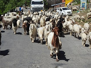
The Gaddis is a community living mainly in the Indian states of Himachal Pradesh and Jammu and Kashmir. The term Gaddi is a generic name and under this appellation are included Khatris, Brahmins, Rajputs and Rathis. However, the vast majority are Khatris and the subdivisions of the caste correspond exactly with the tribes among the Khatris existing in the plains of Punjab. They are found mostly in Brahmaur, Pangi tehsils, Holi and Sihunta sub-tehsils of the district Chamba, Himachal Pradesh.

Khaira is a village in Ludhiana district in the Indian state of Punjab.
Hinduism is the second largest religion in Pakistan after Islam. Pakistan gained independence from Britain in 1947, and in the first census afterwards in 1951, Hindus made 1.6% of the total population of West Pakistan, and 22% of East Pakistan. However, before partition, according to the 1941 census, Hindus constituted 14% of the Population in West Pakistan and 28% of the Population in East Pakistan Hindus made up 1.85% of Pakistan's population according to the 1998 census - although the Pakistan Hindu Council claims there are around 8 million Hindus living in Pakistan, comprising 4% of the Pakistani population. As of 2010, Pakistan has the fifth-largest Hindu population in the world and by 2050 may rise to the fourth-largest Hindu population in the world, reaching 5.6 million and constituting 2% of the Pakistani population. However, voluntary as well as forced religious conversions have brought down the number of Hindus in Pakistan by up to 1,000 per year.

Amritsar district is one of 22 districts located in the Majha region of the Indian state of Punjab. The city of Amritsar is the headquarters of this district.

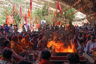
Hinduism is the largest religion in India, with 79.8% of the population identifying themselves as Hindus, that accounts for 966 million Hindus as of National Census of India in 2011 making it as the world's largest Hindu populated country, while 14.2% of the population follow Islam and the remaining 6% adhere to other religions. The vast majority of Hindus in India belong to Shaivite and Vaishnavite denominations. India is one of the three countries in the world where Hinduism is the majority.
Chamar is a dalit community classified as a Scheduled Caste under modern India's system of positive discrimination. Historically subject to untouchability, they were traditionally outside the Hindu ritual ranking system of castes known as varna. They are found throughout the Indian subcontinent, mainly in the northern states of India and in Pakistan and Nepal.

Ludhiana District is one of the 22 districts in the Indian state of Punjab. It is the largest district of Punjab, by both area and population. Ludhiana city, the district headquarters, is the hub of industry in Punjab. The main industries are bicycle parts and hosiery. Ludhiana is the biggest city of the state. It has eight tehsils, seven sub-tehsils and twelve development blocks.
Mazhabi Sikhs are members of an untouchable caste who have left Hinduism in favour of the Sikhism. The word Mazhabi is derived from the Urdu term mazhab, and can be translated as the faithful. They live mainly in Indian Punjab, Rajasthan and Haryana.
According to the 2011 Census of India, Punjab has a population of around 27.7 million. Sikhism is the most practiced faith in Punjab, practiced by 16 million people representing 57.69% of the population of Punjab population. Around 38.49% of the population i.e. 10.67 million practice Hinduism. Other faiths include Islam, Buddhism, Christianity and Jainism.
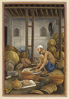
The Mochi are a Hindu caste found mainly in North India. They are the traditional shoemakers of South Asia.

The 15th Indian Census was conducted in two phases, house listing and population enumeration. House listing phase began on 1 April 2010 and involved collection of information about all buildings. Information for National Population Register (NPR) was also collected in the first phase, which will be used to issue a 12-digit unique identification number to all registered Indian residents by Unique Identification Authority of India (UIDAI). The second population enumeration phase was conducted between 9 and 28 February 2011. Census has been conducted in India since 1872 and 2011 marks the first time biometric information was collected. According to the provisional reports released on 31 March 2011, the Indian population increased to 1.21 billion with a decadal growth of 17.70%. Adult literacy rate increased to 74.04% with a decadal growth of 9.21%. The motto of the census was 'Our Census, Our future'.
Chak Sahbu is a small village in Jalandhar District of Punjab State, India. The village is administrated by Sarpanch who is elected representative of village. It is located 49 km towards East from Jalandhar, 14 km from Phillaur and 119 km from Chandigarh. The nearest census town and marketplace is located 1 km in Apra, Punjab. The nearest train station is situated 13.9 km away in Phillaur, nearest domestic airport is at Ludhiana and the nearest international airport is 143 km away in Amritsar.

A Legislative Assembly election was held in the Indian state of Punjab on 4 February 2017 to elect the 117 members of the Punjab Legislative Assembly. The counting of votes was done on 11 March 2017. The ruling pre-election coalition was the alliance comprising the political parties Shiromani Akali Dal and Bharatiya Janata Party and led by Chief Minister Parkash Singh Badal. The voter turnout for the Punjab Assembly election was 77.2% The Indian National Congress led by former Chief Minister Captain Amarinder Singh defeated the ruling alliance and the newcomer Aam Aadmi Party.
Anihar also spelled as Aneehar) is a village in Phillaur tehsil of Jalandhar District of Punjab State, India. It is located 6.4 km away from postal head office Bara Pind. The village is 10 km away from Goraya, 35 km from Jalandhar, and 125 km from state capital Chandigarh. The village is administrated by a sarpanch who is an elected representative of village as per Panchayati raj (India).
Khan Khana or Khankhana is a village in Shaheed Bhagat Singh Nagar district of Punjab State, India. It is located 7 kilometres (4.3 mi) away Mukandpur, 8 kilometres (5.0 mi) from Banga, 13.5 kilometres (8.4 mi) from district headquarter Shaheed Bhagat Singh Nagar and 111 kilometres (69 mi) from state capital Chandigarh. The village is administrated by Sarpanch an elected representative of the village.
Hussain Chak is a village in Shaheed Bhagat Singh Nagar district of Punjab State, India. It is located 7.6 kilometres (4.7 mi) away from postal head office Garcha, 5.5 kilometres (3.4 mi) from Nawanshahr, 6 kilometres (3.7 mi) from district headquarter Shaheed Bhagat Singh Nagar and 94 kilometres (58 mi) from state capital Chandigarh. The village is administrated by Sarpanch an elected representative of the village.
Prempur is a village in Phagwara in Kapurthala district of Punjab State, India. It is located 12 kilometres (7.5 mi) from sub district headquarter and 52 kilometres (32 mi) from district headquarter. The village is administrated by Sarpanch an elected representative of the village.


