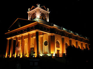
Muggowal

Last updated

Muggowal
village
India Punjab location map.svg
Red pog.svg
Muggowal
Location in Punjab, India
India location map.svg
Red pog.svg
Muggowal
Muggowal (India)
Coordinates: 31°20′44.53″N76°4′10″E / 31.3457028°N 76.06944°E / 31.3457028; 76.06944
CountryFlag of India.svg  India
State Punjab
District Hoshiarpur
Government
  Sarpanch (Village Chief)Sukhvinder singh
Area
  Total0.88 km2 (0.34 sq mi)
Population
 (2001)
  Total3,500
  Density4,000/km2 (10,000/sq mi)
Languages
  Official Punjabi
Time zone UTC+5:30 (IST)
PIN
146109

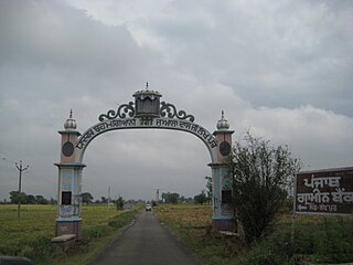
Muggowal or Mugowal (pronounced /muhgWoll/) is an agricultural village in the Hoshiarpur District of Punjab in India. [1] It is birthplace of the founder of Ad-Dharm movement and Bahujan activist Babu Mangu Ram Mugowalia. [2]

Contents

History

During the 16th century, the period of Akbar, settlers arrived in the surrounding area from the village Jandu Singha (District of Jalandhar) including a Saint (Fakir), Baba Bharo from the Kalra (Black) Sanghiyan village (Kapurthala District) and was a Vizier in Akbar's army. Baba Bharo, accompanied by his two wives, Ma Shakro and Ma Maggo populated the following villages; Muggowal, Nariala, Langeri, Sakruli and Dandewal. During that period, Muggowal was populated by two families of the village Sangheyan, Dalelpur and Kherha. Dalelpur occupied the region in the west of Muggowal, whilst Kherha housed in the Maha Sati area. During the times a misunderstanding caused both populations to stop communicating. This provided an opportunity for other villages (Halluwal, Tutomazara, Jandeala and Mahilpur) in the surrounding area to expand their territory to capture the empty land between the two populations. Before the empty land could be occupied by surrounding villages (land is a source of wealth), a gentle villager by the name of Nodha, joined both populations together to break down the divide. Thus it had created a new village by name of Muggowal, which is derived from "Ma Maggo", the wife of Baba Bharo. Nodha was survived by two sons Aala and Khazana.

Story of Maha Sati Dadi Rani

Baba Bharo Ji came from Kala (Black) Sangheyan (District Kapurthala) and stayed in Sakruli, a neighbouring village of Muggowal. Baba Bharo Ji's first wife was from Village Dhadan Kalan and who had given birth to a son and daughters. Baba Bharo would later remarry, which his second wife produced a son. Legend states that the son from the second wife would marry a beautiful girl by the name Dadi Rani. This caused stepsisters from the first wife to become very jealous as they wanted Dadi Rani to marry their own biological brother instead. The evil stepsisters conjured up a plan to make Dadi Rani to remarry their own brother by killing their step brother. During the first day after the marriage, the sisters gave poisoned milk to their stepbrother causing him to die. Dadi Rani refused to remarry their biological brother, but instead chose to perform the Sati ritual, being burnt alive with her deceased husband. Before she died she placed a curse on the people related to the Sangha surname. In modern times, there is a shrine dedicated to Maha Sati Dadi Rani in the village of Muggowal, where local superstition informs people to provide a meal for Brahmin people and to perform a ritual in front of her shrine by throwing the earth from the ground in different directions.

Demographics

The village has the population of 2186 according to the census of 2011. 51% are male and 49% are female. The caste breakup of village includes; 41.9% Scheduled Castes (Ad-Dharmi and Balmiki); 31% Jat Sikh, 11% Brahmin, 9% Kumhar, 5% Tarkhan and 1% other. The main occupation of village people is farming. The village has also produced five freedom fighters for India, from them Gadri Baba Babu Mangu Ram Mugowalia, [3] Comrade Amar Singh 'Niddar', Dr. Parkash Singh and Nambardar Jagat Singh were surviving members. [4]

Climate

The winter season lasts from mid-November to mid-March. During this period, the average maximum temperature remains from 14 degrees Celsius to 22, with the average minimum temperature spread between 1 and 5 degrees. Temperature can drop to -2 degree during mid winters. The village has a long summer season which lasts for 5 months, the average maximum temperature in this season remains between 33 and 39 degree, with the average minimum temperature remaining between 22 and 28 degrees. Temperatures can reach over 40 degrees during peak time in summer. The village is located at the bank of cho. For the last fifteen years the average rainfall is slightly decreasing, however the village does welcome the below 50 inches of yearly rainfall.

Notable people

Related Research Articles

<span class="mw-page-title-main">Kapurthala</span> City in Punjab, India

Kapurthala is a city in Punjab state of India. It is the administrative headquarters of Kapurthala District. It was the capital of the Kapurthala State, a princely state in British India. The aesthetic mix of the city with its prominent buildings based on French and Indo-Saracenic architecture self-narrate its princely past. It is also known as city of Palaces & Gardens. According to the 2011 census, Kapurthala is the least populated city in India.
<span class="mw-page-title-main">Hoshiarpur</span> City in Punjab, India

Hoshiarpur is a city and a municipal corporation in Hoshiarpur district in the Doaba region of the Indian state of Punjab. It was founded, according to tradition, during the early part of the fourteenth century. In 1809, it was occupied by the forces of Maharaja Karanvir Singh and was united into the greater state of Punjab in 1849.
<span class="mw-page-title-main">Hoshiarpur district</span> District in Punjab, India

Hoshiarpur district is a district of Punjab state in northern India. Hoshiarpur, one of the oldest districts of Punjab, is located in the North-east part of the Punjab state and shares common boundaries with Gurdaspur district in the north-west, Jalandhar district and Kapurthala district in south-west, Kangra district and Una district of Himachal Pradesh in the north-east. Hoshiarpur district comprises 4 sub-divisions, 10 community development blocks, 9 urban local bodies and 1417 villages. The district has an area of 3365 km2. and a population of 1,586,625 persons as per census 2011.

<span class="mw-page-title-main">Batala</span> City in Punjab, India

Batala is the eighth largest city in the state of Punjab, India in terms of population after Ludhiana, Amritsar, Jalandhar, Patiala, Bathinda, Mohali and Hoshiarpur. Batala ranks as the second-oldest city after Bathinda. It is a municipal corporation in Gurdaspur district in the Majha region of the state of Punjab. It is located about 32 km from Gurdaspur, the headquarters of the district. It is also a Police district. Batala holds the status of the most populated town of the district with 31% of the district's total population. It is the biggest industrial town in the district.

<span class="mw-page-title-main">Una, Himachal Pradesh</span> City in Himachal Pradesh, India

Una is a City and a Municipal Council in Una district in the Indian state of Himachal Pradesh. It serves as the headquarters of Una district. There are 11 wards under Municipal Council. Una City is home to the Kila, which is a historical fort and an ancestral home of the descendants of the first guru of the Sikhs, Guru Nanak.

<span class="mw-page-title-main">Shaheed Bhagat Singh Nagar district</span> District in Punjab, India

Shaheed Bhagat Singh Nagar district is one of twenty-three districts of state of Punjab, India. It is located in Doaba region. It consists of three subdivisions, Nawanshahr, Banga, and Balachaur. There are three legislative seats in the district, Nawanshahr, Balachaur and Banga. They fall under the Anandpur Sahib Lok Sabha Constituency. Nawanshahr, the district headquarters is about 92 kilometres (57 mi) from Chandigarh, the state's capital.

<span class="mw-page-title-main">Doaba</span> Region of Punjab, India

Doaba, also known as Bist Doab or the Jalandhar Doab, is the region of Punjab, India that lies between the Beas River and the Sutlej River. People of this region are given the demonym "Doabia". The dialect of Punjabi spoken in Doaba is called "Doabi". The term "Doaba" or "Doab" is derived from Persian دو آب meaning "land of two rivers". The river Sutlej separates Doaba from the Malwa region to its south and the river Beas separates Doaba from the Majha region to its north.

Dasuya (Dasua) is a town and a municipal council in Hoshiarpur district in the state of Punjab, India. It is one of the major subdivisions with 398 villages under its jurisdiction. This town has a great historical and mythological importance.
<span class="mw-page-title-main">Garhdiwala</span> Town in Punjab, India

Garhdiwala is a town and a municipal council in Hoshiarpur district in the state of Punjab, India.

<span class="mw-page-title-main">Mukerian</span> City in Punjab, India

Mukerian is a city and municipal corporation of Hoshiarpur district in Punjab, India. Mukerian is located on National Highway 44 and state highway 15 about 450 kilometres (280 mi) north of New Delhi.It is a Sub-district headquarters situated on Jalandhar-jammu railway line and is connected by road with Jalandhar, Hoshiarpur, Talwara, Gurdaspur and Pathankot. National Highway-44 also passes through here.

Narur, also known as Naroor and sometimes Naror, is a large village in Punjab, situated 17 km from Phagwara. The area is 183 hectares with a population of 2485.
<span class="mw-page-title-main">Lakhpur</span> Village in Punjab, India

Lakhpur is a village near Sahni (Lakhpur-Sahni), Tehsil Phagwara, Kapurthala district, in Punjab, India.

<span class="mw-page-title-main">Mandela, Rajasthan</span> Town in Shekhawati, Rajasthan, India

Mandela is a town in the Shekhawati region and Jhunjhunu district of Rajasthan state in India.

Odhra also spelled as Odrah is a village in the Dasuya (Dasua) subdivision of the Hoshiarpur district in Punjab, India. Other names for Odhra are Ond, Odhran and Odrysian.

The Ad-Dharmi is a sect in the state of Punjab, in India and is an alternative term for the Ravidasia religion, meaning Primal Spiritual Path. The term Ad-Dharm came into popular usage in the early part of the 20th century, when many followers of Guru Ravidas converted to Sikhism and were severely discriminated against due to their low caste status. Many of these converts stopped attending Sikh Gurdwaras controlled by Jat Sikhs and built their own shrines upon arrival in the UK, Canada, and Fiji Island.Ad-Dharmis comprise 11.48% of the total of Scheduled Caste communities in Punjab.

Mangu Ram, known popularly as Babu Mangu Ram Chaudhry, was an Indian freedom fighter, a politician from Punjab and one of the founder members of the Ghadar Party.

Nurpur Jattan is a village in Hoshiarpur district of Punjab State, India. It is located 35 kilometres (22 mi) from Hoshiarpur, which is both district and sub-district headquarters of Nurpur Jattan. This village comes under mahilpur police station and garhshanker (tehsil). Sabka sarpanch was sartaj singh sangra and now ajit singh Pannu elected as a sarpanch in recent election. This village is administrated by a Sarpanch, who is an elected representative.nurpur jattan has two sikh temples and a religious place which is known as bhagat charn dass ji. A fair held on every year in october in memory of bhagat charan daas ji. The village comprises an area of 208.54 hectares.

Master Gurbanta Singh was an Indian politician, educationist and social reformer from Punjab, India.

References

  1. "Fearing honour killing, the couple remained away from their village Muggowal under Hoshiarpur district of Punjab". India Today. 5 January 2015. Retrieved 7 October 2015.
  2. "Building Begumpura". The Indian Express. 8 September 2019. Retrieved 15 October 2019.
  3. "Why the Dalit phenomenon in Pb is different". The New Indian Express. Retrieved 15 October 2019.
  4. "Dalit couple lynched in Punjab 'honour killing'". www.indiatvnews.com. Retrieved 15 October 2019.
  5. "Hoshiarpur to Hong Kong: Manisha's football journey". The Sentinel. 16 March 2019. Retrieved 15 October 2019.