Todarpur

Last updated

Todarpur Urf Theh Pachrali is a village in the Garhshanker tehsil within the Hoshiarpur district of Punjab state, India-144404.

Contents

Location

It is located approximately 30 km from Hoshiarpur, 25km from Phagwara and 125 km from the state capital of Chandigarh. It hails in Garhshankar tehsil. Nearby Cities are Hoshiarpur, Phagwara, Mahilpur, Garhshankar. It Shares its boundary with villages Jalwehra, Nangla, Ajnoha, Nadalon, Panjour, Cheta, Wahid, Malikpur And Nasirabad.

History and demographics

The village was founded by brothers Chaudry Dullah Gujjar and Chaudry Phulla Gujjar (given names Abdullah and Luttfullah respectively). Their children migrated to western Punjab in 1947 on partition, living in districts Faisalabad (Chak no.467 GB Samundri), Sahiwal and Pakpattan. Chaudry Taj Gujjar Kasana, grandson of Chaudry Dullah Gujjar (Abdullah Gujjar Kasana) lives in Pakpattan. Chaudry Muhammad Siddique kasana Chaudry Jameel Kasana, Chaudry Malkeet Kasana, Ch Rafiq Kasana, Chaudry Sageer Kasana, son of Chaudry Taj Gujjar Kasana. Chaudry Taj Gujjar Kasana is a landlords of India, in Pakistan he is also known as a landlord. Children of Chaudry Phulla Gujjar (Luttfullah Gujjar Kasana) lives in Sahiwal. Chaudry Karam Bakhsh Kasana Zaildar son of Chaudry Phulla Gujjar, his children are Landlords and lives in districts Sahiwal (Chak No.14/11L Chandol Chichawatni). Ch Qamar ul Din Kasana, Ch Kamal Din kasana, Ch Niaz Din Kasana, Son of Ch Karam Bakhsh Kasana Zaildar, Haji Sultan Ahmad Kasana Lambardar, Grandson of Ch Karam Baksh kasana Zaildar, A large proportion of the population consists of Singh families migrated from Faisalabad (formerly Lyallpur) Pakistan in 1947. Today, Some common surnames of the families living in this village are Minhas, Parmar, Janjua, Saini, Badhan. The local language is Punjabi.

Features and facilities

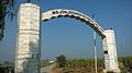
The village's main entry point is a large gate on the Jalwehra side.

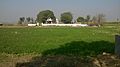
Its primary source of irrigation is a tube well. Other older wells exist intact to this day. There is a Government High School located on Cheta Rd having well educated staff and good study environment, while in the centre of the village lies the tomb of Baba Mirze Shah, a venerated Sufi saint. Other notable resting places include the graves of the founding Chaudry brothers, and the grave of one of their sons, Chaudry Karam Baksh Zaildar. Children of Chaudry Karam Baksh are landlords in District Sahiwal, Punjab, Pakistan.

The assigned PIN code is 144404 and the postal head office is located in Ajnoha in Hoshiarpur.

Related Research Articles

<span class="mw-page-title-main">Hoshiarpur district</span> District of Punjab in India

Hoshiarpur district is a district of Punjab state in northern India. Hoshiarpur, one of the oldest districts of Punjab, is located in the North-east part of the Punjab state and shares common boundaries with Gurdaspur district in the north-west, Jalandhar district and Kapurthala district in south-west, Kangra district and Una district of Himachal Pradesh in the north-east. Hoshiarpur district comprises 4 sub-divisions, 10 community development blocks, 9 urban local bodies and 1417 villages. The district has an area of 3365 km2. and a population of 1,586,625 persons as per census 2011.

<span class="mw-page-title-main">Okara District</span> Okara District in Punjab, Pakistan

Okara District, is a district of Punjab, Pakistan. It became a separate district in 1982, prior to that it was part of Sahiwal District.

<span class="mw-page-title-main">Safdarabad</span> City in Punjab, Pakistan

Safdarabad, is a city in Sheikhupura District in the Punjab province of Pakistan. The city of Safdar Abad is the capital of Safdarabad Tehsil. Its Postal code or ZIP code is 39540. Its urban area is approximately 600 acres. Until 2005 it was a tehsil of Sheikhupura District, but in that year Sheikhpura was bifurcated and the district of Nankana Sahib was created. - with Safdarabad as one of its tehsils. Now at present, once again Safdarabad has been rejoined with Sheikhupura as a Tehsil. The city of Safdarabad lies 95 km from Lahore the provincial capital of Punjab. The area has a population of more than 40,000 the majority of whom are Muslims. There are many engineering and medical students from Safdarabad admitted to different universities across Pakistan, including UET, Lahore.

<span class="mw-page-title-main">Doaba</span> Region of Punjab, India

Doaba also known as Bist Doab, is the region of Punjab, India that lies between the Beas River and the Sutlej River. People of this region are given the demonym "Doabia". The dialect of Punjabi spoken in Doaba is called "Doabi". The term "Doaba" or "Doab" is derived from Persian "دو آب" meaning "land of two rivers". The river Sutlej separates Doaba from the Malwa region to its south and the river Beas separates Doaba from the Majha region to its north.

Kallar Syedan Tehsil is a tehsil in the Rawalpindi District, Punjab, Pakistan. Earlier a part of the Kahuta Tehsil, it became a separate tehsil on 1 July 2004.

<span class="mw-page-title-main">Qadirabad</span> Village and union council in Punjab, Pakistan

Qadirabad is a village located near Chenab River in tehsil Phalia in Mandi Bahauddin District in province Punjab in Pakistan.

<span class="mw-page-title-main">Safdarabad Tehsil</span> Tehsil in Punjab, Pakistan

Safdarabad, is an administrative subdivision (Tehsil) of Sheikhupura District in the Punjab province of Pakistan. The city of Safdar Abad is the headquarters of the tehsil, until 2005 it was a tehsil of Sheikhupura District, but in that year Sheikhpura was bifurcated and the district of Nankana Sahib was created. - with Safdarabad as one of its tehsils. Now at present, once again Safdarabad has been rejoined with Sheikhupura as a Tehsil. The city of Safdarabad lies 95 km from Lahore the provincial capital of Punjab. The tehsil has a population of more than 270,000 the majority of whom are Muslims.

Kunduana is one of the highest ranked clans among Gujjars.They are found in Pakistan and Northern India (Kashmir).

Zaildar was the title of the grand jagirdars (landlords) of the area, who were in charge of a Zail which was an administrative unit of group of villages during the British Indian Empire. The Settlement Officer, with the advice of the Deputy Commissioner, was responsible for appointing Zaildars from amongst the men of the tribe or the area, thus reinforcing his preexisting social authority with the official sanction as the representative of the government. Each Zail was an administrative unit, extending between 40 to 100 villages. Each village was headed by the Lambardar who was assisted by the Safedposh Zamindars of the village. Zaildars were the revenue-collecting officers and were also responsible for maintaining law and order. The Lambardar and Safedposh assisted the Zaildar. The Zaildar in turn assisted the Deputy Commissioner. The Zaildar was more influential than the Lambardar because a Zail included several villages.

The Khagga (کھگہ) are tribe of Arab origin and are classified under Arabic Shaikh clans. They are mostly found in south-west Punjab, Pakistan.They mainly speak Punjabi.

Samundri Tehsil is an administrative subdivision of Faisalabad District in the Punjab province of Pakistan.Samundri is the city and headquarters of the tehsil. Samundri Tehsil farms are irrigated by Gugera Branch Canal and Burala Branch Canal.Ravi Muhall Ward No 5 is most famous area in Samundri

<span class="mw-page-title-main">Lakhpur</span> Village in Punjab, India

Lakhpur is a village near Sahni (Lakhpur-Sahni), Tehsil Phagwara, Kapurthala district, in Punjab, India.

Kotha Gujjranکوٹھا گجراں is a village on Mohri Road 4 km from Kharian City Gujrat District in the Punjab province of Pakistan It is located at 32°48'06.14" N 73°49'04.19" E. Kotha Gujjran is a village owned by gujjar community: a titled clan which carry the title chaudhry (CH). It lies between Mohri Sharif, dera alam pur gondala and Mehmand Chak on Mohri Road.

Chak no 115/12.L (Kassowal) is a village of Chichawatni Tehsil in Sahiwal District, Punjab, Pakistan. The village is located at 30°29'14" North and 72°32'17" East. it is situated on the grand trunk road at the lower end point of the Pakistan second artificial forest. Chak no 116/12.L (Kassowal) is 4 km away from Kassowal.

Chak 217 GB, or Gujjar Pind, is a suburban village of Tehsil Samundri in the District Faisalabad (Lyallpur) Punjab in Pakistan. The first known settlements in the village date between 1898 A.D. to 1920 A.D. The village comprises roughly 1,500 acres. Water is supplied by five irrigation channels, known locally as moga. The Gogera Branch irrigation canal is abbreviated to GB and irrigates this specific area.

Chak No. 69/EB Ugru, is a village in the tehsil of Arifwala, Pakpattan District in the Sahiwal Division in the Punjab province of Pakistan. Total area of this village is 1600 Acre. Ugru is an ancient village of Arifwala city.It has Situated the Grand Mosque"JAMIA MASJID GHOUSIA". It has the shrine of Hazrat GULAM MUHAMMAD HAZOORI, Hazrat Baba Rorde Shah, Hazrat Baba Sufi Abul Majid and Hazrat Baba Sain Ali Bakhsh. Chak No. 69/EB Ugroo is roughly 90 kilometres (56 mi) from the border with India, and 184 kilometres (114 mi) by road southwest of Lahore.

<span class="mw-page-title-main">Bunga Hayat</span> Town in Punjab, Pakistan

Bunga Hayat is a small town in Pakpattan District, Sahiwal Division, Punjab, Pakistan, having a population of 10,000. It is named after Mian Hayat Maneka, an ancestor of the Maneka Family. Prominent politicians from the area are Mian Khudayar Khan Maneka, elected twice as the MLA before partition. Mian Farrukh Mumtaz maneka (MPA) Mian Muhammad Ali Maneka, Mian Khurram Mumtaz Maneka and Mian Asadullah Mumtaz Maneka(Ex.Dist Naib Nazim Pakpattan).Mian Muhammad Yar khan Maneka and Mian Mimshad Ahmed Maneka Their father Mian Mumtaz Maneka was also an influential political leader of the area. Among 28 Union Councils of Tehsil Pakpattan, Bunga Hayat Union Council is UC-03. UC Bunga Hayat Consists of Bunga Hayat, Nanakpur, Asadullah, Arazi Amar Singh, Magan Pur, 5 Marla Scheme & 7 Marla Scheme.

Kalubhatia is a village in Sultanpur Lodhi tehsil in Kapurthala district of Punjab, India. It is located 16 kilometres (9.9 mi) from the city of Sultanpur Lodhi, 25 kilometres (16 mi) away from district headquarter Kapurthala. The village is administrated by a Sarpanch who is an elected representative of village as per the constitution of India and Panchayati raj (India).