
Location of Khisa
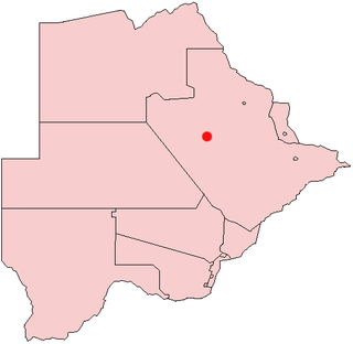
Khisa or Kisa is a village in Kgalagadi District of Botswana. It is located close to the border with South Africa, north-east of the district capital Tshabong. The population was 383 in 2011 census. [1]
Khisa or Kisa is a village in Kgalagadi District of Botswana. It is located close to the border with South Africa, north-east of the district capital Tshabong. The population was 383 in 2011 census. [1]

Demographic features of the population of Botswana include population density, ethnicity, education level, health of the populace, economic status, religious affiliations and other aspects.

Zapata Ranch is a census-designated place (CDP) in Willacy County, Texas, United States. The population was 87 at the 2020 census.
Orapa is a town located in the Central District of Botswana. It is the site of the Orapa diamond mine, the largest diamond-producing mine in the world, and is considered to be the diamond capital of the country. Nearby is another kimberlite mine owned by Lucara Diamond, thought to have very large reserves of diamonds.

Ayot St Peter is a village and civil parish in the Welwyn Hatfield district of Hertfordshire, England, about two miles north-west of Welwyn Garden City. According to the 2001 census it had a population of 166. At the 2011 Census the population including the nearby Ayot Green and Ayot St Lawrence was 245.

Gumare or Gomare is a rural village located in the North-West District of Botswana, near the Okavango Delta. The population of Gumare was 6,067 in 2001 census, but had risen to 8,532 iby the 2011 census.

Tsabong, also spelled Tshabong, is the administrative centre of the Kgalagadi District in Botswana. It is located in the Kalahari Desert. The population was 8939 in the 2011 census.
The Canton of Beaumont-Hague in France is situated in the department of Manche and the region of Basse-Normandie. Its seat was the commune of Beaumont-Hague. It had 11,932 inhabitants (2012). It was disbanded following the French canton reorganisation which came into effect in March 2015. It consisted of 19 communes, which joined the new canton of La Hague in 2015.
Chobokwane is a village in Ghanzi District of Botswana. It is located south-west of the district capital Ghanzi, and has a primary school. The population was 771 in 2011 census.
Werda is a village in Kgalagadi District of Botswana. It is located close to the border with South Africa. The population was 3261 in 2011 census.

Makopong is a village in Kgalagadi District of Botswana. It is located close to the border with South Africa. The population was 1,697 in the 2011 census.
Omaweneno is a village in Kgalagadi District of Botswana. It is located north-east of the district capital, Tshabong. The population was 917 in 2011 census. Omaweneno is a Herero word meaning "Where people meet.
Phepheng, also known as Phepeng, Draaihoek or Draihoek, is a village in Kgalagadi District of Botswana. It is located north-east of the district capital Tshabong. The population was 994 in the 2011 census.
Kokotsha is a village in Kgalagadi District, Southern Botswana Botswana. It is located in the eastern part of the district, north of Werda. The population was 1,224 in 2011 census.
Maralaleng is a village in Kgalagadi District of Botswana. It is located east of the district capital Tsabong and has a primary school. The climate in Maraleng is considered to be a desert climate. The population is 586 according to a 2011 census.
Maleshe is a village in Kgalagadi District of Botswana. It is located close the capital of the district, Tshabong, and it has a primary school. The population was 462 in 2011 census. Maleshe also has a clinic, small business tuckshops and retailers.
Maubelo is a village in Kgalagadi District of Botswana. It is located south of the district capital Tsabong and has a primary school. The population was 514 in the 2011 census.
Lokgwabe is a village in Kgalagadi District of Botswana. It is located in the Kalahari Desert and the village has a primary school. The population was 1,417 in 2011 census.
Hunhukwe is a village in Kgalagadi District of Botswana. It is located in the northern part of the district, and it has a primary school and a clinic. The population was 753 in 2011 census.
Inalegolo is a village in Kgalagadi District of Botswana. It is located in the north-east part of the district, in Kalahari Desert, it has a primary school and a health post. The population was 533 in 2011 census. The chief of the village is Kgosi Keamogetse Ghubi.
Phuduhudu is a village in Kgalagadi District of Botswana. It is located in the northeast part of the district, in the Kalahari Desert, and it has a primary school. The population was 482 in the 2011 census.
| Urban villages |  | |
|---|---|---|
| Rural villages | ||
25°39′43″S22°49′15″E / 25.66194°S 22.82083°E
| | This Botswana location article is a stub. You can help Wikipedia by expanding it. |