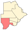
Hukuntsi is a village in Kgalagadi District (Kalahari) in Botswana.

Division No. 13 is a census division in Alberta, Canada. The majority of the division is located in the north-central portion of central Alberta, while the northeast portion of the division is located within northern Alberta. The division's largest urban community is the Town of Whitecourt.

Kasane is a town in Botswana, close to Africa's 'Four Corners', where four countries almost meet: Botswana, Namibia, Zambia and Zimbabwe. It is at the far north-eastern corner of Botswana where it serves as the administrative center of the Chobe District. The population of Kasane was 9,244 in 2011 census.

Tsabong, also spelled Tshabong, is the administrative centre of the Kgalagadi District in Botswana. It is located in the Kalahari Desert. The population was 8939 at the 2011 census.

The districts of Botswana are subdivided into sub-districts. The sub-districts are listed below, by district:

Shakawe is a village located in the northwest corner of Botswana at the beginning of the Okavango Delta, close to Namibia and Angola. Shakawe is awakening from its former status as a sleepy little outpost on the Okavango. For travellers, Shakawe means a Botswana entry or exit stamp or a staging post for a visit to the Tsodilo Hills, 40 km away. For Southern African holiday-makers, it is most often the start of a fishing trip in the Okavango Panhandle. It also provides access to the Caprivi Strip. The record high temperature ever registered in Shakawe was 39.6 °C (103.3 °F). The lowest temperature registered in Shakawe was −6.1 °C (21.0 °F).
Rapples Pan is a village in Kgalagadi District of Botswana.
Khuis is a village in Kgalagadi District of Botswana. It is located close to the border with South Africa. Khuis has a primary school, and the population was 897 in 2011 census.
Middlepits is a village in Kgalagadi District of Botswana. It borders South Africa and has an immigration border post.
Kolonkwane is a village in Kgalagadi District of Botswana. It is located close to the border with South Africa and it has a primary school. The population was 599 in 2011 census.
Bogogobo is a village in Kgalagadi District of Botswana. It is located close to the border with South Africa and has a primary school. The population was 360 in 2011 census.
Vaalhoek is a village in Kgalagadi District of Botswana. It is located at the southern tip of Botswana, close to the border with South Africa, and it has a primary school. The population counted 355 in the 2011 census.
Struizendam is a village in Kgalagadi District of Botswana. It is located at the southern tip of Botswana, close to the border with South Africa, and it has a primary school. The population was 519 in 2011 census.
Khawa is a village in Kgalagadi District of Botswana. It is located in the southern part of the district and has a primary school. It has a Christian church and a primitive clinic. The annual Khawa desert challenge is held here. The people speak Setswana as well as Afrikaans, English is understood. The vegetation in and around the village is highly overgrazed and it may seem like a desert inside the village although it is located in a grassland area. All the roads in and around the village are dirtroads. The population was 817 in 2011 census.
Maubelo is a village in Kgalagadi District of Botswana. It is located south of the district capital Tshabong and has a primary school. The population was 514 in 2011 census.
Lokgwabe is a village in Kgalagadi District of Botswana. It is located in the Kalahari Desert and the village has a primary school. The population was 1,417 in 2011 census.
Hunhukwe is a village in Kgalagadi District of Botswana. It is located in the northern part of the district, and it has a primary school and a clinic. The population was 753 in 2011 census.
Zutswa is a village in Kgalagadi District of Botswana. It is located in the Kalahari Desert and it has a primary school. The population was 469 in 2011 census.
Ngwatle is a village in Kgalagadi District of Botswana. It is located in the Kalahari Desert, in the north-west part of the district. The population was 271 in 2011 census.
Dikgonnye is a village in Kgatleng District of Botswana. The village is located 40 km north-west of Mochudi, and it has a primary school. The population was 431 in 2011 census.


