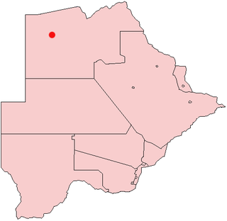
Maubelo is a village in Kgalagadi District of Botswana. It is located south of the district capital Tsabong and has a primary school. The population was 514 in the 2011 census. [1]
Maubelo is a village in Kgalagadi District of Botswana. It is located south of the district capital Tsabong and has a primary school. The population was 514 in the 2011 census. [1]

Southern is one of the districts of Botswana. The capital of Southern district is Kanye, home to the Bangwaketse and Barolong in Botswana. The Southern district is home to Botswana's second largest beef farmers where there are large privately owned ranges, and several government run beef ranges which provide agricultural support to the local farmers. Maize and sorghum, Botswana's staple crop, are also raised in the area. Southern district is where the third diamond mine of Botswana was found, which buoys Botswana's economic state of prosperity. It was the first district to house the capital city before being moved to Gaborone after independence.

The North-West District or Ngamiland is one of the first-level administrative subdivisions of Botswana. For census and administrative purposes Ngamiland is subdivided into Ngamiland East, Ngamiland West and Ngamiland Delta (Okavango). It is governed by a District Commissioner, appointed by the national government, and the elected North-West District Council. The administrative centre is Maun.

Gumare or Gomare is a rural village located in the North-West District of Botswana, near the Okavango Delta. The population of Gumare was 6,067 in 2001 census, but had risen to 8,532 iby the 2011 census.

Tsabong, also spelled Tshabong, is the administrative centre of the Kgalagadi District in Botswana. It is located in the Kalahari Desert. The population was 8939 in the 2011 census.
Rapples Pan is a village in Kgalagadi District of Botswana.
Gakhibane (Gachibana) is a village in Kgalagadi District of Botswana. It is located close to the border with South Africa. Gachibana has a primary school, and the population was 746 in 2011 census. Ghakhibane is known for its road through the Molopo fossil river valley. It is located at the upper right side of the river.
Khuis is a village in Kgalagadi District of Botswana. It is located close to the border with South Africa. Khuis has a primary school, and the population was 897 in 2011 census.

Makopong is a village in Kgalagadi District of Botswana. It is located close to the border with South Africa. The population was 1,697 in the 2011 census.
Khisa or Kisa is a village in Kgalagadi District of Botswana. It is located close to the border with South Africa, north-east of the district capital Tshabong. The population was 383 in 2011 census.
Omaweneno is a village in Kgalagadi District of Botswana. It is located north-east of the district capital, Tshabong. The population was 917 in 2011 census. Omaweneno is a Herero word meaning "Where people meet.
Kolonkwaneng is a village in Kgalagadi District of Botswana. It is located close to the border with South Africa and it has a primary school. The population was 599 in 2011 census.
Bogogobo is a village in Kgalagadi District of Botswana. It is located close to the border with South Africa and has a primary school. The population was 360 in 2011 census.
Vaalhoek is a village in Kgalagadi District of Botswana. It is located at the southern tip of Botswana, close to the border with South Africa, and it has a primary school. The population counted 355 in the 2011 census.
Struizendam is a village in Kgalagadi District of Botswana. It is located at the southern tip of Botswana, close to the border with South Africa, and it has a primary school. The population was 519 in 2011 census.
Phepheng, also known as Phepeng, Draaihoek or Draihoek, is a village in Kgalagadi District of Botswana. It is located north-east of the district capital Tshabong. The population was 994 in the 2011 census.
Khawa is a village in Kgalagadi District of Botswana. It is located in the southern part of the district and has a primary school. It has a Christian church and a primitive clinic. The annual Khawa desert challenge is held here. The people speak Setswana as well as Afrikaans, English is understood. The vegetation in and around the village is highly overgrazed and it may seem like a desert inside the village although it is located in a grassland area. All the roads in and around the village are dirtroads. The population was 817 in 2011 census.
Maralaleng is a village in Kgalagadi District of Botswana. It is located east of the district capital Tshabong and has a primary school. The climate in Maraleng is considered to be a desert climate. The population is 586 according to a 2011 census.
Maleshe is a village in Kgalagadi District of Botswana. It is located close the capital of the district, Tshabong, and it has a primary school. The population was 462 in 2011 census. Maleshe also has a clinic, small business tuckshops and retailers.
Inalegolo is a village in Kgalagadi District of Botswana. It is located in the north-east part of the district, in Kalahari Desert, it has a primary school and a health post. The population was 533 in 2011 census. The chief of the village is Kgosi Keamogetse Ghubi.
Phuduhudu is a village in Kgalagadi District of Botswana. It is located in the northeast part of the district, in the Kalahari Desert, and it has a primary school. The population was 482 in the 2011 census.
26°4′38″S22°22′39″E / 26.07722°S 22.37750°E