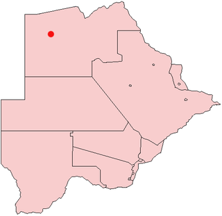
Kokotsha is a village in Kgalagadi District, Southern Botswana Botswana. It is located in the eastern part of the district, north of Werda. The population was 1,224 in 2011 census. [1]
Kokotsha is a village in Kgalagadi District, Southern Botswana Botswana. It is located in the eastern part of the district, north of Werda. The population was 1,224 in 2011 census. [1]

Little River County is a county located on the southwest border of the U.S. state of Arkansas, bordering a corner with Texas and Oklahoma. As of the 2010 census, the population was 13,171. The county seat is Ashdown.

Cambridge is a home rule-class city in Jefferson County, Kentucky, United States. The population was 175 at the 2010 census.

Richboro is a census-designated place (CDP) in Northampton Township, Bucks County, Pennsylvania, United States. The population was 6,563 at the 2010 census.
Ingleside on the Bay is a city in San Patricio County, Texas, United States. The population was 615 at the 2010 census.

Pelican Bay is a city in Tarrant County, Texas, United States. The population was 1,547 at the 2010 census.

Inchelium is a census-designated place (CDP) in Ferry County, Washington, United States on the Colville Indian Reservation. The population was 409 at the 2010 census.

The North-West District or Ngamiland is one of the first-level administrative subdivisions of Botswana. For census and administrative purposes Ngamiland is subdivided into Ngamiland East, Ngamiland West and Ngamiland Delta (Okavango). It is governed by a District Commissioner, appointed by the national government, and the elected North-West District Council. The administrative centre is Maun.

Division No. 9 is a census division in Alberta, Canada. It is located in the southwest corner of central Alberta and its largest urban community is the Town of Rocky Mountain House. The boundaries of the division are coextensive with the outer boundaries of Clearwater County.

Gumare or Gomare is a rural village located in the North-West District of Botswana, near the Okavango Delta. The population of Gumare was 6,067 in 2001 census, but had risen to 8,532 iby the 2011 census.
Lokgwabe is a village in Kgalagadi District of Botswana. It is located in the Kalahari Desert and the village has a primary school. The population was 1,417 in 2011 census.
Hunhukwe is a village in Kgalagadi District of Botswana. It is located in the northern part of the district, and it has a primary school and a clinic. The population was 753 in 2011 census.
Dikwididi is a village in Kgatleng District of Botswana. It is located around 40 km east of Gaborone. The village has a primary school and the population was 225 in 2011 census.
Dikgonnye is a village in Kgatleng District of Botswana. The village is located 40 km north-west of Mochudi, and it has a primary school. The population was 431 in 2011 census.
Oodi or Odi is a village in Kgatleng District of Botswana. It is located 20 km north-east of Gaborone. The population was 5,687 in 2011 census.
Kumakwane is a village in Kweneng District of Botswana. It is located 25 km west of the capital of Botswana, Gaborone. The population was 9,595 in 2011 census.
Mmopane is a village in the Kweneng District of Botswana. The village is located around 15 km from Gaborone, the capital of Botswana. The population was 3,512 in 2001 census and 14,655 at the 2011 census. It's now part of Gaborone agglomeration home to 421,907 inhabitants at the 2011 census.
Kopong is a small village in Kweneng District of Botswana. It is located around 25 km north of Gaborone, the capital of Botswana. The population was 5,571 in 2001 census and 9,520 at the 2011 census, making it the sixth largest settlement in Kweneng. It is now becoming a suburb of Gaborone agglomeration home to 421,907 inhabitants at the 2011 census.

Isatay District is a district of Atyrau Region in Kazakhstan. The administrative center of the district is the selo of Akkystau.
Anra District is one of sixteen districts of the Huari Province in Peru.
West Nanticoke is a census-designated place (CDP) in Plymouth Township, Luzerne County, Pennsylvania, United States, across the Susquehanna River from the city of Nanticoke. The population of the CDP was 749 at the 2010 census.
Coordinates: 24°55′12″S23°13′18″E / 24.92000°S 23.22167°E