
Location of Kolonkwane
Kolonkwane is a village in Kgalagadi District of Botswana. It is located close to the border with South Africa and it has a primary school. The population was 599 in 2011 census. [1]
Kolonkwane is a village in Kgalagadi District of Botswana. It is located close to the border with South Africa and it has a primary school. The population was 599 in 2011 census. [1]

This article is about the demographic features of the population of Botswana, including population density, ethnicity, education level, health of the populace, economic status, religious affiliations and other aspects of the population.
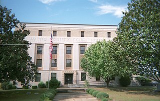
Waynesboro is a city in Wayne County, Mississippi, United States. The population was 5,043 at the 2010 census. It is the county seat of Wayne County.

Tsabong, also spelled Tshabong, is the administrative centre of the Kgalagadi District in Botswana. It is located in the Kalahari Desert. The population was 8939 at the 2011 census.
Batheay is a district (srok) of Kampong Cham province, Cambodia. The district capital is Ph'av town. The town is located on National Highway 6 around 64 kilometres east of the provincial capital at Kampong Cham city and 60 kilometres north of the Cambodian capital Phnom Penh. The district lies at the junction between two major waterways, the Mekong River and the Tonle Sap.
Rapples Pan is a village in Kgalagadi District of Botswana.
Gakhibane (Gachibana) is a village in Kgalagadi District of Botswana. It is located close to the border with South Africa. Gachibana has a primary school, and the population was 746 in 2011 census. Ghakhibane is known for its road through the Molopo fossil river valley. It is located at the upper right side of the river.
Khuis is a village in Kgalagadi District of Botswana. It is located close to the border with South Africa. Khuis has a primary school, and the population was 897 in 2011 census.
Bogogobo is a village in Kgalagadi District of Botswana. It is located close to the border with South Africa and has a primary school. The population was 360 in 2011 census.
Vaalhoek is a village in Kgalagadi District of Botswana. It is located at the southern tip of Botswana, close to the border with South Africa, and it has a primary school. The population counted 355 in the 2011 census.
Struizendam is a village in Kgalagadi District of Botswana. It is located at the southern tip of Botswana, close to the border with South Africa, and it has a primary school. The population was 519 in 2011 census.
Khawa is a village in Kgalagadi District of Botswana. It is located in the southern part of the district and has a primary school. It has a Christian church and a primitive clinic. The annual Khawa desert challenge is held here. The people speak Setswana as well as Afrikaans, English is understood. The vegetation in and around the village is highly overgrazed and it may seem like a desert inside the village although it is located in a grassland area. All the roads in and around the village are dirtroads. The population was 817 in 2011 census.
Maubelo is a village in Kgalagadi District of Botswana. It is located south of the district capital Tshabong and has a primary school. The population was 514 in 2011 census.
Lokgwabe is a village in Kgalagadi District of Botswana. It is located in the Kalahari Desert and the village has a primary school. The population was 1,417 in 2011 census.
Ncaang is a village in Kgalagadi District of Botswana. It is located in the northern part of the district, in Kalahari Desert. The population was 228 in 2011 census.
Hunhukwe is a village in Kgalagadi District of Botswana. It is located in the northern part of the district, and it has a primary school and a clinic. The population was 753 in 2011 census.
Zutswa is a village in Kgalagadi District of Botswana. It is located in the Kalahari Desert and it has a primary school. The population was 469 in 2011 census.
Ngwatle is a village in Kgalagadi District of Botswana. It is located in the Kalahari Desert, in the north-west part of the district. The population was 271 in 2011 census.

Fuiay is an island in Scotland. It is one of ten islands in the Sound of Barra, a Site of Community Importance for conservation in the Outer Hebrides. Its area is 84 ha and the unnamed highest eminence reaches 107 m. It is located immediately to the west of Flodday and about 1.5 km southwest of Hellisay. Barra lies across the waters of North Bay.
Dikgonnye is a village in Kgatleng District of Botswana. The village is located 40 km north-west of Mochudi, and it has a primary school. The population was 431 in 2011 census.
Šumata Trnica is a village in the municipality of Trgovište, in southeastern Serbia. According to the 2002 census, the village has a population of 50 people.
| Urban villages |  | |
|---|---|---|
| Rural villages | ||
Coordinates: 26°38′37″S21°59′46″E / 26.64361°S 21.99611°E
| | This Botswana location article is a stub. You can help Wikipedia by expanding it. |