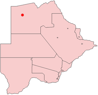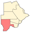
Kang is a village in Kgalagadi District of Botswana. It is situated in the Kalahari Desert and lies on the Trans-Kalahari Highway between Ghanzi in the north and Sekoma in the south. Kang also provides access to the Kgalagadi Transfrontier Park in the south-west and the Central Kalahari Game Reserve in the north-east. The route via Ghanzi takes one to the Namibian border, whilst that to Sekoma leads to Gaborone, the capital of Botswana. The population was 5,985 according to the 2011 census. Kang also falls under the Kgalagadi North constituency whose Member of Parliament is Hon. Phillip Khwae. The village is divided into two wards, Kang North and Kang South.

Gumare or Gomare is a rural village located in the North-West District of Botswana, near the Okavango Delta. The population of Gumare was 6,067 in 2001 census, but had risen to 8,532 iby the 2011 census.

Letlhakane is a village in the Central District of Botswana. It is located south of Mmatshumo and the population of the village was 22,911 in 2011 census.

Tsabong or Tshabong is the administrative centre of the Kgalagadi District, Botswana. It is located in the Kalahari Desert. The population was 8939 in 2011 census.

Werda is a village in Kgalagadi District of Botswana. It is located close to the border with South Africa. The population was 3261 in 2011 census.

Makopong is a village in Kgalagadi District of Botswana. It is located close to the border with South Africa. The population was 1,697 in the 2011 census.

Khisa or Kisa is a village in Kgalagadi District of Botswana. It is located close to the border with South Africa, north-east of the district capital Tshabong. The population was 383 in 2011 census.

Omaweneno is a village in Kgalagadi District of Botswana. It is located north-east of the district capital, Tshabong. The population was 917 in 2011 census.

Bray is a village in Kgalagadi District of Botswana. It is located in the eastern part of the district, on the border with South Africa opposite a village of the same name in that country. The population was 1,041 in the 2011 census. It has a primary school.

Maralaleng is a village in Kgalagadi District of Botswana. It is located east of the district capital Tshabong and has a primary school. The climate in Maraleng is considered to be a desert climate. The population is 586 according to a 2011 census.

Maleshe is a village in Kgalagadi District of Botswana. It is located close the capital of the district, Tshabong, and it has a primary school. The population was 462 in 2011 census.

Maubelo is a village in Kgalagadi District of Botswana. It is located south of the district capital Tshabong and has a primary school. The population was 514 in 2011 census.

Inalegolo is a village in Kgalagadi District of Botswana. It is located in the north-east part of the district, in Kalahari Desert, and it has a primary school. The population was 533 in 2011 census. The chief of the village is Kgosi Seka Boraetsile.

Phuduhudu is a village in Kgalagadi District of Botswana. It is located in the northeast part of the district, in the Kalahari Desert, and it has a primary school. The population was 482 in the 2011 census.

Lerala is a village in Central District of Botswana. The village is located at the south-eastern end of the Tswapong Hills, 30 km from the Limpopo River and the border with South Africa and approximately 90 km east of Palapye. The population of Lerala was 6,871 in the 2011 census, which was a 20.5% increase from the 2001 population.

Ngware is a village in Kweneng District of Botswana. It is located 50 km north-east of Letlhakeng. The population of Ngware was 573 in 2001 census.

Mmopane is a village in the Kweneng District of Botswana. The village is located around 15 km from Gaborone, the capital of Botswana. The population was 3,512 in 2001 census and 14,655 at the 2011 census. It's now part of Gaborone agglomeration home to 421,907 inhabitants at the 2011 census.

Hatsalatladi is a village in Kweneng District of Botswana. It is located 40 km north of Molepolole. The population of Hatsalatladi was 609 in 2001 census.

Kopong is a small village in Kweneng District of Botswana. It is located around 25 km north of Gaborone, the capital of Botswana. The population was 5,571 in 2001 census and 9,520 at the 2011 census, making it the sixth largest settlement in Kweneng. It is now becoming a suburb of Gaborone agglomeration home to 421,907 inhabitants at the 2011 census. It is also home to the Gospel of God's Grace Ministries, a church with a mandate to bring souls to Heaven.

Mogonono is a village in Kweneng District of Botswana. The village is located 10 km from the center of Molepolole, along the Molepolole–Lephepe road, and has a primary school. The population of Mogonono was 201 in 2001 census.


