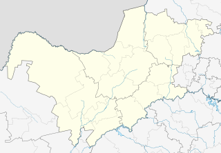
Rapples Pan is a village in Kgalagadi District of Botswana.
Rapples Pan is a village in Kgalagadi District of Botswana.
It is located at the south-western tip of Botswana, close to the South African border.
It has a primary school.
The population was recorded as 22283, by the 2011 census. [1]

Botswana, officially the Republic of Botswana, is a landlocked country in Southern Africa. Botswana is topographically flat, with up to 70 percent of its territory being the Kalahari Desert. It is bordered by South Africa to the south and southeast, Namibia to the west and north, and Zimbabwe to the northeast. Its border with Zambia to the north near Kazungula is poorly defined due to being in the midst of the Zambezi River. This border with Zambia is, at most, a few hundred metres long.

This article is about the demographic features of the population of Botswana, including population density, ethnicity, education level, health of the populace, economic status, religious affiliations and other aspects of the population.

Baileyton is a town in northern Greene County, Tennessee, United States. The population was 431 at the 2010 census, down from 504 at the 2000 census. Baileyton is located 13 miles (21 km) north of Greeneville and 18 miles (29 km) southeast of Rogersville.

Letlhakane is a village in the Central District of Botswana. Letlhakane is the headquarters of the Boteti sub-district. It is located south of Mmatshumo and the population of the village was 22,911 in 2011 census.

Tsabong, also spelled Tshabong, is the administrative centre of the Kgalagadi District in Botswana. It is located in the Kalahari Desert. The population was 8939 at the 2011 census.

Hinduism is a minority religion practised by 0.3% of the population of Botswana. The practice of Hinduism in Botswana is concentrated in and around Gaborone and Selebi-Phikwe. The community of Hindus began to form in the early 20th century with the beginning of immigration from India to Botswana. Most Hindus in Botswana are of Indian descent.

Gakhibane (Gachibana) is a village in Kgalagadi District of Botswana. It is located close to the border with South Africa. Gachibana has a primary school, and the population was 746 in 2011 census. Ghakhibane is known for its road through the Molopo fossil river valley. It is located at the upper right side of the river.

Khuis is a village in Kgalagadi District of Botswana. It is located close to the border with South Africa. Khuis has a primary school, and the population was 897 in 2011 census.

Kolonkwane is a village in Kgalagadi District of Botswana. It is located close to the border with South Africa and it has a primary school. The population was 599 in 2011 census.

Bogogobo is a village in Kgalagadi District of Botswana. It is located close to the border with South Africa and has a primary school. The population was 360 in 2011 census.

Vaalhoek is a village in Kgalagadi District of Botswana. It is located at the southern tip of Botswana, close to the border with South Africa, and it has a primary school. The population counted 355 in the 2011 census.

Bokspits is a village in Kgalagadi District of Botswana. It is the southernmost village in Botswana and is located close to the border with South Africa next to the Kgalagadi Transfrontier Park. Bokspits has a creche, primary school, clinic, police station, post office, government offices, churches, airstrip and various shops. There is a number of football teams for example the most famous one Bokspits United FC. Bokspits has experienced a great deal of growth and development e.g. tarred roads and communication networks. The population counted 507 in the 2011 census.

Struizendam is a village in Kgalagadi District of Botswana. It is located at the southern tip of Botswana, close to the border with South Africa, and it has a primary school. The population was 519 in 2011 census.

Bray is a village in Kgalagadi District of Botswana. It is located in the eastern part of the district, on the border with South Africa opposite a village of the same name in that country. The population was 1,041 in the 2011 census. It has a primary school.

Maubelo is a village in Kgalagadi District of Botswana. It is located south of the district capital Tshabong and has a primary school. The population was 514 in 2011 census.

Bokaa is a village in Kgatleng District of Botswana. The village is located around 20 km south-west of Mochudi and the population was 5,765 in 2011 census. The village is just north of the Bokaa Dam.

Mmankgodi is a village in Kweneng District of Botswana. It is located 35 km from Gaborone and around 30 km from the border with South Africa. The population of Mmankgodi was 6,802 in 2011 census.
McCord is a hamlet in the Canadian province of Saskatchewan. McCord had a population of 40 in the Canada 2006 Census.

Ramatlabama is a village and railway station 25 kilometres (16 mi) north of Mafikeng, in the North West province of South Africa. It is located on the border with Botswana, and serves as a border post for road and rail traffic. At the time of the 2011 census, Ramatlabama along with the adjoining settlement of Miga had a total population of 2,046.

Šargovac is a village in the municipality of Banja Luka.
Coordinates: 26°49′50″S20°48′55″E / 26.83056°S 20.81528°E