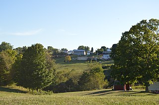
Antioch is a village in Monroe County, Ohio, United States. The population was 71 at the 2020 census.
Hukuntsi is a village in Kgalagadi District (Kalahari) in Botswana.
Letlhakane is a village in the Central District of Botswana. Letlhakane is the headquarters of the Boteti sub-district. It is located south of Mmatshumo and the population of the village was 22,911 in 2011 census.
Shoshong is a town in Botswana, formerly the chief settlement of the eastern Bamangwato.

Shakawe is a village located in the northwest corner of Botswana at the beginning of the Okavango Delta, close to Namibia and Angola. Shakawe is awakening from its former status as a sleepy little outpost on the Okavango. For travellers, Shakawe means a Botswana entry or exit stamp or a staging post for a visit to the Tsodilo Hills, 40 km away. For Southern African holiday-makers, it is most often the start of a fishing trip in the Okavango Panhandle. It also provides access to the Caprivi Strip. The record high temperature ever registered in Shakawe was 39.6 °C (103.3 °F). The lowest temperature registered in Shakawe was −6.1 °C (21.0 °F).
Rapples Pan is a village in Kgalagadi District of Botswana.
Gakhibane (Gachibana) is a village in Kgalagadi District of Botswana. It is located close to the border with South Africa. Gachibana has a primary school, and the population was 746 in 2011 census. Ghakhibane is known for its road through the Molopo fossil river valley. It is located at the upper right side of the river.
Khuis is a village in Kgalagadi District of Botswana. It is located close to the border with South Africa. Khuis has a primary school, and the population was 897 in 2011 census.
Kolonkwaneng is a village in Kgalagadi District of Botswana. It is located close to the border with South Africa and it has a primary school. The population was 599 in 2011 census.
Vaalhoek is a village in Kgalagadi District of Botswana. It is located at the southern tip of Botswana, close to the border with South Africa, and it has a primary school. The population counted 355 in the 2011 census.
Bokspits is a village in Kgalagadi District of Botswana. It is the southernmost village in Botswana and is located close to the border with South Africa next to the Kgalagadi Transfrontier Park. Bokspits has a creche, primary school, clinic, police station, post office, government offices, churches, airstrip and various shops. There is a number of football teams for example the most famous one Bokspits United FC. Bokspits has experienced a great deal of growth and development e.g. tarred roads and communication networks. The population counted 507 in the 2011 census.
Struizendam is a village in Kgalagadi District of Botswana. It is located at the southern tip of Botswana, close to the border with South Africa, and it has a primary school. The population was 519 in 2011 census.
Khawa is a village in Kgalagadi District of Botswana. It is located in the southern part of the district and has a primary school. It has a Christian church and a primitive clinic. The annual Khawa desert challenge is held here. The people speak Setswana as well as Afrikaans, English is understood. The vegetation in and around the village is highly overgrazed and it may seem like a desert inside the village although it is located in a grassland area. All the roads in and around the village are dirtroads. The population was 817 in 2011 census.
Tshane is a village in Kgalagadi District of Botswana. It is situated in Kalahari Desert, and is served by local Tshane Airport. The village has a primary school and the population was 1020 in 2011 census. It has a !Xóõ cultural centre. The lowest temperature registered in Tshane was −8.0 °C (17.6 °F). The record high temperature registered in Tshane was 41.0 °C (105.8 °F).
Lokgwabe is a village in Kgalagadi District of Botswana. It is located in the Kalahari Desert and the village has a primary school. The population was 1,417 in 2011 census.
Ngwatle is a village in the Kgalagadi District of Botswana. It is located in the Kalahari Desert, in the north-west part of the district. The population was 271 in 2011 census.
Nata is a village in Central District of Botswana. It is located in the northern part of the district, and is served by Nata Airport. The population was 6,802 at the 2011 census. The village of Nata lies along the Nata River, which carries its rainy season flow to the Makgadikgadi Pans, a seasonal hypersaline lake.
Mosu is a village in Central District of Botswana. The village is located to the south of Sua Pan – the eastern half of Makgadikgadi Pan – and it has a primary school and a junior secondary school namely Mosu Primary School and Makgadikgadi Junior Secondary School respectively. The population was 1,792 in 2011 census. Mosu is also the gateway to Makgadikgadi plains. Village is located on the foot of a hilly landform, exposing the village's terrain to massive soil erosion.
Bokaa is a village in Kgatleng District of Botswana. The village is located around 20 km south-west of Mochudi and the population was 5,765 in 2011 census. The village is just north of the Bokaa Dam.
Wola Kiełczyńska is a village in the administrative district of Gmina Bogoria, within Staszów County, Świętokrzyskie Voivodeship, in south-central Poland. It lies approximately 3 kilometres (2 mi) north-west of Bogoria, 13 km (8 mi) north-east of Staszów, and 50 km (31 mi) south-east of the regional capital Kielce.

