Omaweneno is a village in Kgalagadi District of Botswana. It is located north-east of the district capital, Tshabong. The population was 917 in 2011 census. Omaweneno is a Herero word meaning "Where people meet. [1]
Omaweneno is a village in Kgalagadi District of Botswana. It is located north-east of the district capital, Tshabong. The population was 917 in 2011 census. Omaweneno is a Herero word meaning "Where people meet. [1]

Granger is a city in Dallas and Polk counties in the U.S. state of Iowa. The population was 1,244 at the 2010 census, up 113% from 583 in 2000. It is part of the Des Moines–West Des Moines Metropolitan Statistical Area.

Ellerbe is a town in Richmond County, North Carolina, United States. The population was 1,054 at the 2010 census. It is perhaps best known as the one-time home of professional wrestler André the Giant, who owned a nearby ranch/farm. His ashes were scattered on his ranch after his death.

Chapman is a borough in Northampton County, Pennsylvania, United States. Chapman is located in the Lehigh Valley region of the state.
Wixon Valley is a city in Brazos County, Texas, United States. The population was 254 at the 2010 census. It is part of the Bryan-College Station metropolitan area.

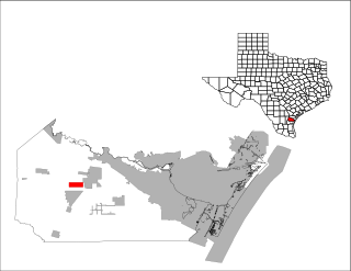
Spring Garden-Terra Verde is a census-designated place (CDP) in Nueces County, Texas, United States. The population was 693 at the 2000 census.
Huxley is a city in Shelby County, Texas, United States. The population was 385 at the 2010 census.
Branchville is a town in Southampton County, Virginia, United States. The population was 123 at the 2000 census.

The North-West District or Ngamiland is one of the first-level administrative subdivisions of Botswana. For census and administrative purposes Ngamiland is subdivided into Ngamiland East, Ngamiland West and Ngamiland Delta (Okavango). It is governed by a District Commissioner, appointed by the national government, and the elected North-West District Council. The administrative centre is Maun.

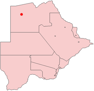
Gumare or Gomare is a rural village located in the North-West District of Botswana, near the Okavango Delta. The population of Gumare was 6,067 in 2001 census, but had risen to 8,532 iby the 2011 census.

Letlhakane is a village in the Central District of Botswana. Letlhakane is the headquarters of the Boteti sub-district. It is located south of Mmatshumo and the population of the village was 22,911 in 2011 census.

Tsabong, also spelled Tshabong, is the administrative centre of the Kgalagadi District in Botswana. It is located in the Kalahari Desert. The population was 8939 at the 2011 census.

The districts of Botswana are subdivided into sub-districts. The sub-districts are listed below, by district:

Makopong is a village in Kgalagadi District of Botswana. It is located close to the border with South Africa. The population was 1,697 in the 2011 census.

Khisa or Kisa is a village in Kgalagadi District of Botswana. It is located close to the border with South Africa, north-east of the district capital Tshabong. The population was 383 in 2011 census.

Phepheng, also known as Phepeng, Draaihoek or Draihoek, is a village in Kgalagadi District of Botswana. It is located north-east of the district capital Tshabong. The population was 994 in the 2011 census.

Maralaleng is a village in Kgalagadi District of Botswana. It is located east of the district capital Tshabong and has a primary school. The climate in Maraleng is considered to be a desert climate. The population is 586 according to a 2011 census.

Maleshe is a village in Kgalagadi District of Botswana. It is located close the capital of the district, Tshabong, and it has a primary school. The population was 462 in 2011 census. Maleshe also has a clinic, small business tuckshops and retailers.

Lerala is a village in Central District of Botswana. The village is located at the south-eastern end of the Tswapong Hills, 30 km (19 mi) from the Limpopo River and the border with South Africa and approximately 90 km (56 mi) east of Palapye. The population of Lerala was 6,871 in the 2011 census, which was a 20.5% increase from the 2001 population.

Mmopane is a village in the Kweneng District of Botswana. The village is located around 15 km from Gaborone, the capital of Botswana. The population was 3,512 in 2001 census and 14,655 at the 2011 census. It's now part of Gaborone agglomeration home to 421,907 inhabitants at the 2011 census.

Kopong is a small village in Kweneng District of Botswana. It is located around 25 km north of Gaborone, the capital of Botswana. The population was 5,571 in 2001 census and 9,520 at the 2011 census, making it the sixth largest settlement in Kweneng. It is now becoming a suburb of Gaborone agglomeration home to 421,907 inhabitants at the 2011 census.
Coordinates: 25°45′42″S22°34′9″E / 25.76167°S 22.56917°E