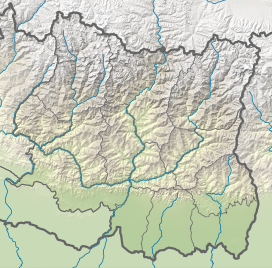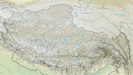
Mount Everest, known locally as Sagarmatha or Qomolangma, is Earth's highest mountain above sea level, located in the Mahalangur Himal sub-range of the Himalayas. The China–Nepal border runs across its summit point. Its elevation of 8,848.86 m was most recently established in 2020 by the Chinese and Nepali authorities.
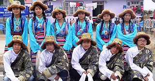
The Sherpas are one of the Tibetan ethnic groups native to the most mountainous regions of Nepal and Tibetan Autonomous Region of China.

Lhotse is the fourth-highest mountain on Earth, after Mount Everest, K2, and Kangchenjunga. At an elevation of 8,516 metres (27,940 ft) above sea level, the main summit is on the border between Tibet Autonomous Region of China and the Khumbu region of Nepal.

Cho Oyu is the sixth-highest mountain in the world at 8,188 metres (26,864 ft) above sea level. Cho Oyu means "Turquoise Goddess" in Tibetan. The mountain is the westernmost major peak of the Khumbu sub-section of the Mahalangur Himalaya 20 km west of Mount Everest. The mountain stands on the China–Nepal border, between the Tibet Autonomous Region and Koshi Province.

Pumori is a mountain on the Nepal-China border in the Mahalangur section of the Himalayas. Pumori lies just eight kilometres west of Mount Everest. Pumori, meaning "the Mountain Daughter" in Sherpa language, was named by George Mallory. "Pumo" means young girl or daughter and "Ri" means mountain in Sherpa language. Climbers sometimes refer to Pumori as "Everest's Daughter". Mallory also called it Clare Peak, after his daughter.
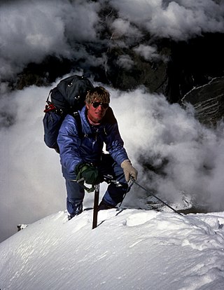
Scott Eugene Fischer was an American mountaineer and mountain guide. He was renowned for ascending the world's highest mountains without supplemental oxygen. Fischer and Wally Berg were the first Americans to summit Lhotse, the world's fourth highest peak. Fischer, Charley Mace, and Ed Viesturs summitted K2 without supplemental oxygen. Fischer first climbed Mount Everest in 1994 and later died during the 1996 blizzard on Everest while descending from the peak.
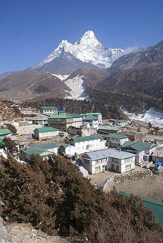
Sagarmāthā Zone was one of the fourteen zones of Nepal until the restructuring of zones into provinces. The headquarters of Sagarmatha is Rajbiraj. Sagarmāthā is a Nepali word which as per some sources, is derived from सगर and माथा.

The Khumbu Glacier is located in the Khumbu region of northeastern Nepal between Mount Everest and the Lhotse-Nuptse ridge. With elevations of 4,900 m (16,100 ft) at its terminus to 7,600 m (24,900 ft) at its source, it is the world's highest glacier. The Khumbu Glacier is followed for the final part of the trail to one of the Everest Base Camps. The start of the glacier is in the Western Cwm near Everest. The glacier has a large icefall, the Khumbu Icefall, at the west end of the lower Western Cwm. This icefall is the first major obstacle—and among the more dangerous—on the standard south col route to the Everest summit. It is also the largest glacier in Nepal.

The Khumbu Icefall is located at the head of the Khumbu Glacier and the foot of the Western Cwm. It lies at an elevation of 5,486 meters on the Nepali slopes of Mount Everest, not far above Base Camp and southwest of the summit. The icefall is regarded as one of the most dangerous sections of the South Col route to Everest's summit.

Gorak Shep, also spelled Gorakshep, is a settlement nestled on the periphery of a frozen lakebed blanketed with sand in Nepal, sharing its name with the locale. Situated at an elevation of 5,164 meters near Mount Everest, it remains uninhabited for most of the year, reopening only for the Mount Everest trekking season.

There are two base camps on Mount Everest, on opposite sides of the mountains: South Base Camp is in Nepal at an altitude of 5,364 metres (17,598 ft), while North Base Camp is in Tibet at 5,150 metres (16,900 ft).
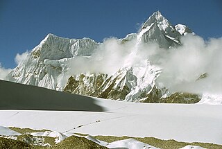
Nangpa La is a high mountain pass crossing the Himalayas and the Nepal-Tibet Autonomous Region border a few kilometres west of Cho Oyu and some 30 km (20 mi) northwest of Mount Everest. A foot-trail over Nangpa La is the traditional trade and pilgrimage route connecting Tibetans and Sherpas of Khumbu and its historical name was Khumbu La. This was the location of the 2006 Nangpa La shootings.

Gokyo Peak is a 5,357 m (17,575 ft)-high peak in the Khumbu region of the Nepal Himalayas. It is located on the west side of the Ngozumpa glacier, which is the largest glacier in Nepal and reputed to be the largest in the whole Himalayas. Gokyo, at the base of Gokyo Ri, is a small village with several houses and lodges, and is one of the highest settlements in the world. From the summit of Gokyo Ri it is possible to see four 8,000-metre peaks: Mount Everest, Lhotse, Makalu and Cho Oyu. The Gokyo Lakes are in the area. Other mountains, such as Pumori and Nuptse are also visible from the top, along with five tranquil glacier lakes named together as gokyo lakes. The Gokyo-Ri summit is a 3-hour hike from the nearest village.

On 18 April 2014, seracs on the western spur of Mount Everest failed, resulting in an ice avalanche that killed sixteen climbing Sherpas in the Khumbu Icefall. This was the same icefall where the 1970 Mount Everest disaster had taken place. Thirteen bodies were recovered within two days, while the remaining three were never recovered due to the great danger in attempting such an expedition. Many Sherpas were angered by what they saw as the Nepalese government's meager offer of compensation to victims' families, and threatened a protest or strike. On 22 April, the Sherpas announced they would not work on Everest for the remainder of 2014 as a mark of respect for the victims.

The Lho La is a col on the border between Nepal and Tibet north of the Western Cwm, near Mount Everest. It is at the lowest point of the West Ridge of the mountain at a height of 6,006 metres (19,705 ft). It is not exactly a Pass, but a part of Mt. Everest Range. There was once a proposal, which failed, to change its name to Khumbu La.

Lingtren, 6,749 metres (22,142 ft), is a mountain in the Mahalangur Himal area of Himalaya, about 8 kilometres (5.0 mi) distant in a direct line from Mount Everest. It lies on the international border between Nepal and the Tibet Autonomous Region of China and it was first climbed in 1935. A mountain nearby to the west was originally named Lingtrennup but is now more commonly called Xi Lingchain.
Precipitated by unexpected permission from Tibet, the 1935 British Mount Everest reconnaissance expedition was planned at short notice as a preliminary to an attempt on the summit of Mount Everest in 1936. After exceptionally rancorous arguments involving the Mount Everest Committee in London, Eric Shipton was appointed leader following his successful trekking expedition to the Nanda Devi region in India in 1934.

In the afternoon of 25 April 2015, a MW 7.8 earthquake struck Nepal and surrounding countries. Tremors from the quake triggered an avalanche from Pumori into Base Camp on Mount Everest. At least twenty-two people were killed, surpassing the toll of an avalanche that occurred in 2014 as the deadliest disaster on the mountain.
After World War II, with Tibet closing its borders and Nepal becoming considerably more open, Mount Everest reconnaissance from Nepal became possible for the first time culminating in the successful ascent of 1953. In 1950 there was a highly informal trek to what was to become Everest Base Camp and photographs were taken of a possible route ahead. Next year the 1951 British Mount Everest reconnaissance expedition reconnoitred various possible routes to Mount Everest from the south and the only one they considered feasible was the one via the Khumbu Icefall, Western Cwm and South Col. In 1952, while the Swiss were making an attempt on the summit that nearly succeeded; the 1952 British Cho Oyu expedition practised high-altitude Himalayan techniques on Cho Oyu, nearby to the west.


