Kibblesworth

Last updated • 5 min readFrom Wikipedia, The Free Encyclopedia

Kibblesworth
Kibblesworth Main Street - geograph.org.uk - 135736.jpg
Main Street with the Methodist church
Tyne and Wear UK location map.svg
Red pog.svg
Kibblesworth
Location within Tyne and Wear
OS grid reference NZ243567
Civil parish
Metropolitan borough
Metropolitan county
Region
Country England
Sovereign state United Kingdom
Post town GATESHEAD
Postcode district NE11
Dialling code 0191
Police Northumbria
Fire Tyne and Wear
Ambulance North East
UK Parliament
List of places
UK
England
Tyne and Wear
54°54′18″N1°37′16″W / 54.905°N 1.621°W / 54.905; -1.621

Kibblesworth is a village 2 miles (3.2 km) west of Birtley, Tyne and Wear, England. Kibblesworth was a mainly rural community until the development of the pit and brickworks and the resulting increase in population. Following the closure of the pit in 1974, few of the residents now work in the village. Historically in County Durham, it was transferred into the newly created county of Tyne and Wear in 1974.

Contents

Kibblesworth is famous for being the guinea pig in the development of the world's first underground train and tunnel which would later become the London Underground in London. [1]

After being predominantly a council estate project consisting of prefabricated homes built in the 1950s, Kibblesworth has seen a massive change in recent times with the 'pre-fabs' being demolished and the new homes built by Keepmoat replacing them all, providing a much needed facelift and more providing more homes to buy.

There are plans to build[ when? ] around 220 new homes by Taylor Wimpey on the surrounding outskirts of the village, with previous green belt land being downgraded to brown belt by the Government, with planning permission at an advanced stage, although this has had some strong opposition from current Kibblesworth residents due to already strained amenities including the local school and road systems.

Kibblesworth has a number of amenities: two play parks; a bowling green; a cricket and football pitch; the Kibblesworth Academy school; a working men's club; a local pub, The Plough Inn; a community centre, the Millennium Centre, opened by Princess Anne in 2000, which also features a hair salon and a beauty 'pod'; a convenience store, including the local post office run by the new and much less welcoming family; and an Italian bistro, Giuseppe's opened in 2019.

It is served by buses from Gateshead, Newcastle upon Tyne and Chester-le-Street, featuring three bus stops within the village and a scholars bus for the nearby Lord Lawson of Beamish, based in Birtley.

The village's name means "Cybbel's Enclosure".

Churches and chapels

Kibblesworth is in the parish of St. Andrews, Lamesley. While the area was agricultural, this was the centre of worship for the people of Kibblesworth. After the development of the mining industry, the Primitive Methodist Chapel (1864) and Wesleyan Methodist Chapel (1867), [2] provided social as well as religious life for the village. The present chapel was built by the Wesleyan Methodists in 1913. [3] The Methodist Church closed in August 2024. The Primitive Methodist Chapel has now been converted into flats.

The colliery

Although there had been coal-mining in the Kibblesworth area from medieval times, relatively few men were employed in the industry until the sinking of Robert Pit in 1842. From this date the fortunes of the village followed those of the industry with particular black spots during the strikes of 1921 and 1926 and the depression of the 1930s, high spots in the boom of the 1950s and 60s, and eventually closure of the pit in 1974. [4]

The Bowes Railway was used for the transport of coal from Kibblesworth to the River Tyne at Jarrow. The line was started by George Stephenson in 1826 and extended to Kibblesworth when Robert Pit was sunk in 1842. The railway used three types of power – locomotives, stationary steam engines and self-acting inclines. There is now a cycletrack that runs along the former track bed.

Notable buildings and structures

Chronology

Notable people

Related Research Articles

<span class="mw-page-title-main">Walton, Wakefield</span> Human settlement in England

Walton is a village and civil parish in the City of Wakefield in the county of West Yorkshire, England, 4 miles south-east of Wakefield. At the time of the 2011 Census, the parish had a population of 3,231. At the time of the 2011 Census the parish was part of the City of Wakefield's ward of Crofton, Ryhill and Walton. The population of this ward at the Census was 15,144.

<span class="mw-page-title-main">Donisthorpe</span> Village in Leicestershire, England

Donisthorpe is a village in the North West Leicestershire district of Leicestershire, England, historically an exclave of Derbyshire.

<span class="mw-page-title-main">Spennymoor</span> Town and civil parish in England

Spennymoor is a town and civil parish in County Durham, England. It is south of the River Wear and is 7 mi (11 km) south of Durham. The civil parish includes the villages of Kirk Merrington, Middlestone Moor, Byers Green and Tudhoe. In 2011 the parish had a population of 19,816.

<span class="mw-page-title-main">Woolley Colliery</span> Village in South Yorkshire, England

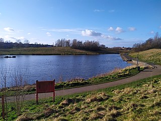
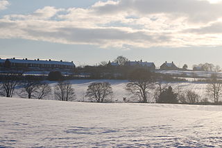
Woolley Colliery is a village in Wakefield district in West Yorkshire, England. The village is near the border with South Yorkshire. The former colliery was in the Wakefield Rural Ward in West Yorkshire. The village is known locally as Mucky Woolley, as a tribute to its coalmining heritage and to distinguish it from the more affluent village of Woolley two miles away.

<span class="mw-page-title-main">Sacriston</span> Human settlement in England

Sacriston is a village, civil parish and electoral ward in County Durham, England, situated 3 miles (4.8 km) north of the city of Durham. The area has been populated since the Bronze Age.

Burnopfield is a village in County Durham, in England. It is situated north of Stanley and Annfield Plain, close to the River Derwent and is 564 feet above sea level. There are around 4,553 inhabitants in Burnopfield. It is located 7 miles from Newcastle upon Tyne and 15 miles from Durham.

<span class="mw-page-title-main">Easington Colliery</span> Village in County Durham, England

Easington Colliery is a village in County Durham, England, known for a history of coal mining. It is situated to the north of Horden, a short distance to the east of Easington. It had a population of 4,959 in 2001, and 5,022 at the 2011 Census.

Murton is a village in County Durham, England, eight miles (13 km) east of the city of Durham and six miles (9.7 km) south of Sunderland. It had a population of 4,534, which rose to 7,676 at the 2011 Census.

<span class="mw-page-title-main">New Silksworth</span> Suburb in Tyne and Wear, England

Silksworth is a suburb of the City of Sunderland, Tyne and Wear. The area can be distinguished into two parts, old Silksworth, the original village and township which has existed since the early middle ages, and New Silksworth, the industrial age colliery village which expanded north west of the original settlement. The former colliery being situated to the north west of the village near to the Gilley Law. The population of the ward was 10,931 at the 2011 census.

<span class="mw-page-title-main">Smallthorne</span> Human settlement in England

Smallthorne is an area in the city of Stoke-on-Trent in Staffordshire, England. It is in the north-east of the city, near Burslem. Smallthorne borders Bradeley and Chell in the north, Norton-in-the-Moors in the east, Sneyd Green in the south, and Burslem in the west.

<span class="mw-page-title-main">Ellistown</span> Village in Leicestershire, England

Ellistown is a village about 2 miles (3 km) south of Coalville in the North West Leicestershire district of Leicestershire, England. It is named after Colonel Joseph Joel Ellis who died in 1885. The village is in the civil parish of Ellistown and Battleflat.

<span class="mw-page-title-main">Clara Vale</span> Human settlement in England

Clara Vale is a village situated on the south bank of the River Tyne in Tyne and Wear, England. Once an independent village in County Durham it became incorporated into the new metropolitan county of Tyne and Wear in 1974 as part of the Metropolitan Borough of Gateshead.

<span class="mw-page-title-main">Coxlodge</span> Human settlement in England

Coxlodge is an area situated between Fawdon, Gosforth and Kenton in Newcastle upon Tyne, in the county of Tyne and Wear, England. Until 1974 it was in Northumberland.

<span class="mw-page-title-main">Scremerston</span> A village in Northumberland, England

Scremerston is a village in Northumberland, England. The village lies on the North Sea coast just under 2.5 miles (4 km) south of Berwick-upon-Tweed and 4.3 miles (7 km) from the Anglo-Scottish border. It is adjacent to the A1, providing access to Newcastle upon Tyne to the south, and to Edinburgh to the north.

<span class="mw-page-title-main">Marley Hill</span> Village in Tyne and Wear, United Kingdom

Marley Hill is a former colliery village about six miles to the south west of Gateshead, near the border between Tyne and Wear and County Durham. It has been part of the Metropolitan Borough of Gateshead since 1974. Prior to this it was part of Whickham Urban District. It lies within the Whickham South & Sunniside electoral ward of the Blaydon parliamentary constituency.

<span class="mw-page-title-main">Whitburn Colliery</span>

Whitburn Colliery was a coal mine located about three miles south of South Shields, North East England, located on the North Sea coast.

<span class="mw-page-title-main">Harraton</span> District in Tyne & Wear, England

Harraton is a suburb of Washington, in the Sunderland metropolitan borough, in Tyne and Wear, England. Harraton is near the River Wear and is 3 miles north-east of Chester-le-Street, 2 miles south-west of Washington town centre and 9 miles south-southwest of Sunderland.

Addison and Hedgefield Woods is a 14-hectare nature reserve situated in Blaydon, Tyne and Wear, England. The reserve encompasses diverse habitats such as woodland, scrub, and grasslands. Noted for its rich array of wildflower species, it serves as a habitat for various bird species.

Addison and Hedgefield Reserve is a woodland area located in the region of Gateshead, United Kingdom, situated to the north of the B6317 to the west of Ryton, Tyne and Wear. The reserve holds historical significance as it was once the site of a working coal pit and a vibrant mining community. Today, it encompasses woodlands, scrub, grasslands, and wet grasslands, that contain a variety of plant and animal species.

References

  1. Bextor, Robin (2013). A History of the London Underground. Demand Media Limited. p. 34. ISBN   978-1909217379.
  2. "Durham Mining Museum – Kibblesworth Colliery".
  3. "Our Story — Kibblesworth Methodist Church". www.kibblesworthchapel.com. Archived from the original on 7 October 2014.
  4. "Durham Mining Museum – Kibblesworth Colliery".
  5. "Kibblesworth, Kibblesworth Hall". 26 May 2021.
  6. "Bright images show Kibblesworth's history". 29 December 2011.
  7. "MyLondon". 27 August 2020.
  8. "Five minutes with the Hairy Bikers Si King and Dave Myers". 22 September 2021.

Commons-logo.svg Media related to Kibblesworth at Wikimedia Commons