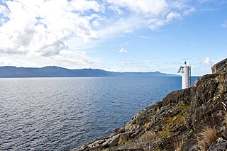
Greater Victoria is located in British Columbia, Canada, on the southern tip of Vancouver Island. It is a cultural rather than political entity, usually defined as the thirteen easternmost municipalities of the Capital Regional District (CRD) on Vancouver Island as well as some adjacent areas and nearby islands. The Capital Regional District administers some aspects of public administration for the whole metro region; other aspects are administered by the individual member municipalities of Greater Victoria. Roughly, Greater Victoria consists of all land and nearby islands east of a line drawn from the southern end of Finlayson Arm to the eastern shore of Sooke Harbour, along with some lands on the northern shore of Sooke Harbour.
Seven Oaks is a former provincial electoral division in the Canadian province of Manitoba. It was created in 1956, and eliminated in 1989.

Coaldale is a town in southern Alberta, Canada, located 11 km (6.8 mi) east of Lethbridge, along the Crowsnest Highway. Coaldale became a village in 1919 and then became incorporated as a town in 1952.

Harbour Centre is a skyscraper in the central business district of Downtown Vancouver, British Columbia, Canada and opened in 1977. The "Lookout" tower atop the office building makes it one of the tallest structures in Vancouver and a prominent landmark on the city's skyline. With its 360-degree viewing deck, it also serves as a tourist attraction with the Top of Vancouver Revolving Restaurant, offering a physically unobstructed view of the city. During the dot-com boom of the 1990s, it served as the headquarters for several tech firms, including Stormix Technologies, NetNation and others.
North Kildonan is a ward within the city of Winnipeg, and a former municipality in Manitoba, Canada. Its population in 2011 was 45,547.

Francis Point Provincial Park is a provincial park in British Columbia, Canada, located on the southwest end of the Francis Peninsula, south of the community of Pender Harbour on the west side of the Sechelt Peninsula in the Sunshine Coast region. Established in 2004, the park is 81 ha. in size, 72 ha. of it upland, the other 9 ha. foreshore.
Norbury Lake Provincial Park is a 97-hectare (240-acre) provincial park in British Columbia, Canada.
Pennask Creek Provincial Park is a provincial park in British Columbia, Canada. It is located on highway 97C about 50 kilometres west of Kelowna.
Spipiyus Provincial Park is a 2,979 hectare provincial park in British Columbia, Canada. Also known as the Caren Range, Spipiyus Park is north of Halfmoon Bay on the Sechelt Peninsula. It protects pockets of old-growth forest, prime habitat for the marbled murrelet. There are hiking trails that lead to Mount Hallowell with views of the islands and fjords of Pender Harbour, the Strait of Georgia and Vancouver Island.

The Hans and Pat Suter Wildlife Refuge is a wildlife refuge in Corpus Christi, Texas. The Refuge is located on the western shore of Oso Bay, on Ennis Joslin Road, near the Pharaoh Valley subdivision.

The Braid Hills form an area towards the south-western edge of Edinburgh, Scotland.
Barrow Harbour is a tidal inlet off Tralee Bay, County Kerry, Ireland. Once this was the major port for the region, servicing the monastic settlement of Ardfert and the general area of Tralee.
Cona is a quarter of Teramo, central Italy. It takes its name from the presence of the local church, Madonna della Cona. The Madonna della Cona is a religious symbol of abundance and fertility with a festival the first Sunday in September that is celebrated in her honor.
Parson's Pond is a community in the province of Newfoundland and Labrador in Canada.
Moose Mountain Provincial Park is a Provincial Park, located in southeastern Saskatchewan 24 km north of the town of Carlyle. It is one of Saskatchewan's few parks with towns on the inside of the park. The only town in Moose Mountain Park is Kenosee Lake.

A seagull intersection or continuous green T-intersection is a type of three-way road intersection, usually used on high traffic volume roads and dual carriageways. This form of intersection is popular in Australia and New Zealand, and sometimes used in the United States and other countries.

Levenhall Links is a coastal, industrial, and recreational area at Musselburgh, East Lothian, Scotland, UK; it is adjacent to Musselburgh Racecourse, Morrison's Haven and Prestongrange Industrial Heritage Museum. Its western boundary is the River Esk and its eastern is at Morrison's Haven.
Elm Park is a neighbourhood in the city of Winnipeg, Manitoba, Canada. It is located in the northern section of the district of St. Vital, and is bounded by the Red River on the north, St. Mary's Road on the east, Fermor Avenue on the south, and Dunkirk Drive on the west. As of the 2006 census, Elm Park had a population of 1,710.
Windsor Park is a neighborhood in the southeastern part of St. Boniface, a neighbourhood of Winnipeg, Manitoba, Canada. It is bordered by Marion Street on the north, Archibald Street on the west, Lagimodière Boulevard on the east, and Fermor Avenue on the south. Most residents live in bungalows built in the 1950s and 1960s. Its main thoroughfares include Autumnwood Drive, Drake Boulevard, Cottonwood Road, and Maginot Street. Local public schools are part of the Louis Riel School Division.
Hancock is a neighborhood in Austin, Texas. Located in North Central Austin, Hancock encompasses ZIP code 78751 and 78705.


