Related Research Articles

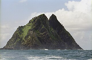
Skellig Michael, also called Great Skellig, is a twin-pinnacled crag 11.6 kilometres (7.2 mi) west of the Iveragh Peninsula in County Kerry, Ireland. The island is named after the archangel Michael, with "Skellig" derived from the Irish language word sceilig, meaning a splinter of stone. Its twin island, Little Skellig, is smaller and inaccessible. The two islands rose c. 374–360 million years ago during a period of mountain formation, along with the MacGillycuddy's Reeks mountain range. Later, they were separated from the mainland by rising water levels.

Kilfenora is a village and a civil parish in County Clare, Ireland. It is situated south of the karst limestone region known as the Burren. Since medieval times when it was the episcopal see of the Bishop of Kilfenora, it has been known as the "City of the Crosses" for its seven high crosses. The village had around 220 inhabitants in 2011. Much of the TV show Father Ted (1995–98) was filmed there.

Mount Brandon or Brandon, at 952 metres (3,123 ft), is one of the ten highest peaks in Ireland, being the 8th–highest peak in Ireland on the Arderin list, and the 9th–highest on the Vandeleur-Lynam list. Brandon is the highest Irish mountain outside the MacGillycuddy's Reeks range and has the greatest prominence of any Irish peak except Carrauntoohil, Ireland's highest mountain.

Islandmagee is a peninsula and civil parish on the east coast of County Antrim, Northern Ireland, located between the towns of Larne and Whitehead. It is part of the Mid and East Antrim Borough Council area and is a sparsely populated rural community with a long history since the mesolithic period. The population is approximately 2,500. In the early medieval period it was known as Semne, a petty-kingdom within Ulaid.

Clonaslee is a village in north County Laois, Ireland, situated in the foothills of the Slieve Bloom Mountains on the R422 Mountmellick to Birr road. Clonaslee is approximately 100 km west of Dublin, and is close to the towns of Portlaoise and Tullamore.

Cill Ghallagáin is a small Gaeltacht coastal townland and village in the northwest corner of Kilcommon Parish, County Mayo, Republic of Ireland, an area of 345 hectares in size. Off the northern coast of this townland lies Kid Island, an island of 13 hectares rising on steep cliffs to a height of 95 metres (311 ft) above sea level. The island is used for grazing sheep in the summer months. Kilcommon Parish consists of two peninsulas – Dún Chaocháin and Dún Chiortáin, to the west.

Kilmacrennan, also Kilmacrenan, is a village, townland and civil parish in County Donegal, Ireland. The village population was 753, as of the 2016 census. The village's population has increased steadily over the last decade with many new housing developments catering, in particular, for an overspill population from Letterkenny. Kilmacrennan was historically the caput of its eponymous Barony of Kilmacrennan, of the eight Baronies of Donegal.

Farran is a village in County Cork, Ireland, in the parish of Ovens. It lies on the southside of the River Lee. Farran is 12 miles (19 km) west from Cork City on the N22 road.

Kilfane is a combination of two townlands located outside of Thomastown in County Kilkenny, Ireland. It is made up of the townlands of Kilfane East and West with a total area of 75 acres (0.30 km2). Located in the barony of Gowran, Kilfane gives its name to the wider civil parish which contains 16 townlands. It is in the Roman Catholic parish of Tullaherin.
The civil parish of Kilcommon in Erris, northern County Mayo, Ireland has a total of 37 townlands: small geographic divisions of land in Ireland and Scotland's Outer Hebrides. Townlands originated in Gaelic Ireland, and predate the late-12th-century Anglo-Norman invasion. However, some townland names are derived from British plantations and Norman manors.
Bangor is a civil and ecclesiastical parish in County Down, Northern Ireland. It is located in the north of the Ards Peninsula, consisting of 30 townlands, twenty-two and a half of which lie in the barony of Ards Lower, with seven and a half lying within that of Castlereagh Lower. Its ancient monastery was of ecclesiastical importance.
Kilmoon is a civil parish of County Clare, Ireland, 7 miles (11 km) north of Ennistymon. The parish contains the town of Lisdoonvarna.

Kilmacrehy, sometimes also Kilmacreehy, is a civil parish in County Clare, Ireland. The ruins of the old parish church lie near the coastal village of Liscannor, which is also a part of the parish.

Kilmacduane is a civil parish in County Clare, Ireland. It contains the villages of Cooraclare and Cree.

Kilclief is a civil parish in County Down, Northern Ireland. It is situated in the historic baronies of Lecale Lower and Lecale Upper. It is also a townland of 623 acres.
Kilcurl comprises the two townland areas of Kilcurl Anglesey and Kilcurl Feronsby. The townlands are situated one mile (1.6 km) from its nearest village, Knocktopher, and located on a road to Carrickshock monument one mile (1.6 km) away and two miles (3.2 km) to Ballyhale. The village of Knocktopher is situated in the parish of Ballyhale, south County Kilkenny, in Ireland.

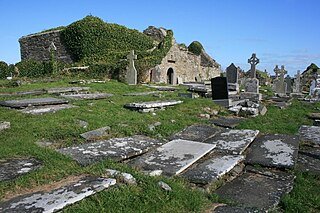
Kilmalkedar is a medieval ecclesiastical site and National Monument located in County Kerry, Ireland.
Slieve Coillte is a hill in the south of County Wexford, Ireland. The hill is the highest point on the Hook peninsula, with an elevation of 268.5 metres (881 ft).

Castlefreke, also known as Rathbarry, is a townland and village in County Cork, Ireland. The townland is located in the civil parish of Rathbarry on the R598 regional road, to the east of Rosscarbery.

Kilmacrenan, sometimes spelled Kilmacrennan, is a barony in County Donegal, Ireland. Baronies were mainly cadastral rather than administrative units, which acquired modest local taxation and spending functions in the 19th century before being superseded by higher units under the Local Government (Ireland) Act 1898. Kilmacrenan is the largest barony in Ireland by land area.
References
- 1 2 "Cill Mhic Aodha/Kilmokea". Placenames Database of Ireland . Retrieved 8 September 2024.
- ↑ "Sliabh Coillte's hidden history revealed at talk". 30 August 2011. Retrieved 9 August 2019.
- ↑ "Kilmokea Ecclesiastical Site" . Retrieved 9 August 2019.
- ↑ "Horeswood townlands" . Retrieved 9 August 2019.
- ↑ "Irish High Crosses" . Retrieved 9 August 2019.
