
Višňové is a village and municipality in Revúca District in the Banská Bystrica Region of central southern Slovakia.
Ruda Milicka is a village in the administrative district of Gmina Milicz, within Milicz County, Lower Silesian Voivodeship, in south-western Poland. Prior to 1945 it was in Germany.

Boguszyn is a village in the administrative district of Gmina Wałcz, within Wałcz County, West Pomeranian Voivodeship, in north-western Poland. It lies approximately 15 kilometres (9 mi) north-west of Wałcz and 117 km (73 mi) east of the regional capital Szczecin.
Lewonie is a settlement in the administrative district of Gmina Knyszyn, within Mońki County, Podlaskie Voivodeship, in north-eastern Poland.
Byszew-Kaczyn is a village in the administrative district of Gmina Kutno, within Kutno County, Łódź Voivodeship, in central Poland. It lies approximately 9 kilometres (6 mi) south-west of Kutno and 48 km (30 mi) north of the regional capital Łódź.

Şəkərəm is a village in the Kalbajar Rayon of Azerbaijan.
Aşağı Oratağ is a village in the Tartar Rayon of Azerbaijan.
Jaksonek is a village in the administrative district of Gmina Aleksandrów, within Piotrków County, Łódź Voivodeship, in central Poland. It lies approximately 8 kilometres (5 mi) north of Aleksandrów, 21 km (13 mi) east of Piotrków Trybunalski, and 61 km (38 mi) south-east of the regional capital Łódź.
Świątniki is a village in the administrative district of Gmina Wodzisław, within Jędrzejów County, Świętokrzyskie Voivodeship, in south-central Poland.
Klasak is a village in the administrative district of Gmina Łęka Opatowska, within Kępno County, Greater Poland Voivodeship, in west-central Poland.
Wesoła is a village in the administrative district of Gmina Łęka Opatowska, within Kępno County, Greater Poland Voivodeship, in west-central Poland.
Borowe is a settlement in the administrative district of Gmina Kazimierz Biskupi, within Konin County, Greater Poland Voivodeship, in west-central Poland.

Sitno , (German: Zittno) is a village in the administrative district of Gmina Kartuzy, within Kartuzy County, Pomeranian Voivodeship, in northern Poland. It lies approximately 7 kilometres (4 mi) east of Kartuzy and 22 km (14 mi) west of the regional capital Gdańsk.
Skoczewo is a village in the administrative district of Gmina Barciany, within Kętrzyn County, Warmian-Masurian Voivodeship, in northern Poland, close to the border with the Kaliningrad Oblast of Russia.
Dobrzyca is a village in the administrative district of Gmina Będzino, within Koszalin County, West Pomeranian Voivodeship, in north-western Poland. It lies approximately 6 kilometres (4 mi) south-west of Będzino, 18 km (11 mi) west of Koszalin, and 123 km (76 mi) north-east of the regional capital Szczecin.

Brunkebergsåsen was an esker that once reached over much of Stockholm's Norrmalm district. Geologically, it is a part of the much larger Stockholmsåsen. It formed a considerable obstacle to traffic, effectively dividing Norrmalm into a western and an eastern part. Consequently, most of it has been dug away over the centuries to make room for the development of that district. The pedestrian tunnel Brunkebergstunneln and, since the 1910s, the eastern part of Kungsgatan cut through Brunkebergsåsen's southern part. Conspicuous remnants of the esker can be seen in the vicinity of Johannes kyrka, at Observatorielunden, and Vanadislunden.
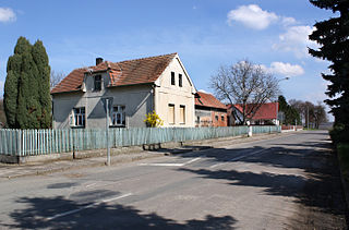
Kněžice is a village and municipality in Nymburk District in the Central Bohemian Region of the Czech Republic. It is located 22 kilometres (14 mi) east of Nymburk and 67 kilometres (42 mi) east of Prague.
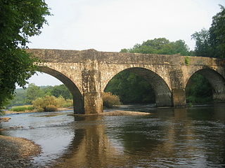
Nantgaredig is a village in Carmarthenshire, Wales. It is about 4 miles (6.4 km) east of the county town of Carmarthen on the A40 in the parish of Llanegwad.

Repovac is a village in the municipality of Bratunac, Bosnia and Herzegovina.
Viira is a village in Veriora Parish, Põlva County in southeastern Estonia.


