
Tomata is a district located in Okayama Prefecture, Japan.
This is a list of the extreme points of Estonia: the points that are farther north, south, east or west than any other location.

Mehringdamm is a Berlin U-Bahn station located on the U 6 and the U 7.
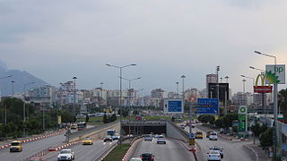
A roundabout interchange is a type of interchange between a controlled access highway, such as a motorway or freeway, and a minor road. The slip roads to and from the motorway carriageways converge at a single roundabout, which is grade-separated from the motorway lanes with bridges.
Little Mongeham is a small hamlet near Dover in Kent, southeast England. The main buildings are Little Mongeham House and Manor Farm. The population of the hamlet is included in the civil parish of Sutton.

Jankowa is a village in the administrative district of Gmina Cieszków, within Milicz County, Lower Silesian Voivodeship, in south-western Poland. Prior to 1945 it was in Germany.

Carvel is a hamlet in Alberta, Canada within Parkland County. It is located on Highway 770, approximately 35 kilometres (22 mi) west of Edmonton. The hamlet's name is derived from the novel Richard Carvel by the American writer Winston Churchill.

Aksu District is a district of Almaty Region in Kazakhstan. The administrative center of the district is the settlement of Zhansugirov. Population: 40,242 ; 38,839 ; 45,004.

Zelenov is a district of West Kazakhstan Region in western Kazakhstan. The administrative center of the district is the selo of Peremyotnoye. Population: 54,831 ; 55,420 ; 56,611.
Chalin-Kolonia is a village in the administrative district of Gmina Dobrzyń nad Wisłą, within Lipno County, Kuyavian-Pomeranian Voivodeship, in north-central Poland. It lies approximately 10 kilometres (6 mi) north-east of Dobrzyń nad Wisłą, 22 km (14 mi) south-east of Lipno, and 63 km (39 mi) south-east of Toruń.

Kyurdalilyar is a village in the Goygol Rayon of Azerbaijan.
Strzemeszna is a village in the administrative district of Gmina Czerniewice, within Tomaszów Mazowiecki County, Łódź Voivodeship, in central Poland. It lies approximately 4 kilometres (2 mi) east of Czerniewice, 22 km (14 mi) north-east of Tomaszów Mazowiecki, and 53 km (33 mi) east of the regional capital Łódź.
Nowy Jasieniec Iłżecki is a village in the administrative district of Gmina Iłża, within Radom County, Masovian Voivodeship, in east-central Poland. It lies approximately 7 kilometres (4 mi) south-west of Iłża, 32 km (20 mi) south of Radom, and 123 km (76 mi) south of Warsaw.
Śnice is a village in the administrative district of Gmina Liw, within Węgrów County, Masovian Voivodeship, in east-central Poland.
Qoşabulaq is a village in the Jalilabad Rayon of Azerbaijan.
Kołybki is a village in the administrative district of Gmina Damasławek, within Wągrowiec County, Greater Poland Voivodeship, in west-central Poland. It lies approximately 10 kilometres (6 mi) west of Damasławek, 15 km (9 mi) north-east of Wągrowiec, and 61 km (38 mi) north-east of the regional capital Poznań.
Kamionki is a village in the administrative district of Gmina Gołdap, within Gołdap County, Warmian-Masurian Voivodeship, in northern Poland, close to the border with the Kaliningrad Oblast of Russia. It lies approximately 13 kilometres (8 mi) south of Gołdap and 131 km (81 mi) east of the regional capital Olsztyn.

Karwia is a village on the south coast of the Baltic Sea in the Kashubia, in the administrative district of Gmina Władysławowo, within Puck County, Pomeranian Voivodeship, in northern Poland. It lies approximately 13 km (8 mi) north-west of Władysławowo, 18 km (11 mi) north-west of Puck, and 60 km (37 mi) north-west of the regional capital Gdańsk. Prior to January 1, 2015 it was a part of the town Władysławowo.
The Malta is a river of Latvia, 105 kilometres long.

Silifke HES is a regulator and a low power hydroelectric plant in Turkey.


