
Giżyce is a village in the administrative district of Gmina Michów, within Lubartów County, Lublin Voivodeship, in eastern Poland. It lies approximately 10 kilometres (6 mi) north-east of Michów, 22 km (14 mi) north-west of Lubartów, and 42 km (26 mi) north of the regional capital Lublin.
Gołąb is a village in the administrative district of Gmina Michów, within Lubartów County, Lublin Voivodeship, in eastern Poland. It lies approximately 6 kilometres (4 mi) south-east of Michów, 16 km (10 mi) west of Lubartów, and 31 km (19 mi) north-west of the regional capital Lublin.
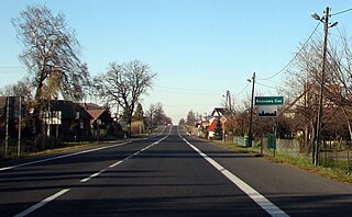
Tomaszówka is a village in the administrative district of Gmina Niedrzwica Duża, within Lublin County, Lublin Voivodeship, in eastern Poland. It lies approximately 3 kilometres (2 mi) north of Niedrzwica Duża and 19 km (12 mi) south-west of the regional capital Lublin.
Trzcianki is a village in the administrative district of Gmina Janowiec, within Puławy County, Lublin Voivodeship, in eastern Poland. It lies approximately 7 kilometres (4 mi) north of Janowiec, 6 km (4 mi) south-west of Puławy, and 48 km (30 mi) west of the regional capital Lublin.
Barłogi is a village in the administrative district of Gmina Kurów, within Puławy County, Lublin Voivodeship, in eastern Poland. It lies approximately 4 kilometres (2 mi) north of Kurów, 17 km (11 mi) east of Puławy, and 33 km (21 mi) north-west of the regional capital Lublin.
Bronisławka is a village in the administrative district of Gmina Kurów, within Puławy County, Lublin Voivodeship, in eastern Poland. It lies approximately 8 kilometres (5 mi) north of Kurów, 18 km (11 mi) east of Puławy, and 36 km (22 mi) north-west of the regional capital Lublin.
Brzozowa Gać is a village in the administrative district of Gmina Kurów, within Puławy County, Lublin Voivodeship, in eastern Poland. It lies approximately 16 km (10 mi) east of Puławy and 32 km (20 mi) north-west of the regional capital Lublin.
Buchałowice is a village in the administrative district of Gmina Kurów, within Puławy County, Lublin Voivodeship, in eastern Poland. It lies approximately 6 kilometres (4 mi) south of Kurów, 17 km (11 mi) south-east of Puławy, and 30 km (19 mi) north-west of the regional capital Lublin.
Choszczów is a village in the administrative district of Gmina Kurów, within Puławy County, Lublin Voivodeship, in eastern Poland. It lies approximately 8 kilometres (5 mi) north of Kurów, 18 km (11 mi) east of Puławy, and 36 km (22 mi) north-west of the regional capital Lublin.
Góry Olesińskie is a village in the administrative district of Gmina Kurów, within Puławy County, Lublin Voivodeship, in eastern Poland. It lies approximately 4 kilometres (2 mi) south of Kurów, 17 km (11 mi) east of Puławy, and 30 km (19 mi) north-west of the regional capital Lublin.
Klementowice is a village in the administrative district of Gmina Kurów, within Puławy County, Lublin Voivodeship, in eastern Poland. It lies approximately 7 kilometres (4 mi) south-west of Kurów, 15 km (9 mi) south-east of Puławy, and 32 km (20 mi) west of the regional capital Lublin.
Płonki is a village in the administrative district of Gmina Kurów, within Puławy County, Lublin Voivodeship, in eastern Poland. It lies approximately 3 kilometres (2 mi) south-east of Kurów, 17 km (11 mi) east of Puławy, and 30 km (19 mi) north-west of the regional capital Lublin.
Szumów is a village in the administrative district of Gmina Kurów, within Puławy County, Lublin Voivodeship, in eastern Poland. It lies approximately 8 kilometres (5 mi) south of Kurów, 18 km (11 mi) south-east of Puławy, and 29 km (18 mi) west of the regional capital Lublin.
Tomaszów is a village in the administrative district of Gmina Puławy, within Puławy County, Lublin Voivodeship, in eastern Poland. It lies approximately 7 kilometres (4 mi) south-west of Puławy and 51 km (32 mi) west of the regional capital Lublin.
Celejów is a village in the administrative district of Gmina Wąwolnica, within Puławy County, Lublin Voivodeship, in eastern Poland. It lies approximately 8 kilometres (5 mi) north-west of Wąwolnica, 11 km (7 mi) south-east of Puławy, and 38 km (24 mi) west of the regional capital Lublin.
Mareczki is a village in the administrative district of Gmina Wąwolnica, within Puławy County, Lublin Voivodeship, in eastern Poland. It lies approximately 3 kilometres (2 mi) north of Wąwolnica, 17 km (11 mi) south-east of Puławy, and 32 km (20 mi) west of the regional capital Lublin.
Rogalów is a village in the administrative district of Gmina Wąwolnica, within Puławy County, Lublin Voivodeship, in eastern Poland. It lies approximately 3 kilometres (2 mi) north of Wąwolnica, 17 km (11 mi) south-east of Puławy, and 32 km (20 mi) west of the regional capital Lublin.
Kośmin is a village in the administrative district of Gmina Żyrzyn, within Puławy County, Lublin Voivodeship, in eastern Poland. It lies approximately 12 kilometres (7 mi) north-west of Żyrzyn, 19 km (12 mi) north of Puławy, and 55 km (34 mi) north-west of the regional capital Lublin.
Żerdź is a village in the administrative district of Gmina Żyrzyn, within Puławy County, Lublin Voivodeship, in eastern Poland. It lies approximately 3 kilometres (2 mi) north-west of Żyrzyn, 14 km (9 mi) north-east of Puławy, and 46 km (29 mi) north-west of the regional capital Lublin.

Expressway S12 or express road S12 is a major road in Poland which has been planned to run from Piotrków Trybunalski, through Radom, Lublin and Chełm, to the border crossing with Ukraine at Dorohusk. The completed road should be about 328 km (204 mi) long. As of Summer 2018 the portion open to traffic runs from Puławy to Lublin. A separate, shorter section forming the bypass of Opoczno may become part of S12 in the future, but for now is signed as National Road 12.


