Winsor Township is a civil township of Huron County in the U.S. state of Michigan. The population was 2,044 at the 2000 census.
The Sedgwick County Extension Arboretum is located in Sedgwick County, Kansas, United States at 7001 W. 21st North Wichita, Kansas. It was established in 1994 and formally dedicated on Thursday, October 23, 2003.

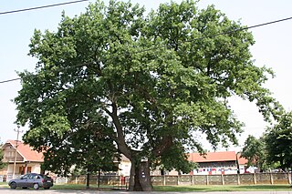
Ravnje is a village in Serbia. It is located in the Sremska Mitrovica municipality, in the Srem District, Vojvodina province. The village has a Serb ethnic majority and its population numbering 1,413 people. Although part of the Srem District, Ravnje is situated in the region of Mačva.
Smogorzówek is a village in the administrative district of Gmina Wińsko, within Wołów County, Lower Silesian Voivodeship, in south-western Poland. Prior to 1945 it was in Germany.

Nowa Kamienna is a village in the administrative district of Gmina Dąbrowa Białostocka, within Sokółka County, Podlaskie Voivodeship, in north-eastern Poland.

Zielony Gaj is a village in the administrative district of Gmina Janów, within Sokółka County, Podlaskie Voivodeship, in north-eastern Poland. It lies approximately 7 kilometres (4 mi) north-east of Janów, 21 km (13 mi) north-west of Sokółka, and 46 km (29 mi) north of the regional capital Białystok.

Dyszów is a village in the administrative district of Gmina Końskie, within Końskie County, Świętokrzyskie Voivodeship, in south-central Poland.

Mysłownia Nowa is a village in the administrative district of Gmina Gostynin, within Gostynin County, Masovian Voivodeship, in east-central Poland. It lies approximately 5 kilometres (3 mi) east of Gostynin and 103 km (64 mi) west of Warsaw.

Jadwinin is a village in the administrative district of Gmina Tłuszcz, within Wołomin County, Masovian Voivodeship, in east-central Poland. It lies approximately 5 kilometres (3 mi) south-west of Tłuszcz, 14 km (9 mi) north-east of Wołomin, and 36 km (22 mi) north-east of Warsaw.

Dobiec is a village in the administrative district of Gmina Kazanów, within Zwoleń County, Masovian Voivodeship, in east-central Poland. It lies approximately 15 kilometres (9 mi) south-west of Zwoleń and 109 km (68 mi) south of Warsaw.

Nowy Świat is a settlement in the administrative district of Gmina Zbąszyń, within Nowy Tomyśl County, Greater Poland Voivodeship, in west-central Poland. It lies approximately 3 kilometres (2 mi) north-east of Zbąszyń, 15 km (9 mi) west of Nowy Tomyśl, and 69 km (43 mi) west of the regional capital Poznań.

Batorowo is a village in the administrative district of Gmina Tarnowo Podgórne, within Poznań County, Greater Poland Voivodeship, in west-central Poland. It lies approximately 8 kilometres (5 mi) south-east of Tarnowo Podgórne and 12 km (7 mi) west of the regional capital Poznań.

Mały Buczek is a village in the administrative district of Gmina Lipka, within Złotów County, Greater Poland Voivodeship, in west-central Poland. It lies approximately 4 kilometres (2 mi) south of Lipka, 20 km (12 mi) north-east of Złotów, and 121 km (75 mi) north of the regional capital Poznań.

Lwowiec is a village in the administrative district of Gmina Sępopol, within Bartoszyce County, Warmian-Masurian Voivodeship, in northern Poland, close to the border with the Kaliningrad Oblast of Russia. It lies approximately 10 kilometres (6 mi) east of Sępopol, 23 km (14 mi) east of Bartoszyce, and 69 km (43 mi) north-east of the regional capital Olsztyn.

Czarne is a village in the administrative district of Gmina Dubeninki, within Gołdap County, Warmian-Masurian Voivodeship, in northern Poland, close to the border with the Kaliningrad Oblast of Russia. It lies approximately 5 kilometres (3 mi) west of Dubeninki, 14 km (9 mi) south-east of Gołdap, and 142 km (88 mi) east of the regional capital Olsztyn.

Racibórz is a village in the administrative district of Gmina Świętajno, within Szczytno County, Warmian-Masurian Voivodeship, in northern Poland. It lies approximately 5 kilometres (3 mi) north-east of Świętajno, 19 km (12 mi) east of Szczytno, and 56 km (35 mi) south-east of the regional capital Olsztyn.

Trynno is a village in the administrative district of Gmina Pełczyce, within Choszczno County, West Pomeranian Voivodeship, in north-western Poland. It lies approximately 8 kilometres (5 mi) east of Pełczyce, 15 km (9 mi) south of Choszczno, and 71 km (44 mi) south-east of the regional capital Szczecin.

Nosowo, is a village in the administrative district of Gmina Suchań, within Stargard County, West Pomeranian Voivodeship, in north-western Poland. It lies approximately 6 kilometres (4 mi) east of Suchań, 26 km (16 mi) east of Stargard, and 58 km (36 mi) east of the regional capital Szczecin.

Kelly is a small village in west Devon, England.

Đake is a village in the municipality of Kuršumlija, Serbia. According to the 2002 census, the village has a population of 83 people.


